
That’s a USGS reconstruction of Yellowstone topography, over 2 million years ago, before volcanism started up there.
I came across it in an excellent YVO article while reading up on Yellowstone for the series of in-depth posts coming up here soon.
The gray area they show is volcanic material that probably blew, fell, and rolled in over the millennia from a Yellowstone-like supervolcano complex to the west.
Perhaps that part looked like this. (Image: USGS, public domain.
The area, they say, was mountainous, just like the region surrounding Yellowstone is today, and the scenery would have been similar to the nature we view today while driving to Yellowstone:
Technically, today’s post is a guest video, but it needed explanation.
Then this happened:
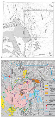
The two images are not identically scaled but the state lines allow us to see the big holes that were blasted out of that formerly gorgeous montane region. Bottom image: USGS, public domain.
Here is the geologic map again:
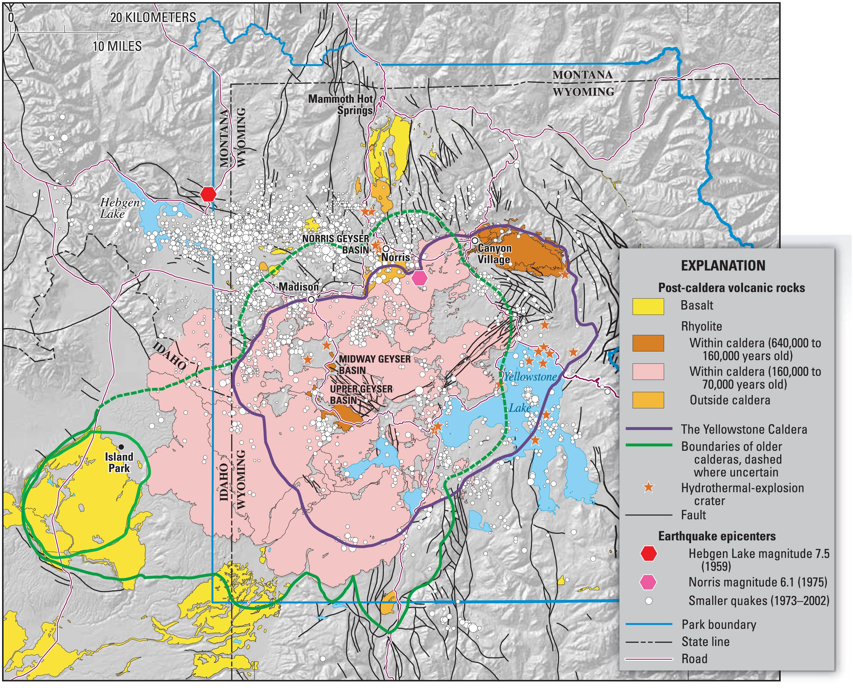
USGS, public domain
- Blue outline: Park boundary
- Big green outline: The Huckleberry Ridge supereruption formed Island Park Caldera (yes, it was a biggie!)
- Small green outline: The Mesa Falls eruption (scroll down at link) formed Henry’s Fork caldera: this eruption is ranked at VEI 7, but LaMEVE gives it a 7.8 magnitude, which is close enough to “super” for me!
- Purple outline: The Lava Creek supereruption formed today’s Yellowstone Caldera, 631,000 years ago, and now is mostly covered and, in parts of the caldera rim, draped by lava flows that happened intermittently for several hundred thousand years after the Lava Creek blast, most recently about 70,000 years ago.
For the next few Sundays, we will be leaving the hydrothermal fields and exploring parts of the Yellowstone National Park that formed in these tumultuous events.
For lagniappe: A scenic nature and wildlife-spotting hike outside the caldera but inside the park.
