
Some of the newest land on the planet forms here intermittently, yet Iceland is very old, as we humans see things. It has been a player in European history for many centuries and today conducts business with the world, much as the Icelanders’ Viking ancestors once did (minus the longboats, of course, which aren’t needed in this modern globally interconnected era).
Also, longboats can’t do things like this!
From the Earth’s much broader perspective, this volcanic island in the North Atlantic — most of it sitting just outside the Arctic Circle — is quite young, going back only a few tens of millions of years.
Yet no matter how we look at Iceland, it appears extreme in so many ways.
Most extreme of all is Iceland’s savage yet gentle wildness. One does not mess with Iceland or Icelanders; it is enough to enjoy the simple good things that they offer to us all.
I’m not going to try listing even a few of the ways that Iceland is naturally extreme because doing so would imply an understanding of its geology.
As a fairly sensible person, I looked at Iceland a while back and realized that it’s way beyond a layperson’s grasp.
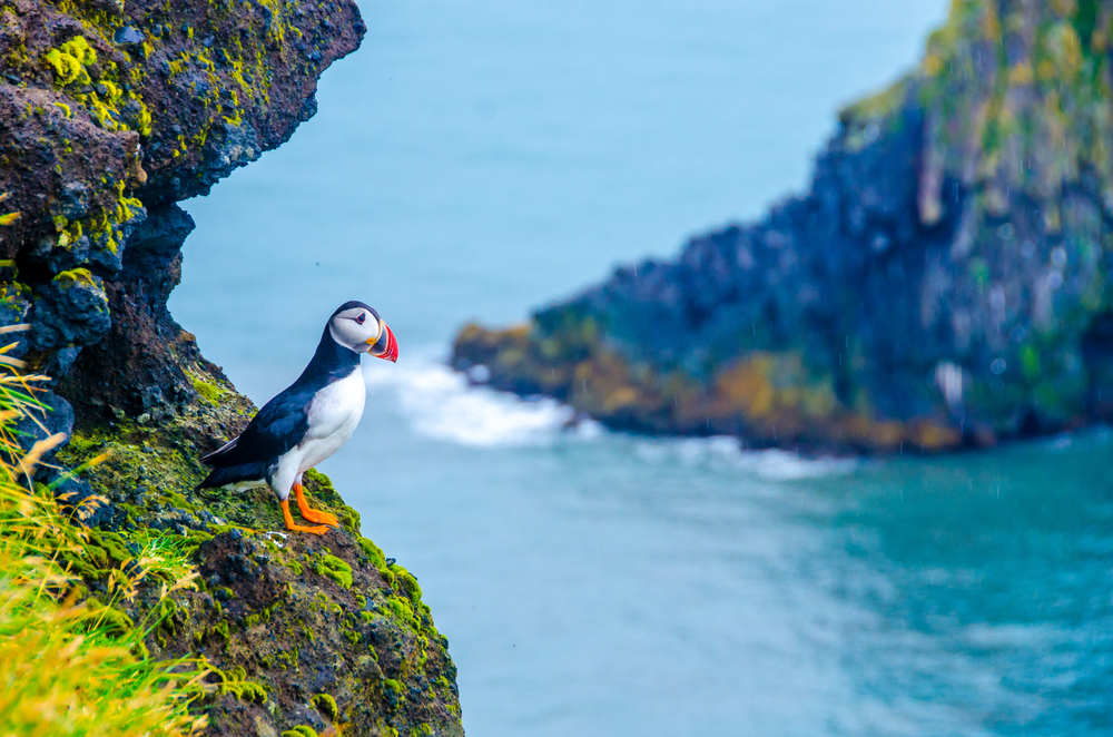
Boffin, not puffin. (Image: Simon Dannhauser/Shutterstock)
Even boffins meet a variety of challenges to their in-depth studies of this complicated little hotspot island/Mid-Atlantic Ridge segment!
So I didn’t blog about it much until 2021 to early 2023, when like everyone else I watched the live cam views and enjoyed other images of those three gorgeous red-lava eruptions that occurred near Reykjavik, on the Reykjanes Peninsula north coast, after a horizontal sill of magma had moved up from the depths and intruded its way underneath the Svartsengi plain and Mount Thorbjorn in a flurry of earthquakes starting at least as far back as 2019.
The “Fagradalsfjall Fires” were beautiful, uncomplicated events in a remote area that drew tourists in to visit from all over the world — a win-win situation for everyone involved until late 2023.
That’s when things got a tad biblical for folks in the Svartsengi area and the nearby south peninsula port of Grindavik, although not nearly as bad as they could have been.
The Grindavik area, by drone, in 2017:
That’s Mount Thorbjorn, behind Grindavik in the opening views. Later, the drone flies over Thorbjorn’s summit and we see the geothermal power plant, on Svartsengi plain, steaming away with the Blue Lagoon to the left.
This situation continues at the time of writing (March 29, 2024), but Icelanders, bless them, are hanging in there.
The Svartsengi/Grindavik eruptions

As you might know, Iceland sits on a boundary between two tectonic plates, one carrying North America more or less westward and the other plate moving Eurasia along in the opposite direction.
In between these two plates is a spreading ridge where magma rises up from the mantle to cool and harden into new oceanic crust (widening the northern Atlantic Ocean in the process — something that, as we’ll see, probably has been going on for at least sixty million years, while Iceland itself is a little more recent than that).
This magmatism is episodic, which means — fun!
At Thingvellir you can safely walk between North America and Eurasia!
But there are hazards, too, as everyone found out in 2023.
The plate boundary runs through Svartsengi plain, close to Mount Thorbjorn, located a little north of Grindavik.
On November 10, 2023, this part of the North America-Eurasia plate boundary rifted apart, and a large dike opened above the sill of magma that had been sitting about three miles below Svartsengi and Mount Thorbjorn all these years and growing larger.
What is it like to be at a plate boundary when it moves?
They are used to earthquakes in Iceland, but not like these!
This description by Sigmundsson et al. is dry and scientific but it still conveys the impressiveness of those powerful events:
Around 7:00 UTC on 10 November 2023, rapid low-magnitude seismicity, typical of subsurface magma migration (24), started at 4- to 6-km depth under Sundhnúkur crater row, gradually moving 3.5 km northward to Stóra-Skógfell over the next 8.5 hours (Fig. 1C and fi gs. S13 to S16). We did not detect surface deformation signals during this time. Southward migration of the seismicity commenced after a M 4.1 event at 15:23; thereafter, seismic propagation occurred both to the north and the south (Fig. 1E). The propagation to the south was faster, and the events much larger than on the northern segment. At 16:56, a M 4.8 earthquake occurred just north of Mt. Hagafell, and more events immediately followed. At 18:01, a M 5.2 event occurred at Hagafell, followed by a continuous swarm of small and large events that advanced at a fast pace toward Grindavík. By 18:30, the events had reached the town of Grindavík, and by 19:30, earthquakes were detected south of the town. From just before noon on 10 November until midnight, around 25 ≥MW 4 earthquakes occurred, two of which were of ~MW 5.2. At 16:40, deformation commenced at high rates as detected by the GNSS network (Fig. 2 and fi g. S7). Horizontal and vertical deformation reached 1 m by 20:00, after which deformation rates and seismicity decreased. The temporal evolution of GNSS displacements shows that the northeast part of the dike expanded first, followed by the southwest part (fig. S6), which was in broad agreement with development of seismicity. Dike-induced extension was accommodated at the surface along dike-subparallel normal faults and fissures forming near Svartsengi and south, toward the coast, including the town of Grindavík (fig. S19).
Fortunately (and for reasons that are still a mystery), that 8-meter-wide dike did not reach the surface and spew its contents — an estimated 130 to 140 million cubic meters of magma — over everything and everybody in a violent flood of deep lava.
Authorities knew that it could do this, though, and ASAP they evacuated Grindavik and other areas at risk (most notably, these are the Svartsengi geothermal power plant, which was already being operated remotely, and the Blue Lagoon tourist destination located next to the plant).
And then everyone waited. And waited. And waited some more.
Meanwhile, in Grindavik some evacuees had noticed cracks and areas of uplift in the road as they drove away. Others photographed structural damage, such as an evacuated nursing home that almost seemed to be tearing itself apart.
As it turned out, this is exactly what the ground in between the tectonic plates and underneath much of Grindavik was doing: widening by fissuring open and dropping down parcels of the land in between deep cracks.
It’s typical rift zone behavior but a serious hazard to people and their property and infrastructure.
Only one person has been lost thus far, but that is one too many.
Why did they build here?
Nobody knew about plate tectonics when Grindavik was established around an excellent natural harbor more than a thousand years ago.
And the plates and Reykjanes Peninsula had been quiet since the 1200s, until the first eruption occurred so beautifully and peaceably in 2021 near Reykjavik.
Also, even though they know about plate tectonics now, nothing like this has been observed with instruments before — most spreading ridges are buried kilometers down under the sea.
Iceland is the only major ridge segment above water (for reasons that we’ll get to later), where close observation is possible.
And now, just a few weeks before Christmas 2023, a nightmare was unfolding at Svartsengi and Grindavik!
At the time it seemed likely to me that those cracks would extend all the way down to the new dike, which was under Grindavik and its harbor, and that the now empty town would be blown away and buried in a series of surtseyan explosive blasts and thick lava flows.
Earth had other ideas.
GPS and other data told volcanologists at the Icelandic Met Office (IMO) that, below the new dike, sill expansion continued unabated. Nevertheless, it took buoyant magma almost forty days to find the right crustal weaknesses that would form its path from the underground reservoirs (sill and dike) to the surface.
Finally, on December 18th, a red glare suddenly brightened the night sky as lava fountains hundreds of feet tall broke out of the ground near the ancient Sundukhnur crater row north of Grindavik.
In minutes, the series of eruption fissures extended north and south — stopping about two miles away from Grindavik.
That was lucky break number one.
Then Iceland got two more lucky breaks:
- The eruption was very short.
- Its lava production was just a tiny fraction of the dike’s estimated magma volume.
Much has happened since then, and a pinned post on the front page covers the current state of things and contains links to both background information and local online news sources, autotranslated into English.
One of those news sources — national broadcaster RUV — published an in-depth article (autotranslated) last week about volcanic risk to Reykjavik.
It is very informative, and thanks to my reading up on volcanoes, I can see it, too, as an excellent public outreach effort.
But as mentioned, Iceland is complex and many of us laypeople outside the country must be wondering about the many, seemingly disconnected facets to this drama: tourist-friendly events in one place; town-shattering earthquakes elsewhere; eruptions in yet another location that definitely are not fun for anyone; and now they’re preparing the nation’s capital for future emergencies?
It’s compelling drama but more than a little confusing. And people who were planning to vacation there are wondering now if Iceland is safe.
This layperson thinks Iceland safe to visit and explore. What is happening is really very simple overall: volcanism happens in cycles on the Reykjanes Peninsula, and after about eight centuries of quiet, another cycle has begun.
Maybe I can help others see the overall picture by focusing my reading on Iceland and doing a couple of blog posts about it and the “Reykjanes Fires.”
I’m going to try, anyway, and the next post (next week, hopefully) will look into the ridge and the mantle plume that, together, make Iceland’s beauty, scariness, and productivity possible.
Featured image: Oxanaso/Shutterstock
