
- Global Volcanism Program (GVP) page.
December 11, 2025, 10:11 a.m., Pacific: I’m updating all these posts, and here is the most recent GVP report:
Most Recent Weekly Report: 20 August-26 August 2025
The Rabaul Volcano Observatory (RVO) reported that activity at Ulawun was low during 1-20 August. Summit emissions occasionally observed during periods of clearer weather were characterized as white with variable densities; weather clouds obscured views of the summit on most days. There were reports of brief periods of minor summit incandescence observed from the Bakada and Likuranga areas to the NE, but those observations were unconfirmed. Seismicity was dominated by small low- and high-frequency volcanic earthquakes, with low-frequency earthquakes being the dominant signal. Occasionally periods of low-level volcanic tremors were recorded by the seismic network, lasting between one hour and several hours. The Alert Level remained at Stage 1 (the lowest level of a four-stage scale).
May 3, 2025, 2:21 a.m., Pacific: Per the GVP in their report through April 29th:
Rabaul Volcano Observatory (RVO) reported that activity at Ulawun was low during 7-25 April. Summit emissions were white and had variable densities. On some days there were no emissions. Brief low rumbling sounds were heard during 15-16 and 19 April. In general seismicity was low, though slightly higher that background (RSAM values of 100-200). Data from the seismic station (UULA), 2.8 km from the summit on the lower WSW flank, was characterized by both low- and high-frequency volcanic earthquakes, with low-frequency earthquakes being the dominant signal. Brief surges in seismicity activity occasionally occurred and consisted of changes from discrete low- and high-frequency earthquakes to low-level, continuous volcanic tremors that lasted between several minutes and less than few hours. The Alert Level was at Stage 1 (the lowest level of a four-stage scale).
April 8, 2025, 2:43 p.m., Pacific: Per the Global Volcanism Program:
Most Recent Weekly Report: 26 March-1 April 2025
The Rabaul Volcano Observatory (RVO) reported that at 0800 on 27 March a dense, dark-gray ash plume rose 2-3 km above the Ulawun’s summit and drifted S.
Two seismic stations, located 10 km NW and 6 km from the volcano, indicated that seismicity remained low, though small, low-frequency earthquakes within background noise were detected by both stations. Increase seismicity was detected at the station 10 km NW in Real-time Seismic-Amplitude Measurement (RSAM) data 1-2 hours before the eruptive event, peaked about 30 minutes after the event, and then decreased to near-background levels about three hours later. RVO noted that the ash event was likely over, though seismic data suggested that there was a low probability that small ash plumes could sometimes occur. Continuous low rumbling was heard on 28 March. During 28 March-1 April activity was low and diffuse plumes contained ash but over the week changed to only white steam plumes.Operations were restored at the third, and primary, seismic station (UULA) 2.8 km from the summit, on the lower WSW flank, on 28 March. The station immediately began recording small low- and high-frequency volcanic earthquakes, with low-frequency earthquakes being the dominant signal. Both the number and magnitude of both types of earthquakes increased on 1 April.
Source: Rabaul Volcano Observatory (RVO)
There also has been a swarm of strong tectonic quakes not too far off the New Britain Island coast — this layperson’s concern regarding those is cone stability, which so far appears good, and I also wonder if this swarm has anything to do with the recent ash emission although there was no time synchronicity.
March 31, 2025, 6:02 a.m., Pacific: This old post is all updates, now that the Decade Volcano book is available for sale online, but the reminder of Ulawun’s deadly 2023 eruption is good background for why I’m pinning the post today.
Rabaul Observatory reportedly said that today’s ash emission was “one-off,” but that story also mentions some seismicity. Also, Ulawun is dangerous.
I don’t have time to do a post on it just now but will try to get one up later this week.
Correction: It occurred on the 26th:
Mt Ulawun in Ulamona-Bialla West New Britain this morning 8am. Thick black emissions as reported by Disaster West New Britain. Disaster personnel are on the ground to monitor the situation. Photo supplied by Disaster WNB. pic.twitter.com/jmiwfHsQ5S
— Quentin Pangomeli Talingapua (@Quency_Hoooraay) March 27, 2025
https://platform.twitter.com/widgets.js
December 16, 2023, 10:11 p.m., Pacific: Per the Global Volcanism Program, “According to ReliefWeb, the U.S. Agency for International Development (USAID) reported that the 20 November eruption at Ulawun resulted in five deaths and the evacuation of more than 16,000 people, with many more affected, as of 9 December. Ashfall from the eruption impacted oil palm trees, water sources, household gardens, and nearby properties.”
November 29, 2023, 4:29 p.m., Pacific: Per the GVP, covering November 22 through November 28:
Rabaul Volcano Observatory (RVO) reported that white steam plumes and occasional puffs of ash rose from Ulawun’s summit crater during 22-24 November, though weather clouds hindered views during 23-24 November. Lava continued to flow from a new fissure vent that had opened on the SW flank, near the vent that had formed in 2019. The intensity of the incandescence from the flow decreased during 23-24 November, suggesting that effusion may have slowed. Seismicity remained at background levels. The Alert Level remained at Stage 2 (on the four-level scale).
There was a M6.5 quake west of New Britain Island and just off Papua New Guinea’s northern coast on the 27th.
It doesn’t seem to have affected Ulawun. (Wonder if any changes were noted at Manam or other New Guinean volcanoes?)
A couple of days ago there was this online outburst of concern about sulfur from Ulawun affecting populations to the north as far away as the Philippines.
The air-quality officials in the Philippines posted on Facebook that they had detected nothing, air quality was good, and they would post an update if necessary.
They haven’t updated anything, and I can find no more news about the sulfur issues thus far. (Of note TROPOMI SO2 did detect and tweet about sulfur emissions from Bagana twice, so there’s that.)
Will keep an eye on it all and see how things go.
November 27, 10:42 p.m., Pacific: There is no major news, just this gorgeous imagery of the recent eruption:
Aftermath of recent eruption of #Ulawun #volcano in #PapuaNewGuinea.
Lava flows reached as far as ~6.5 km from the summit.
Two #radar images taken by @CopernicusEU #Sentinel1 before and after the eruption.@volcaholic1 @CultureVolcan#NewBritain #SAR pic.twitter.com/HbtoGLtL02
— kosmi 🛰️🌍 (@kosmi64833127) November 27, 2023
https://platform.twitter.com/widgets.js
November 23, 2023, 12:42 a.m., Pacific: The GVP just released the activity report. Read the whole thing; they do confirm a fissure eruption on the southwest flank in addition to the summit eruption.
That hulk has only two seismometers — and one was broken!
November 21, 2023, 2:50 p.m., Pacific: Ulawun reportedly has calmed down.
The image shared in that Facebook post shows Ulawun’s “Mother” hill on the right.
See the original post here, down below all these updates, to see how that hill is connected to concerns about the present volcano’s stability.
This was a big concern back during the International Decade: edifice collapse followed by almost immediate tsunami — megasized, given Ulawun’s volume — that would devastate nearby islands (and have long-distance effects, a concern that, combined with the surprisingly intense explosive phases that raised the specter of a Mount St. Helens/Bezymianny-style lateral blast, probably was what prompted Japan’s report).
There apparently was no lateral blast. (I’m still trying to find out more about those reported flank eruptions.)
All that is a very difficult concept to convey to ordinary folks; it’s not something that can be transmitted to everyone instantly during a volcano crisis — especially not with such recent public memories of the massive, and massively different, Hunga Tonga blast and its volcanic and meteorological tsunamis.
And so there was panic, with people reportedly fleeing shelters from the actual threat: Ulawun’s eruption.
That’s not good, and neither is the possibilty of those people remembering this false alarm and refusing to budge if and when a coming collapse is detected and a for-real tsunami evacuation from the coast is called.
Much outreach is needed here, for sure.
November 20, 2023, 11:43 p.m., Pacific: This news report, if valid, posted less than an hour ago, concerns me with its news of a possible flank vent opened on the north side.
I don’t know if that is an accredited journalism site, though it certainly appears all right.
A few hours ago, NBC News PNG was quoting Rabaul Observatory as saying they had received reports of effusive flank eruptions on the east to southeast side.
Disoriented observers? At least two flank fissures? Who knows?
Major eruptions like this produce a “fog of war” effect, which is one more reason why volcano observatories are so valuable.
Sigh. Will wait and see what reliable information can be gathered.
November 20, 2023, 11:16 p.m., Pacific: The rampage continues, per this one-hour-old Facebook post.
Ashfall isn’t superthick in this two-hour-old NBC News West New Britain video — that is, not Vesuvius AD 79 at Pompeii thick — but it could hurt the gardens which most people use to support themselves here, as well as heavily damage this vegetation.
Dr. Simon Carn has weighed in on the SO2 situation thus far:
Ongoing #eruption of #Ulawun #volcano (#PapuaNewGuinea) clearly detected amid tropical convection by the @JMA_kishou #Himawari8 SO₂ RGB product (yellow/orange = upper-level SO₂). Emissions continuing as of 15:40 UTC/Nov 20. Largest Ulawun eruption since 2019.
Credit: @CIRA_CSU pic.twitter.com/oN9GDjG57A— Prof. Simon Carn (@simoncarn) November 20, 2023
https://platform.twitter.com/widgets.js
November 20, 2023, 7:10 p.m., Pacific: Tweeted about half an hour ago:
And this, tweeted nine minutes ago, showing activity from the onset to this morning (local time):
Citra satelit yang menunjukkan aktifitas erupsi gunung api #Ulawun Papua New Guinea sejak tanggal 20-November-2023 hingga pagi ini. Cc: @volcanodiscover @Volcanologist pic.twitter.com/o1ZRdBYQxl
— INFOMITIGASI (@infomitigasi) November 21, 2023
https://platform.twitter.com/widgets.js
Sigh.
And what about those lava flows?
November 20, 2023, 5:38 p.m., Pacific: There is a fissure vent, east and southeast side, and NBC News Papua New Guinea reports ongoing lava flow from it, as well as lots of noise.
This needs to be watched closely.
It might be escalating — read this update from NBC News PNG, about an hour ago. (The volcano observers were described in my original post, below all these updates — and yes, they were still on duty at the mission! ♥️)
Nov. 21, 0158 UTC: No more news. Some terrific images on Facebook, including these from about five hours ago.
Nov. 21, 0208 UTC: Animation through 2230 on the 20th (no TROPOMI SO2 tweets noted yet):
🔴⚠️🌋🇵🇬A first #eruption around 13.30UTC, then high activity until 21.20 with a new strong explosion:this is #Ulawun strongest phase since https://t.co/X54UhOT19v the SO2 @JMA_kishou #Himawari9 10-hrs animation until 22.30UTC.#volcano #PapuaNewGuinea #eastnewbritain pic.twitter.com/8G8M8EGyw9
— SatWorld (@or_bit_eye) November 21, 2023
https://platform.twitter.com/widgets.js
Nov. 21, 0227 UTC: From Indonesia, posted about a half hour ago (I don’t know what it signifies but they describe it as events at Ulawun in the last 12 hours):
Dan event yang terjadi di Gunung Api #Ulawun dalam waktu 12 jam terakhir. pic.twitter.com/hBhNh3MJAr
— INFOMITIGASI (@infomitigasi) November 21, 2023
https://platform.twitter.com/widgets.js
A few minutes later, I found this: “Graph of Volcano Radiation Power of Volcanoes #Ulawun Papua New Guinea when a violent eruption occurred several hours ago.” (Link added.)
Grafik Volcano Radiation Power Gunung Api #Ulawun Papua New Guinea ketika terjadi erupsi hebat beberapa jam yang lalu. Cc: @volcanodiscover @Volcanologist pic.twitter.com/1lG7So1xhh
— INFOMITIGASI (@infomitigasi) November 21, 2023
https://platform.twitter.com/widgets.js
Looks like that was a BIG blast. Wish we had word on how the edifice is holding up.
Nov. 21, 0252 UTC: Here is an overview, with pix and tweets, from The Watchers.
Nov. 21, 0305 UTC: Per Twitter translation, “Hotspot resulting from volcanic eruption #ulawun Papua New Guinea. Our data is presented in Western Indonesia standard time. 11/21/2023.”
Hotspot yang dihasilkan dari erupsi gunung api #ulawun papua new guinea. Data kami sajikan dalam standar waktu Indonesia Bagian Barat. 21/11/2023. Cc: @volcanodiscover @Volcanologist pic.twitter.com/NEb8SLOzvc
— INFOMITIGASI (@infomitigasi) November 21, 2023
https://platform.twitter.com/widgets.js
November 20, 2023, 4:22 p.m., Pacific: Ulawun has gone off, with plume up to 50,000 feet (check second tweet for close-up):
[1/2]
Eruption of #Ulawun #volcano on the island of #NewBritain, #PapuaNewGuinea.
Look at that big boom in the end😖
Images taken today by GEO-KOMPSAT 2A satellite.
Data processed in @CIRA_CSU / RAMMB Slider.
🕑 17:00-21:50 UTC@volcaholic1 @Wulkany1 @CultureVolcan pic.twitter.com/gwqGA9GHBb
— kosmi 🛰️🌍 (@kosmi64833127) November 20, 2023
https://platform.twitter.com/widgets.js
Japan experts were reportedly concerned about a possible tsunami, but that hasn’t materialized.
I am still trying to track down information and will update below when possible.
Nov. 21, 0034 UTC: About five hours ago, this Facebook post reported that the volcano was still going strong and evacuations were underway.
The accompanying photograph shows:
- An eruption that, to this layperson, resembles Ulawun’s previous VEI 4 plumes.
- A standing mountain, seemingly without collapse. 🙂)
The above observatory link has not been updated
Nov. 21, 0109 UTC: This was uploaded five hours ago:
Looks like a summit eruption thus far. I think that orange light off to the right just after the 40-second mark is likely atmospheric; hope so, anyway.
Nov. 21, 0120 UTC: Volcano Discovery reports “strong paroxysm episode today, spectacular lava fountains, significant pyroclastic flow and emissions to 50,000 ft.”
Nov. 21, 0128 UTC: More pix. No word, thus far, of injuries, though that linked Facebook post is less than an hour old. Ulawun is tall and very steep; people live in the lowlands; and although that looked like a strong pyroclastic flow, it is possible that it didn’t reach inhabited areas.
More images: Ashfall.
November 8, 9:14 p.m., Pacific: Per the GVP for November 1-8:
Rabaul Volcano Observatory (RVO) reported that diffuse white plumes rose from Ulawun’s summit crater on 1 November. A low booming noise was heard at 1945. Minor crater incandescence began to be visible later that day at around 2100 and was observed until sunrise. White emissions were visible early on 2 November but by the afternoon clouds of gray-to-brown ash were occasionally observed when weather permitted observations. Crater incandescence was again visible at nightfall but was more intense than the previous night and remained visible until sunrise. Seismicity was dominated by low-level volcanic tremor. Small, low-frequency earthquakes occurring at long intervals began to be recorded at some point before 2300 on 1 November; an increase in both magnitude and frequency occurred after 2300 and the signal again intensified after 0800 on 2 November. Seismicity slightly declined around 0800 on 3 November and remained at those levels at least through noon. The Alert Level remained at Stage 2 (on the four-level scale).
November 2, 2023, 8:53 p.m., Pacific: Per the GVP, end of October (emphasis added):
Rabaul Volcano Observatory (RVO) reported that variable amounts of white steam emissions rose from Ulawun’s summit crater during 1-28 October and drifted SE; small volumes of blue vapor were visible on 18 October. Low-level seismicity, characterized by small continuous volcanic tremors recorded during the last week of September, continued through the first week of October. Small, discrete, low-frequency volcanic earthquakes and short-duration sub-continuous volcanic tremors emerged on 8 October and fluctuated at low-to-moderate levels through 28 October. The pattern of seismicity again changed on 28 October when both low-frequency and high-frequency earthquakes were detected. Though activity was forecasted to remain low, RVO noted that some of the seismic patterns were similar to those observed before the 14 and 25 September eruptions; RVO recommended that the Alert Level be raised to Stage 2 (on the four-level scale).
The banner scrawl mentioned above still has Ulawun at Level 1.
October 18, 2023, 2:31 p.m., Pacific: I’m keeping this pinned, despite seeing nothing recent in online news or the GVP site, because Ulawun is dangerous enough to have been made a Decade Volcano and also because there seems to be little news from Melanesia ever in the Anglophone Net sphere that I inhabit unless something drastic happens — and only then do outsiders learn that the situation was active long before that drastic change.
At last report, Ulawun was erupting and everyone felt it would continue but at low levels. Presumably, since Rabaul Observatory still has it at Level 1 on their website, that is still the case.
October 2, 2023, 12:12 p.m., Pacific: I’m kind of busy today but this article from local media has lots of information on Ulawun’s ongoing low-level activity (summit only, apparently) and the government response.
September 28, 2023, 2:52 p.m., Pacific: According to this, Ulawun had another summit eruption today, with some lava flow up there.
I haven’t found any news sources on it yet, just mention on Facebook of:
- An earthquake at
5:44 p.m.a.m. local time (14 minutes after the eruption reported in the linked article above).I got confused by time zones. That was posted two hours ago, on September 29, local time, which is concerning if verified (I don’t know any of these posters.)
- This impressive photograph, posted five hours ago, which does appear to be Ulawun, with lighting matching the reported time of day on Monday, ? on the 29th:


[Layperson speculation] As far as I know, a summit eruption is okay; let’s hope no activity starts lower down on the flanks, as has happened before (see the Ulawun chapter below these updates). [/Layperson speculation]
September 27, 2023, 4:01 p.m., Pacific: Here’s the GVP update through September 26th:
Rabaul Volcano Observatory (RVO) reported that diffuse white emissions occasionally rose from the active vent at Ulawun’s summit crater from 1430 on 19 September through most of 25 September. Weather conditions sometimes prevented visual observations. Seismicity was characterized as low during the beginning of the reporting period, dominated by low-level, continuous volcanic tremors that were punctuated by occasional, small, low-frequency, volcanic events. The pattern of seismicity changed just before 1000 on 22 September with the emergence of very distinct, low-frequency volcanic earthquakes and short-duration, sub-continuous, volcanic tremors with increased amplitudes.
The amplitude of the continuous volcanic tremor fluctuated but slowly rose overall until about 1300 on 25 September when the increase became rapid. At around 1739 on 25 September a 4-5-km tall, white-to-pale-gray plume and minor incandescence at the summit vent were visible in webcam images. The incandescence intensified as the evening grew darker. The plume did not change and no ashfall was reported, suggesting low ash content. The incandescence intensified and became distinct in total darkness by 1830. Incandescent lava fragments around the summit crater area and a possible small lava flow on the upper N flank were visible; rumbling and roaring sounds were heard. The eruption was over by 2000. RSAM values peaked at 6,000 during the eruption; at the end of the activity seismicity decreased rapidly and was characterized by low levels of volcanic tremor. The Alert Level remained at Stage 1 (the lowest level on the four-level scale).
I wonder if that webcam is public facing, too…
…Yes! Yes, it is!
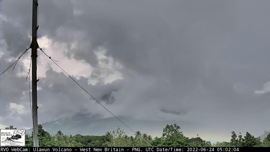
At last view, Ulawun was mostly hidden by weather clouds.
Edit: I just checked the time stamp — August 2022. This is not helpful to us volcanophiles but from the report above, the people who really need to can see what’s going on.
That’s the main thing.
September 26, 1:40 p.m., Pacific: Sorry to report that I got distracted by other projects and haven’t rechecked the GVP website until today after reading that Ulawun erupted yesterday.
Per the current GVP report (through September 19th):
Rabaul Volcano Observatory (RVO) reported a small eruption at Ulawun during 14-15 September. Minor incandescence at the summit crater was first visible at around 2107 on 14 September from Ulamona Observatory. The incandescence intensified, and eruption plumes reflecting the glow were visible in webcam images drifting NE. Starting at about 0004 and lasting to about 0800 on 15 September there were brief periods when the plumes appeared darker, likely due to denser and more intense emissions. The plumes drifted W and WSW. Rumbling noises were reported, though they became less frequent by 0800. The Alert Level was raised to Stage 2 (the second level on the four-level scale).
Staff from the West New Britain Provincial Disaster Office conducted a field inspection on 15 September and found only minor ashfall around the volcano. During 0800 on 15 September to 1430 on 19 September the volcano was quiet; small volumes of diffuse white emissions sometimes rose from the summit and drifted W and WSW. On 19 September RVO recommended that the Alert Level should be lowered to Stage 1.
Increased seismicity coincided with the eruption. During most of 14 September RSAM values were 200-300, though they began to increase at about 1955 and reached a value of around 800 by midnight. RSAM continued to increase; values reached 1,600 by 0100 on 15 September, rapidly increased during 0100-0200, and reached a value of 4,060 almost two hours later at 0300. Seismicity was dominated by continuous low-frequency volcanic tremors. Seismicity began to decline at 0700, reached background levels by 0900, and remained low with values of 200-450. During 16-19 September seismicity was characterized by low level volcanic tremors with sporadic occurrences of discrete, small, low-frequency volcanic events. RSAM values were around 200.
Judging from the news report linked above, yesterday’s eruption was likely a bit stronger. These images posted on Facebook are impressive:

September 3, 2023, 11:20 a.m., Pacific: TROPOMI SO2 tweeted about enhanced sulfur dioxide recently, but the origin was unclear with both Bagana and Ulawun restless in the area.
This seems to suggest it was from Ulawun:
#volcan #volcano #Ulawun🇵🇬 Il semble qu'il y ait de faibles dépôts de cendres récents sur le versant nord de l'édifice/Looks like there are some recent slight ash deposits on the north flank via @sentinel_hub @esa @CopernicusEU cc @SmithsonianGVP @volcanessa pic.twitter.com/UfWzoqsaIt
— CultureVolcan (@CultureVolcan) September 3, 2023
https://platform.twitter.com/widgets.js
This is probably just minor activity. Per the most recent GVP report (through August 15th), with link added:
RSAM fluctuated during 4 July-12 August but overall showed an upward trend and corresponded to an increase in volcanic tremor amplitudes. RVO warned that minor eruptive activity may occur if the trend continued and that ash emissions had previously occurred at similar RSAM levels. The Alert Level remained at Stage 1 (the lowest level on the four-level scale).
July 27, 2023, 8:32 a.m., Pacific: I don’t know how reliable this report is (it’s not from RVO), but for what it’s worth, seismic activity might be increased for the first time since 2019.
Per the Global Volcanism Program:
RVO reported that minor ash emissions at Ulawun began on 18 July, and during the morning of 19 July brown-to-gray emissions with low ash content were rising a few hundred meters above the crater rim and drifting SE. During 20-25 July steam-and-gas plumes with minor-to-moderate amounts of ash rose from the summit crater and rapidly dispersed. The emissions drifted in various directions, but mainly NW; minor ashfall was reported in areas downwind. Sulfur dioxide emissions were detected in satellite images on 21 and 24 July. Seismicity had begun increasing on 16 July, with RSAM values climbing at a slow but erratic rate, and peaking on 18 July. Afterwards RSAM values decreased and remained at low levels (150-200); seismicity was dominated by continuous volcanic tremors. RSAM values steadily increased to 550 during 0400-1400 on 22 July and fluctuated at moderate levels of 300-350 through 23 July. Values were variable on 24 July between values of 400 to 700. The Alert Level remained at Stage 1 (the lowest level on a four-level scale).
Featured image: Mike Workman/Shutterstock
Sources:
- Avouris, D. M.; Carn, S. A.; and Waite, G. P. 2017. Triggering of volcanic degassing by large earthquakes. Geology, 45(8): 715-718.
- Brown, S.K.; Jenkins, S.F.; Sparks, R.S.J.; Odbert, H.; and Auker, M. R. 2017. Volcanic fatalities database: analysis of volcanic threat with distance and victim classification. Journal of Applied Volcanology, 6: 15.
- Cas, R. A. 2019. IAVCEI: from small beginnings to a vibrant international association. History of Geo-and Space Sciences, 10(1): 181-191.
- European Volcanological Society (SVE). n. d. Decade volcano program 1990/2000. http://www.sveurop.org/gb/program/program.htm
- Global Volcanism Program (GVP). 2000. Report on Ulawun (Papua New Guinea) (Wunderman, R., ed.). Bulletin of the Global Volcanism Network, 25:8. Smithsonian Institution. https://volcano.si.edu/showreport.cfm?doi=10.5479/si.GVP.BGVN200008-252120
- ___. 2000. Report on Ulawun (Papua New Guinea) (Wunderman, R., ed.). Bulletin of the Global Volcanism Network, 25:11. Smithsonian Institution. https://volcano.si.edu/showreport.cfm?doi=10.5479/si.GVP.BGVN200011-252120
- ___. 2023. Ulawun. https://volcano.si.edu/volcano.cfm?vn=252120 Last accessed July 12, 2023.
- IAVCEI Workshop on Ulawun Decade Volcano, Papua New Guinea. 1998. Volcanic Cone Collapses and Tsunamis: Issues for Emergency Management in the Southwest Pacific Region. https://www.adrc.asia/management/PNG/Ulawun%20Decade%20Volcano.html
- International Federation of Red Cross and Red Crescent (IFRC). Emergency Plan of Action Final Report
Papua New Guinea – Volcanic Eruptions. https://adore.ifrc.org/Download.aspx?FileId=296099 (PDF) - Johnson, J. B., and Ripepe, M. 2011. Volcano infrasound: A review. Journal of Volcanology and Geothermal Research, 206(3-4): 61-69.
- Johnson, R. (2013). Fire Mountains of the Islands: A history of volcanic eruptions and disaster management in Papua New Guinea and the Solomon Islands. ANU Press. https://openresearchlibrary.org/content/84395a8e-81fb-452f-a7bb-41ec37ce62f7
- Kloss, C.; Berthet, G.; Sellitto, P.; Ploeger, F.; and others. 2020. Stratospheric aerosol layer perturbation caused by the 2019 Raikoke and Ulawun eruptions and climate impact. Atmospheric Chemistry and Physics Discussions, 1-33.
- Liu, E. J.; Aiuppa, A.; Alan, A.; Arellano, S.; and others. 2020. Aerial strategies advance volcanic gas measurements at inaccessible, strongly degassing volcanoes. Science Advances, 6(44): eabb9103.
- McCormick, B. T.; Edmonds, M.; Mather, T. A.; and Carn, S. A. 2012. First synoptic analysis of volcanic degassing in Papua New Guinea. Geochemistry, Geophysics, Geosystems, 13(3).
- McGonigle, A. J. S.; Oppenheimer, C.; Tsanev, V. I.; Saunders, S.; and others. 2004. Sulphur dioxide fluxes from Papua New Guinea’s volcanoes. Geophysical Research Letters: 31(8).
- McKee, K.; Smith, C. M.; Reath, K.; Snee, E.; and others. 2021. Evaluating the state-of-the-art in remote volcanic eruption characterization Part II: Ulawun volcano, Papua New Guinea. Journal of Volcanology and Geothermal Research, 420: 107381.
- Michigan Tech (MTU). 1996. Ulawun Decade Volcano, Papua New Guinea. http://www.geo.mtu.edu/volcanoes/boris/mirror/mirrored_html/ULAWUN.html
- Newhall, C. 1996. IAVCEI/International Council of Scientific Unions Decade Volcano projects: Reducing volcanic disaster. status report. US Geological Survey, Washington, DC. Retrieved from https://web.archive.org/web/20041115133227/http://www.iavcei.org/decade.htm
- ___. 1999. IAVCEI’s Primary IDNDR Project: Decade Volcanoes. IAVCEI News 1999. 2:8-9. https://tinyurl.com/ycxtsu4h (PDF)
- Oregon State University (OSU). 2020. Ulawun. http://volcano.oregonstate.edu/ulawun. Last accessed April 20, 2020.
- Papua New Guinea, Minerals page (archived). 2005. Ulawun. https://web.archive.org/web/20050322025513/http://www.mineral.gov.pg/volcObs/ulawun.htm
- Silver, E.; Day, S.; Ward, S.; Hoffmann, G.; and others. 2009. Volcano collapse and tsunami generation in the Bismarck volcanic arc, Papua New Guinea. Journal of Volcanology and Geothermal Research, 186(3-4): 210-222.
- Thompson, D. 2002. Volcano Cowboys: The Rocky Evolution of a Dangerous Science. St. Martin’s Griffin (this edition: https://www.goodreads.com/en/book/show/178244.Volcano_Cowboys).
- Vaughan, G.; Wareing, D.; and Ricketts, H. 2020. Measurement Report: Lidar measurements of stratospheric aerosol following the Raikoke and Ulawun volcanic eruptions. Atmospheric Chemistry and Physics Discussions: 1-10.
- Vernier, J. P.; Thomason, L. W.; Pommereau, J. P.; Bourassa, A.; and others. 2011. Major influence of tropical volcanic eruptions on the stratospheric aerosol layer during the last decade. Geophysical Research Letters: 38(12).
- Wood, M.; Foale, S.; and Gabriel, J. 2020, April. Anticipating Ulawun Volcano in New Britain, Papua New Guinea. In Anthropological Forum (Vol. 30, No. 1-2, pp. 30-41). Routledge.
- Zorn, E. U.; Orynbaikyzy, A.; Plank, S.; Babeyko, A.; and others. 2022. Identification and ranking of volcanic tsunami hazard sources in Southeast Asia, EGUsphere [preprint], https://doi.org/10.5194/egusphere-2022-130, 2022.
