El nivel de actividad naranja 🔶 del VNR nos indica que debemos estar preparados para una posible erupción de magnitud considerable. Como existe la probabilidad de que el volcán alcance el nivel de actividad rojo, este es el momento de tomar medidas de prevención⛑️ pic.twitter.com/jRoZPkXZEG
— Servicio Geológico Colombiano (@sgcol) May 1, 2023
Also, here is the daily video with some images from today. It is in Spanish, but he basically reads the SGC update (see below):
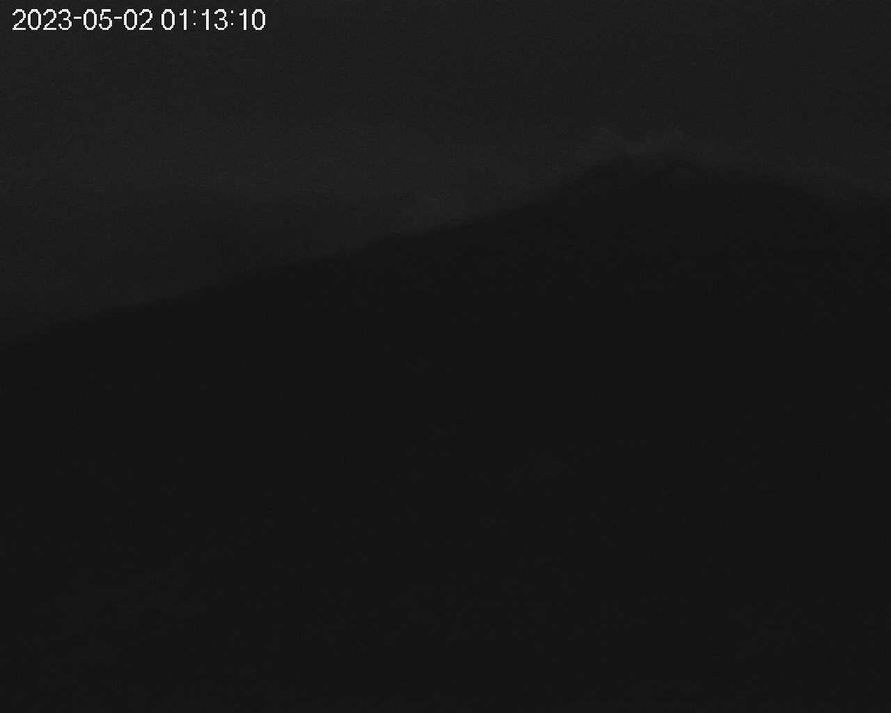
Update, May 2, 10:40 a.m., Pacific: Those “quick updates” in last night’s update (below this one) actually spanned a watching time of about five hours. I continued checking the Cerro Gualí cam, which updates every five minutes, until the moon set, close to 3 a.m., local time, and then quickly tired of looking at only slight and infrequent summit glow.
Did get a cam shot of one puff, I think, a small one, but it was during moonset and the light was not as good as it had been previously. That moonlight was very helpful last night!
Ruiz got more ambitious this morning, per today’s SGC report about two hours ago — yes, I think we’re close to the point where hours matter, not just days (which El Tiempo has summed up in a multimedia article quite well).
Emphasis is by either SGC or me:
Yesterday, May 1, there was a slight increase in seismic activity associated with rock fracturing inside the volcanic edifice. The earthquakes were located mainly at an average distance of 2 km south-southeast of the Arenas crater, at depths between 3 and 4 km. The largest earthquake was recorded during this increase, at 03:43 p.m., with a magnitude of 1.8.
Regarding the seismic activity related to the movement of fluids inside the volcanic conduits, yesterday and until 8:30 a.m. today, this type of seismicity has shown an increase in the seismic energy released, compared to the previous day (April 30). Some seismic signals of this type have been associated with pulsatile ash emissions that were confirmed through the web cameras used for volcanic monitoring. The ash emission recorded this morning at 07:47 a.m. stands out. both for its energy level and for the height of the column, which in dispersion reached 3000 m and had a northwesterly direction.
The outgassing of sulfur dioxide into the atmosphere and the release of water vapor from the volcano continue. The maximum height of the column of gases and/or ash observed yesterday was 800 m measured from the top of the volcano, this presented a predominant dispersion direction towards the west-northwest of the volcano.
Regarding the thermal anomalies at the bottom of the crater, yesterday and until 8:30 a.m. Today, reports have been obtained from satellite monitoring platforms.
All these indicators ratify what the SGC has reiterated: the activity of the Nevado del Ruiz volcano continues to be highly unstable. It is possible that the levels of seismic activity, as well as the levels of degassing or ash output, decrease or be oscillating, in the sense of increasing on some days and decreasing on others. However, this does not imply that the volcano has returned to its normal levels of activity, so it is recommended not to get used to these oscillating changes in activity and think that it is a normal activity of the volcano.
Therefore, we reiterate that the activity of the Nevado del Ruiz volcano continues at ORANGE LEVEL, which indicates that there is a probability that in days or weeks it will erupt more than it has in the last 10 years. To change the level and return to the yellow level, a prudential time is required where trends and patterns can be observed that allow us to infer the possible decrease in activity, aspects that the current activity of the volcano still does not show, which is why it is warned that the The activity level of the Nevado del Ruiz volcano will remain at ORANGE LEVEL for several weeks. During this time, in the event of an acceleration of processes suggesting an imminent eruption or the eruption itself occurring, the activity level will be changed to red.
We recommend that the community remain calm, follow all the instructions of the National Unit for Disaster Risk Management (UNGRD) and local authorities, and be attentive to the information provided by the Colombian Geological Service on the evolution of the state of the volcano.
The level of activity of the volcano remains at ORANGE LEVEL of activity or (II):
ERUPTION LIKELY WITHIN DAYS OR WEEKS.
The COLOMBIAN GEOLOGICAL SERVICE will continue to be attentive to the evolution of the volcanic phenomenon and will inform opportunely about the changes that may occur.
All earlier updates to this post are below, too, but they are better sorted at the update link above.
Update, May 1, 8:07 p.m., Pacific, to around 1 a.m., Pacific, May 2: Incandescense glow. Haven’t checked the cam in about an hour, but it wasn’t there before — at least, while I’ve been looking. As noted earlier, incandescence glow does appear at times.
Update, May 1, 2024 2023, 7 p.m., Pacific: Checked cam at 1:43 UTC, took about a 15-minute break, checked again, and saw this:
Will see if and how it develops. Quick update: At 0203 check it’s gone: human source, most likely; in daylight you can see lots of trails up there. If it’s late evacuees, bet they’re wishing it was daylight.
Quick update: Meanwhile, the latest helicorder image:
Now that I can see (sort of) the summit, I recognize what the SGC has described in their updates; that is, the more intense squiggles correspond to the more voluminous plume, and the quieter last line corresponds to the much smaller plume now.
Edit: They would, if the helicorder were live. I forgot that there is a delay. The correspondence was just a coincidence, but I think the general idea is sound, since SGC mentioned it.
[Layperson speculation]Those squiggles may represent outgassing, so while their presence looks scary, it’s actually a sign of Ruiz literally letting off steam. The quiet lines on the helicorder might signify blockage of outgassing. Why are squiggles more intense? Not pressurization, perhaps, so much as vastly increased outgassing as that large volume of magma nears the surface.[/layperson speculation]
Will look for SO2 measuring sites and see if it has increased today.
Of course, I could wait for tomorrow’s update, but this is more fun.
And with SGC tweeting that they might have only 10 or 15 minutes to call a RED, why wait?
Quick update: Found the Manizales Observatory page. So. Much. Data. 🎁
Have only a mobile connection but will see if I can find the sulfur links.
Last quick update for now: According to this, Sangay is the only current major stinker.
[Layperson speculation]That may be good news, or it might mean Ruiz’s sulfur dioxide emission is blocked.[/layperson speculation] Will see how it goes.
Update, May 1, 6:17 p.m., Pacific: The Cerro Gualí webcam is clear at the moment, and the summit is just visible in the darkness, at least on the cam.
Here’s an image from about six minutes ago (UTC on this cam timestamp); don’t know how good it is:
There appears to be the usual white plume, perhaps with more volume.
I wish some incandescence showed. Reportedly, the dome up there isn’t blocking the entire vent — hence the outgassing.
This is good, since gas powers explosive eruptions. Note on the webicorder that the big shock came after a quiet period, presumably when gas could not escape.
It would be bad if the vent got completely closed off right now.
That crater is very deep and the plume is thick; there often isn’t incandescence glow up there, I guess, but I have seen an image of it on Twitter, a week or so ago. Someone was asking SGC what it meant.
Well, let’s just keep watching and waiting.
Update, May 1, 5:04 p.m., Pacific: The helicorder mentioned earlier today had been showing what looked to this layperson like periods of increased seismicity winding down into fairly quiet spells, and then repeating, until yesterday at some point, when the signals had more intensity and were more frequent or perhaps even constant.
So I kept my eye on it while working today and noted a strong shock and sudden drop in activity:
I haven’t checked them since, because of work, but got online and saw that SGC tweet:
El nivel de actividad naranja 🔶 del VNR nos indica que debemos estar preparados para una posible erupción de magnitud considerable. Como existe la probabilidad de que el volcán alcance el nivel de actividad rojo, este es el momento de tomar medidas de prevención⛑️ pic.twitter.com/jRoZPkXZEG
— Servicio Geológico Colombiano (@sgcol) May 1, 2023
“The orange … activity level of the VNR indicates that we must be prepared for a possible eruption of considerable magnitude. As there is a probability that the volcano will reach the red activity level, now is the time to take preventive measures…”
I’m no expert, but IMO that’s as strong as they get before going to RED.
Gonna keep eyes on the news tonight.
The helicorder displays are not live, but here is the full page of that period to date:
Meanwhile, El Pais English recently published interviews with people under the volcano.
May 1, 2023, 8:29 a.m., Pacific: Still ORANGE, still in the awful holding pattern of “will it or won’t it?”.
To watch Ruiz labor, I’ve been following the filtered (filtrada) AZUM HHE CM90 record here. (The Alaska Volcano Observatory has some advice on reading seismic helicorders, which are also called helicorders.)
From today’s SGC’s update (video added; bold emphasis by SGC):
Yesterday April 30 and so far today, the seismic activity related to the movement of fluids inside the volcanic conduits continues to predominate, which maintains, in general, a similar behavior in terms of number of earthquakes and energy seismic compared to the previous day (April 29). Some seismic signals of this type, this morning, have been associated with pulsatile ash emissions, confirmed through the web cameras used for volcanic monitoring, highlighting the one registered at 07:38 a.m., which reached a height of 600 m measured from the top of the volcano and presented a direction of dispersion towards the west-northwest.
The seismic activity associated with rock fracturing within the volcanic edifice presented, on April 30, a similar behavior in the number of registered earthquakes and a slight increase in the seismic energy released, compared to the previous day. The seismicity was located around the Arenas crater, within a radius of less than 4.0 km, measured from there. The maximum magnitude registered yesterday was 2.0 corresponding to the earthquake at 03:06 a.m. located 0.7 km north-northeast of the Arenas crater, 3.0 km deep, which was opportunely reported in yesterday’s extraordinary bulletin.
In relation to the maximum height of the column of gases and/or ash observed, yesterday it reached 1600 m measured from the top of the volcano and presented a dispersion direction mainly to the northwest and southwest of it. Thermal anomalies continue at the bottom of the crater, which could be observed from satellite monitoring platforms, as well as the degassing of sulfur dioxide into the atmosphere and the release of water vapor from the volcano.
All these indicators ratify what the SGC has reiterated: the activity of the Nevado del Ruiz volcano continues to be highly unstable. It is possible that the levels of seismic activity, as well as the levels of degassing or ash output, decrease or be oscillating, in the sense of increasing on some days and decreasing on others. However, this does not imply that the volcano has returned to its normal levels of activity, so it is recommended not to get used to these oscillating changes in activity and think that it is a normal activity of the volcano.
Therefore, we reiterate that the activity of the Nevado del Ruiz volcano continues at ORANGE LEVEL, which indicates that there is a probability that in days or weeks it will erupt more than it has in the last 10 years. To change the level and return to the yellow level, a prudential time is required where trends and patterns can be observed that allow us to infer the possible decrease in activity, aspects that the current activity of the volcano still does not show, which is why it is warned that the activity level of the Nevado del Ruiz volcano will remain at ORANGE LEVEL for several weeks. During this time, in the event of an acceleration of processes suggesting an imminent eruption or the eruption itself occurring, the activity level will be changed to red.
We recommend that the community remain calm, follow all the instructions of the National Unit for Disaster Risk Management (UNGRD) and local authorities, and be attentive to the information provided by the Colombian Geological Service on the evolution of the state of the volcano.
The level of activity of the volcano remains at ORANGE LEVEL of activity or (II): PROBABLE ERUPTION IN TERMS OF DAYS OR WEEKS.
The COLOMBIAN GEOLOGICAL SERVICE will continue to be attentive to the evolution of the volcanic phenomenon and will inform opportunely about the changes that may occur.
El Tiempo’s minute-by-minute coverage (April 30th — yes, even though at time of writing it says the 29th), autotranslated.
Update, April 30, 2023,1:37 p.m., Pacific: No changes in volcano status. I just wanted to share this new source of daily videos: satellite and Google Earth as well as SGC webcams.
It’s in Spanish, but he follows closely the SGC update, I think.
When available, I’ll add these to the day’s SGC update.
Update, April 30, 2023, 8:35 a.m., Pacific: No major changes noted in this morning’s update.
Right now, it looks to this layperson as though the volcano is slowly, more or less steadily, ramping up to an eruption rather than settling down — but all I’ve read shows that volcanoes, even when this lively or more so, do stop.
It’s a major problem in volcano activity forecasting, experts agree.
As mentioned in my Vesuvius post, no one yet can identify the point at which an eruption becomes inevitable.
But I suspect Ruiz might be close to it.
From today’s SGC update, via Google Translate (emphasis by SGC or me):
Yesterday April 29 and so far today, seismic activity related to the movement of fluids inside the volcanic conduits has predominated, which showed an increase in seismic energy compared to the previous day (April 28). This type of seismicity has been associated with several pulsatile ash emissions, some confirmed through the web cameras used for volcanic monitoring and associated with slight ash fall in the city of Manizales.
The seismic activity associated with rock fracturing inside the volcanic edifice presented, on April 29, a similar behavior in the number of registered earthquakes and the seismic energy released compared to the previous day. The seismicity was located in and around the Arenas crater, within a radius of less than 4.0 km, measured from there. The maximum magnitude registered yesterday was 0.5 corresponding to the earthquake at 11:55 a.m. located in the Arenas crater, 0.9 km deep. Today, this seismic activity has shown an increase in seismic energy, highlighting the earthquake at 03:06 a.m. with a magnitude of 2.0, located 0.7 km north-northeast of the Arenas crater, 3.0 km deep.
In relation to the maximum height of the column of gases and/or ash observed, yesterday it reached 1400 m measured from the top of the volcano and presented a dispersion direction mainly to the northwest of it. The outgassing of sulfur dioxide into the atmosphere and the release of water vapor from the volcano continue.
All these indicators ratify what the SGC has reiterated: the activity of the Nevado del Ruiz volcano continues to be highly unstable. It is possible that the levels of seismic activity, as well as the levels of degassing or ash output, decrease or be oscillating, in the sense of increasing on some days and decreasing on others. However, this does not imply that the volcano has returned to its normal levels of activity.
Therefore, we reiterate that the activity of the Nevado del Ruiz volcano continues at ORANGE LEVEL, which indicates that there is a probability that in days or weeks it will erupt more than it has in the last 10 years. To change the level and return to the yellow level, a prudential time is required where trends and patterns can be observed that allow us to infer the possible decrease in activity, which is why it is warned that the level of activity of the Nevado del Ruiz volcano will remain at LEVEL ORANGE for several weeks. During this time, in the event of an acceleration of processes suggesting an imminent eruption or the eruption itself occurring, the activity level will be changed to red.
We recommend that the community remain calm, follow all the instructions of the National Unit for Disaster Risk Management (UNGRD) and local authorities, and be attentive to the information provided by the Colombian Geological Service on the evolution of the state of the volcano.
The level of activity of the volcano remains at ORANGE LEVEL of activity or (II):
ERUPTION LIKELY WITHIN DAYS OR WEEKS.
The COLOMBIAN GEOLOGICAL SERVICE will continue to be attentive to the evolution of the volcanic phenomenon and will inform opportunely about the changes that may occur.
I haven’t seen any stories yet on public reaction to the ashfall in Manizales, nor any stories on whether/how people near Ruiz are evacuating per yesterday’s UNGRD recommendation.
I hope they are.
Here is the volcano through SGC webcams this morning before clouds intervened.
All of modern volcanology is based upon the knowledge that looks are deceiving, when it comes to volcanoes.
El Tiempo’s minute-by-minute coverage (April 29th), autotranslated.
Update, April 29, 2023, 9:55 a.m., Pacific: Still Orange, but this was posted by UNGRD this morning, via Google Translate:
In the case of the communities that are located in the zone with high threat and within the perimeter of 0 to 15 kilometers from the Arenas del Nevado del Ruiz crater, the entity recommends an immediate evacuation in the places indicated by the municipal management councils of the disaster risk, given that the population located in this area would only have an evacuation time of approximately less than one hour.
In this sense, the UNGRD verified together with the entities of the SNGRD and the municipal authorities that some sectors of 19 villages located in the municipalities of Herveo, Casabianca, Villahermosa and Murillo in the department of Tolima; eight in the municipality of Villamaría in Caldas and one in Santa Rosa de Cabal, Risaralda, are within the perimeter and must be evacuated preventively, according to the map provided by the Colombian Geological Service (SGC).
On the other hand, the populations that are in high threat located at distances greater than 15 kilometers from the Arenas crater should take into account that the flow of lahars could move along the Gualí River from its source to the mouth of the Magdalena River and would involve to the municipalities of Herveo, Fresno, Mariquita, Honda, Falán Palocabildo and Casabianca in Tolima, as well as the municipality of Guaduas, in the department of Cundinamarca.
In addition, the municipalities of Casabianca, Villahermosa, Murillo, Líbano, Lérida, Ambalema, Armero and Honda in Tolima are at risk due to the passage of the Azufrado river and the Lagunilla river from its source to its discharge into the Magdalena river, while the Recio river would cause damages as it crosses the municipalities of Murillo, Líbano, Lérida, Venadillo and Ambalema in Tolima, and the Claro and Chinchiná rivers would affect Manizales and the Caldas municipalities of Anserma, Neira, Palestina, Chinchiná and Villamaría.
It is worth noting that the municipalities that are in high threat due to lahar flows must monitor and follow up in the field, update the status of secondary and tertiary roads considered evacuation routes, carry out evacuation drills with the community, review and adjust the emergency response strategy and strengthen early warning systems.
Finally, the UNGRD reiterates to the emergency operating entities that they update the map of actors and the call chain and urges the authorities of the departments to activate their early warning systems, strengthen the telecommunications and mass dissemination systems through loudspeaker, as well as alerts that facilitate timely notice to the communities located in these areas of the country.
Also see the graphic at that link.
April 29, 2023, 8:56 a.m., Pacific: Yesterday morning — a vulcanian blast (but, as SGC explained in this tweet thread, well within alert parameters:
⛅Esta mañana, a las 8:06 a.m., se registró una emisión de ceniza en el volcán Nevado del Ruiz. Gracias a las condiciones atmosféricas favorables, se pudo observar la columna de gases y cenizas que alcanzó una altura de 1800 m y se dispersó hacia el occidente.🧵👇 pic.twitter.com/tUBepnf25S
From SGC’s update today, tweeted about an hour ago, via Google Translate (highlighting by SGC or me).
Yesterday, April 28, the seismicity associated with the movement of fluids and the fracturing of rock within the volcanic edifice, generally maintained a similar behavior in terms of the number of earthquakes and seismic energy compared to the previous day. The seismicity was located in the Arenas crater and its surroundings, in a radius of less than 2.5 km measured from there.
Through the web cameras used for volcanic monitoring, several pulsatile ash emissions were confirmed, with a dispersion direction towards the southwest and northwest of the volcano. In the last few hours, there has been a predominance of seismic activity associated with the movement of fluids inside the volcanic conduits, which has been associated with the emission of ash. At 07:38 a.m. this morning, a confirmed pulsatile ash emission was recorded through the web cameras, with a column height of 1100 m and dispersion direction to the west-southwest.
On the other hand, the degassing of sulfur dioxide into the atmosphere and the release of water vapor from the volcano continue. Although yesterday and so far today it has not been possible to detect thermal anomalies from the satellite monitoring platforms, mainly due to atmospheric conditions, it is important to mention that this does not mean that they are not still present in the background. of the crater.
All these indicators ratify what the SGC has reiterated: that the activity of the Nevado del Ruiz volcano continues to be highly unstable. It is possible that the levels of seismic activity, as well as the levels of degassing or ash output, decrease or be oscillating, in the sense of increasing on some days and decreasing on others. However, this does not imply that the volcano has returned to its normal levels of activity.
Therefore, we reiterate that the activity of the Nevado del Ruiz volcano continues at ORANGE LEVEL, which indicates that there is a probability that in days or weeks it will erupt more than it has in the last 10 years. To change the level and return to the yellow level, a prudential time is required where trends and patterns can be observed that allow us to infer the possible decrease in activity, which is why it is warned that the level of activity of the Nevado del Ruiz volcano will remain at LEVEL ORANGE for several weeks. During this time, in the event of an acceleration of processes suggesting an imminent eruption or the eruption itself occurring, the activity level will be changed to red.
We recommend that the community remain calm, follow all the instructions of the National Unit for Disaster Risk Management (UNGRD) and local authorities, and be attentive to the information provided by the Colombian Geological Service on the evolution of the state of the volcano.
The level of activity of the volcano remains at ORANGE LEVEL of activity or (II): PROBABLE ERUPTION IN TERMS OF DAYS OR WEEKS.
The COLOMBIAN GEOLOGICAL SERVICE will continue to monitor the evolution of the volcanic phenomenon and will inform opportunely about the changes that may occur.
El Tiempo’s minute-by-minute coverage (April 28th), autotranslated.
April 28, 2023, 9:45 a.m., Pacific:
Ruiz this morning, from Tolima Civil Defense: at that moment, the plume was not powerful, but as you can see, this is a BIG volcano (and ice cap) — not apparent, but present, are the 56,000 people in that neighborhood.
From today’s SGC bulletin (bolding is from SGC; this layperson underlined a few things, too):
Yesterday, April 27, the seismic activity associated with rock fracturing inside the volcanic edifice decreased compared to the previous day (April 26). The earthquakes were located in the northwestern, northeastern, eastern, and southern sectors of the volcano, at depths between 1 and 6 km. The maximum magnitude was 0.4 corresponding to the earthquake at 04:44 a.m., located about 5 km northwest of the crater and 5 km deep.
Regarding the seismic activity related to the movement of fluids inside the volcanic conduits, it showed seismic energy levels similar to the previous day and was associated with pulsatile ash emissions that were confirmed through the web cameras used for monitoring. volcanic. The emission of ash associated with the seismic signal registered yesterday at 08:37 a.m. stands out, from which, a few hours later, a report of ash fall in the city of Manizales was received. Also so far today, the ash emission at 08:06 a.m. stands out, which could be confirmed by the inhabitants of Manizales thanks to the excellent weather conditions in the early hours of the morning. The height of the column of gases and ash was 1800 m and its dispersion towards the northwest. On the other hand, the degassing of sulfur dioxide into the atmosphere and the release of water vapor from the volcano continue.
All these indicators ratify what the SGC has reiterated: that the activity of the Nevado del Ruiz volcano continues to be highly unstable. It is possible that the levels of seismic activity, as well as the levels of degassing or ash output, decrease or be oscillating, in the sense of increasing on some days and decreasing on others. However, this does not imply that the volcano has returned to its normal levels of activity.
Therefore, we reiterate that the activity of the Nevado del Ruiz volcano continues at ORANGE LEVEL, which indicates that there is a probability that in days or weeks it will erupt more than it has in the last 10 years. To change the level and return to the yellow level, a prudential time is required where trends and patterns can be observed that allow us to infer the possible decrease in activity, which is why it is warned that the level of activity of the Nevado del Ruiz volcano will remain at LEVEL ORANGE for several weeks. During this time, in the event of an acceleration of processes suggesting an imminent eruption or the eruption itself occurring, the activity level will be changed to red.
We recommend that the community remain calm, follow all the instructions of the National Unit for Disaster Risk Management (UNGRD) and local authorities, and be attentive to the information provided by the Colombian Geological Service on the evolution of the state of the volcano.
The level of activity of the volcano remains at ORANGE LEVEL of activity or (II): PROBABLE ERUPTION IN TERM OF DAYS OR WEEKS.
The COLOMBIAN GEOLOGICAL SERVICE will continue to be attentive to the evolution of the volcanic phenomenon and will inform opportunely about the changes that may occur.
El Tiempo’s minute-by-minute coverage (April 27th), autotranslated.
Update, April 27, 2023, 9:25 a.m., Pacific: Not much change, per today’s SGC update. They do note a continued increase yesterday in rock-fracturing seismicity within the edifice and describe it this way (per Google Translate, as always):
The earthquakes were located mainly in the northeastern and eastern sectors of the volcano, at depths between 2 and 3.5 km. The maximum magnitude was 1.4 corresponding to the earthquake at 09:48 p.m., located 0.9 km northeast of the crater, at a depth of about 3 km.
Colombia has been getting a LOT of rain, and today El Tiemporeports that various communities in this Central Andean terrain are under elevated landslide, flash flood, and/or lahar alerts.
Yes, lahar: these happen whenever enough loose volcanic ash and other debris is mobilized by water, and Ruiz has been erupting since 2012.
What worries everyone nowadays about a larger than usual eruption at Ruiz is the likelihood of BIG lahars as the glacier melts; this happened at Mount St. Helens in 1980, during its voluminous ash-producing eruption.
If Ruiz were to go off right now, this current rain and flooding would add to that some, but they can’t even come close to the water volume of that glacier.
In fact, this wet weather may be a blessing, for it makes people focus on flood/lahar threats they deal with every day and so prepares them mentally, a little bit, for the possibility of a fast-moving existential threat of the same type.
I hope that, if it comes, it isn’t night, as at Armero in 1985.
To end this blog update on a positive note, El Tiempo also has a story today about the Palestina fault underlying both Ruiz and nearby Santa Isabel (which we’ll visit this weekend).
The geology papers I’ve read discuss
La Palestina and other regional faults a lot, but this is the first time I’ve ever seen a media source cover such a topic. 😎
El Tiempo’s minute-by-minute coverage (April 26th), autotranslated.
Update, April 26, 2023, 9:55 a.m., Pacific: SGC is using more bolding so, as mentioned yesterday, I’ll not use it but draw attention to the information given in the first part of the bulletin.
It looks to this layperson as though Nevado del Ruiz may be ramping up a bit — though alert level is still ORANGE.
On April 25 and so far today, the seismic activity related to the movement of fluids inside the volcanic conduits increased in seismic energy compared to the previous day (April 24) and has been associated with several pulsatile emissions and continuous ash that were confirmed through the web cameras used for volcanic monitoring. The maximum height of the column of gases and/or ash observed was 2500 m measured from the top of the volcano corresponding to the ash emission recorded yesterday at 07:48 a.m., with the dispersion direction of the column to the north-northwest, which was visible from several municipalities of Tolima, Caldas and Risaralda, thanks to favorable weather conditions.
Regarding the seismicity associated with rock fracturing inside the volcanic edifice, it showed a decrease in seismic energy compared to that registered on April 24. The earthquakes were located in the northeast, southeast, and southwest sectors of the volcano, as well as in the Arenas crater, at depths between 1 and 5 km. The maximum magnitude was 0.7 corresponding to the earthquake registered today at 02:24 a.m., located in the crater, 1.4 km deep.
Both the significant thermal anomalies continue at the bottom of the crater, which could be observed from satellite monitoring platforms, as well as the degassing of sulfur dioxide into the atmosphere and the release of water vapor from the volcano.
All these indicators ratify what the SGC has reiterated: that the activity of the Nevado del Ruiz volcano continues to be highly unstable. It is possible that the levels of seismic activity, as well as the levels of degassing or ash output, decrease or be oscillating, in the sense of increasing on some days and decreasing on others. However, this does not imply that the volcano has returned to its normal levels of activity.
Therefore, we reiterate that the activity of the Nevado del Ruiz volcano continues at ORANGE LEVEL, which indicates that there is a probability that in days or weeks it will erupt more than it has in the last 10 years. To change the level and return to the yellow level, a prudential time is required where trends and patterns can be observed that allow us to infer the possible decrease in activity, which is why it is warned that the level of activity of the Nevado del Ruiz volcano will remain at LEVEL ORANGE for several weeks. During this time, in the event of an acceleration of processes suggesting an imminent eruption or the eruption itself occurring, the activity level will be changed to red.
We recommend that the community remain calm, follow all the instructions of the National Unit for Disaster Risk Management (UNGRD) and local authorities, and be attentive to the information provided by the Colombian Geological Service on the evolution of the state of the volcano.
The level of activity of the volcano remains at ORANGE LEVEL of activity or (II): PROBABLE ERUPTION IN TERM OF DAYS OR WEEKS.
The COLOMBIAN GEOLOGICAL SERVICE will continue to be attentive to the evolution of the volcanic phenomenon and will inform opportunely about the changes that may occur.
Note the effect on the sky; there was ‘muscle’ behind that punch. Sigh.
Per today’s El Tiempoupdate (autotranslated), the Red Cross is implementing some sort of a real-time activity/alert notification system in high-risk communities that, because of terrain, etc., can’t rely on cell networks and sirens.
El Tiempo’s minute-by-minute coverage (April 25th), autotranslated.
Update, April 25, 2023, 7:38 a.m., Pacific: Today the SGC used bolding in their update, so I won’t, but do note the information given first.
Via Google Translate, from today’s SGC bulletin:
Yesterday April 24 and so far today, the seismic activity related to the movement of fluids inside the volcanic conduits showed an increase in seismic energy compared to the previous day (April 23) and has been associated with several pulsatile ash emissions that were confirmed through the web cameras used for volcanic monitoring. The maximum height of the column of gases and/or ash observed was 2200 m measured from the top of the volcano corresponding to an ash emission recorded this morning at 05:51 a.m., with the direction of dispersion of the column towards the northwest. The outgassing of sulfur dioxide into the atmosphere and the release of water vapor from the volcano continue.
Regarding the seismicity associated with rock fracturing inside the volcanic edifice, it showed an increase in seismic energy compared to that registered on April 23. The earthquakes were located in the eastern, northeastern and southwestern sectors of the volcano, as well as in the Arenas crater, at depths between 1 and 5 km. The maximum magnitude was 1.7 corresponding to the earthquake at 05:35 p.m., located 4.1 km to the east of the crater, at a depth of 3.2 km. This earthquake was reported as felt by inhabitants in the Lagunilla river canyon.
All these indicators ratify what the SGC has reiterated: that the activity of the Nevado del Ruiz volcano continues to be highly unstable. It is possible that the levels of seismic activity, as well as the levels of degassing or ash output, decrease or be oscillating, in the sense of increasing on some days and decreasing on others. However, this does not imply that the volcano has returned to its normal levels of activity.
Furthermore, it is important to mention that although it is not always possible to detect thermal anomalies from satellite monitoring platforms, mainly due to bad weather, this does not mean that they are not still present at the bottom of the crater.
Therefore, we reiterate that the activity of the Nevado del Ruiz volcano continues at ORANGE LEVEL, which indicates that there is a probability that in days or weeks it will erupt more than it has in the last 10 years. To change the level and return to the yellow level, a prudential time is required where trends and patterns can be observed that allow us to infer the possible decrease in activity, which is why it is warned that the level of activity of the Nevado del Ruiz volcano will remain at LEVEL ORANGE for several weeks. During this time, in the event of an acceleration of processes suggesting an imminent eruption or the eruption itself occurring, the activity level will be changed to red.
We recommend that the community remain calm, follow all the instructions of the National Unit for Disaster Risk Management (UNGRD) and local authorities, and be attentive to the information provided by the Colombian Geological Service on the evolution of the state of the volcano.
The level of activity of the volcano remains at ORANGE LEVEL of activity or (II): PROBABLE ERUPTION IN TERM OF DAYS OR WEEKS.
The COLOMBIAN GEOLOGICAL SERVICE will continue to monitor the evolution of the volcanic phenomenon and will inform opportunely about the changes that may occur.
El Comercioreports, among other things, that noises which might be due to seismic activity have been reported since April 18 in the Sifón sector northeast of the summit.
And La Patriareports on concerns over roads, warning sirens, and mobile network coverage (something also mentioned in today’s El Tiempo coverage).
El Tiempo’s minute-by-minute coverage (April 24th), autotranslated.
Update, April 24, 2023, 11:31 a.m., Pacific: Overall, no change reported in SGC’s update today.
Here’s an excerpt (bolding added):
…Yesterday, the seismic activity associated with rock fracturing inside the volcanic edifice and that associated with the movement of fluids inside the conduits, maintained a similar behavior in terms of seismic number and energy compared to the previous day (April 22). The earthquakes associated with rock fracturing were located mainly in the southern, southeastern, and eastern-northeastern sectors of the volcano, as well as in the Arenas crater, at depths between 0.4 and 4 km. The maximum magnitude registered was 0.8 corresponding to the earthquake registered on April 23 at 09:20 a.m., which was located 0.6 km to the east-northeast of the volcano, at a depth of 3.5 km.
The seismicity related to the movement of fluids was basically concentrated in the crater sector and some of these earthquakes were associated with pulsatile ash emissions that were confirmed through the web cameras used for volcanic monitoring.
The maximum height of the column of gases and/or ash observed was 1400 m, measured from the top of the volcano with a dispersion direction that oscillated between the east and southeast. Thermal anomalies continue at the bottom of the crater, which are observed from satellite monitoring platforms. Regarding the output of sulfur dioxide into the atmosphere, it maintained levels similar to the previous days…
I have put the archived link to the shelter-danger article in with the other header links in hopes of drawing some attention to the problem BEFORE Ruiz erupts (if it ever does) and before vulnerable Colombianos/Colombianas are forced into what may well be an equal or worse danger to them personally.
It’s very frustrating to support evacuations near a lethal volcano that might erupt, perhaps even going plinian, but to be unable to reply with a big “WRONG!” to that article’s headline — why shelters should be avoided — for fear of what might happen to the people seeking shelter.
Someone, please tell me that this is not a real problem facing all people at risk from Ruiz.
In this day and age, it’s incredible that such a social concern still exists.
I can do nothing out here; why don’t Colombia’s government, its people, and its religious leaders do something while there is still time, if only to acknowledge the problem publicly?
It’s true, something I read in G. K. Chesterton recently — that there are secret cruelties in all civilizations.
He didn’t go on, in that essay, to state the obvious: such cruelties cannot continue when the secrecy is removed.
But so many decent, comfortable people look away…
There. Now back to more objective blogging about the volcanic unrest. But, while I know there’s nothing volcanologists can do about the shelters, I can no longer wholeheartedly cheer on the information updates from emergency management sources.
I suspect now that they’re not handling (or not able to handle) the whole situation as it affects every Colombiano/Colombiana.
Anyone with sufficient motor skills and the right training can bulldoze a hillside to widen a road.
Who has the guts to stand up to the thugs and bullies who would own the emergency shelters and other places that vulnerable people would have to use? To say, “Stop. This is wrong.” and mean it?
Of course, this is not merely a Colombian problem. Such intestinal fortitude is always in short supply, including here in my country (the only place where I can make a difference).
El Tiempo’s minute-by-minute coverage (April 23rd), autotranslated.
Update, April 23, 2023, 10:53 a.m., Pacific: Not much change noted in today’s update from SGC or in the El Tiempo coverage, which includes the facts that work on evacuation routes continues and that more evacuations in at-risk areas of the Tolima District are urged but not yet being followed.
Per that story, only 3 familes out of 1,000 at risk in Tolima have left. Perhaps this mind-blowing story from last week explains why.
SHOCKING!
Here’s an excerpt (note: the officials are federal and from Caldas, but I imagine this societal problem is widespread):
The recommendation is that evacuees self-shelter at the home of relatives, friends, or be allowed to do so in hotels where they can spend the emergency, shelters should be avoided due to difficulty eating, to control the risks of sexual violence or of gender and in general for its administration”, assured the official , who insists that shelters should be the last option in contingencies like this.
Here’s the archive page in case anyone tries to memory-hole this excellent story about a shameful fact of life under the volcano hereabouts.
Come on, Colombia — look at Indonesia’s shelter system, as just one example, and learn!
El Tiempo’s minute-by-minute coverage (April 22nd), autotranslated.
Update, April 22, 11 a.m., Pacific: It’s still ORANGE, and there is not a lot of change, per today’s SGC update (bolding added):
On April 21, the seismic activity associated with rock fracturing inside the volcanic edifice maintained a similar behavior in terms of the number of earthquakes and increased slightly in seismic energy, compared to the previous day (April 20). Some of these earthquakes were associated with the activity of the lava dome (bulge or mound) located at the bottom of the crater. The seismicity record continues in the south-southwestern sector of the volcano, at depths between 1.2 and 6.2 km. The maximum magnitude recorded was 1.4, corresponding to an earthquake that occurred at 03:04 p.m., which was located 5 km south-southwest of the volcano and 2.7 km deep.
The seismicity associated with the movement of fluids inside the volcanic conduits maintained levels and characteristics similar to those registered on April 20. Regarding surface activity, the maximum height of the gas column was 1800 m, measured from the top of the volcano, which was associated with an ash emission recorded on April 21 at 10:48 a.m. The outgassing of sulfur dioxide into the atmosphere and the release of water vapor from the volcano continue. The record of thermal anomalies at the bottom of the crater also persists, which are observed from satellite monitoring platforms.
All these indicators ratify what the SGC has reiterated: that the activity of the Nevado del Ruiz volcano continues to be highly unstable. Although the seismicity of the fracture can vary and change location, the presence of thermal anomalies in the bottom of the crater greater than those presented in previous months, associated with the output -sometimes continuous- of ash, are parameters that indicate a higher level. of activity of this with respect to previous weeks, which must be monitored in a permanent and special way.
Therefore, we reiterate that the activity of the Nevado del Ruiz volcano continues at ORANGE LEVEL, which indicates that there is a probability that in days or weeks it will erupt more than it has in the last 10 years. To change the level and return to the yellow level, a prudential time is required where trends and patterns can be observed that allow us to infer the possible decrease in activity, which is why it is warned that the level of activity of the Nevado del Ruiz volcano will remain at LEVEL ORANGE for several weeks. During this time, in the event of an acceleration of processes suggesting an imminent eruption or the eruption itself occurring, the activity level will be changed to red.
We recommend that the community remain calm, follow all the instructions of the National Unit for Disaster Risk Management (UNGRD) and local authorities, and be attentive to the information provided by the Colombian Geological Service on the evolution of the state of the volcano.
The level of activity of the volcano remains at ORANGE LEVEL of activity or (II): PROBABLE ERUPTION IN TERM OF DAYS OR WEEKS.
The COLOMBIAN GEOLOGICAL SERVICE will continue to monitor the evolution of the volcanic phenomenon and will inform opportunely about the changes that may occur.
I keep hoping to read that they’ve lowered the alert but no, Ruiz is keeping everybody on edge.
Meanwhile, some good is coming out of it:
Colombia’s military and other groups reportedly (various Twitter and El Tiempo sources) are doing a lot of public outreach of the sort done, especially in the highest risk zones, at Merapi, on Java, before that volcano’s 2010 blast — efforts that did save lives. (Source)
Roads in districts around Ruiz are getting improvement as evacuation routes — this is a good investment in the future as well as the present. There are over 55,000 people in that mountainous terrain who will need to move FAST in the lead-up to and during an eruption at any of Los Nevados and/or their fiery companions (Cerro Machin, etc.).
I know it’s true for me, and also, hopefully, for everyone near the volcano, that it is now possible mentally to focus on Nevado del Ruiz now, in the 21st century, rather than only in connection to the terrible late 20th-century tragedy that occurred here.
El Tiempo’s minute-by-minute coverage (April 21st), autotranslated.
April 21, 2023, 7:47 p.m., Pacific: There’s no change reported in the volcano’s status; SGC just released an in-depth summary (Spanish) of volcanic activity this far.
I’m not sure if the autotransplant linking will work, so here is the text via browser translator:
Bogotá, April 21, 2023. On the night of March 30, due to the considerable increase in earthquakes in the Nevado del Ruiz volcano, from the Colombian Geological Service (SGC) we changed its level of activity from Yellow (with a behavior unstable in which increases in seismic activity are contemplated but not an eruption greater than what it has done in the last decade) to Orange (it is likely that, in days or weeks, it will erupt more than it has done in the last decade). In order to clarify the current state of the Volcano, from the SGC we specify how its behavior has evolved:
March 24 to 28, 2023: On March 24, an increase in seismicity associated with rock fracturing was recorded in the northwestern and southwestern sectors of the volcano, an average distance of 4 km from the Arenas crater. In the following days, this type of seismicity continued to increase and was located mainly in the southwestern sector of the volcano at a distance of between 2.0 and 5.0 km from the crater, reaching the highest number of recorded daily earthquakes on March 28. since 2010 in this volcano: 6500. [1]
March 29 and 30, 2023: The number and magnitude of earthquakes associated with rock fracturing increased in the southwestern sector of the volcano (between 2.0 and 5.0 km away from the crater and at depths between 2.0 and 4.0 km from the top) and reached unprecedented levels. During these days a little more than 12 thousand earthquakes occurred a day, this being the highest daily rate of seismicity recorded since seismic monitoring began in the volcano in 1985. Likewise, on March 30 the highest magnitude (amount of energy released when the rock fractures) was recorded since it began to increase the seismic activity of the volcano on March 24: 3.1. This aspect, added to the comprehensive analysis and evaluation of all monitoring parameters, led to the change of activity level from Yellow to Orange.
First week of April 2023: Seismicity associated with rock fracturing continued to be recorded in the southwestern sector of the volcano with daily rates between 5,000 and 10,500 earthquakes until April 5. Also, during the first days of the week the magnitude of the earthquakes increased and has been the highest magnitude recorded in this sector of the volcano since 1985: 3.9. At the same time, the seismicity that was initially located to the southwest of the volcano, at a distance of 2.0 to 5.0 km from the crater, began to approach it until it concentrated much more there, at a distance of between 1.8 and 3 0.0 km and at slightly shallower depths (2.0 and 3.0 km from the top of the volcano). Then,This type of seismicity began to decrease in number and magnitude, while the seismicity associated with the release of volcanic gases, water vapor and/or ash (fluid movement) began to increase, as did the temperature of thermal anomalies in the bottom of the crater (on April 6 they reached values that had not been detected since 2017). From the SGC this phenomenon was interpreted as a possible migration of magma from the southwest of the volcano, through the La Palestina fault, to a magma reservoir (magma chamber) that was already 3 km below the crater. Additionally, during this week several confirmed ash emissions were recorded and several reports of ash fall were received in the municipality of Murillo (Tolima).
Second week of April 2023: After the magma that was mobilized by the La Palestina fault reached the magma chamber located 3 km below the crater, the seismicity associated with the fracturing of rock located in the southwestern sector decreased remarkably, for which reason the number of registered daily earthquakes ceased to be a determining indicator of the Volcano’s activity. On the contrary, the seismic activity associated with the release of volcanic gases, water vapor and/or ash and the possible mobilization of magma towards the surface, the record of small earthquakes located in the Arenas crater (which have to do with lava dome activity [2]located at the bottom of the crater), and thermal anomalies, began to be crucial indicators of the volcano’s activity. As of April 13, the seismicity in the crater increased: almost 2,000 small and repetitive earthquakes occurred there, associated with the pressure that the magma that is mobilizing to the surface exerts on the dome that has been in the dome since the end of 2015. Arenas crater bottom.
At the moment: The magma continues to generate pressure on the dome, which, in turn, produces small, repetitive earthquakes in that area. Simultaneously, the seismicity associated with the outflow of gases, steam and/or ash continues to predominate, and thermal anomalies persist and continue to increase in temperature. Also, sulfur dioxide emissions continue, indicating that the Volcano system is not completely closed; if it were, the gases inside the structure would accumulate, making the probability of an eruption increase exponentially. More recently, inhabitants of the El Sifón sector (about 7 km northeast of the crater), reported noises coming from the Volcano at dawn, a phenomenon that is within the parameters contemplated in the orange activity level of a volcano like this and that does not accelerate the condition that a larger eruption is probable than it has done in the last 10 years in terms of days or weeks. Also, from the satellite monitoring platforms, thermal anomalies were observed at the bottom of the crater, with values very close to those observed in 2015, when the process of exit of the lava dome occurred at the bottom of the Arenas crater, which shows the flow of heat coming from the interior of the Volcano associated with the magma that is possibly moving towards the surface.
In conclusion, what can we say about the current activity of the Volcano?
The persistence of thermal anomalies and earthquakes near the Arenas crater, as well as the continuity of the degassing processes (gas emission) and the seismicity associated with the movement of fluids (possibly magma pushing the plug that constitutes the dome in the bottom of the crater), indicate that the Nevado del Ruiz volcano continues with a very unstable behavior, according to which the probability that in days or weeks it will erupt more than it has in the last 10 years (Orange level) ).
To change the level and return to the Yellow level, a prudential time is required where trends and patterns can be observed that allow us to infer the possible decrease in activity, which can extend to several weeks. During this time, in the event of an acceleration of processes suggesting an imminent eruption or the eruption itself occurring, the activity level will be changed to red.
For this reason, from the SGC we reiterate our call to the respective authorities not to lower their guard and take all the necessary preventive actions, as well as we invite the community that lives in the area of influence to follow the recommendations of the National Unit for the Management of Disaster Risk (UNGRD), governors and mayors.
Update, April 21, 2021, 12:03 p.m., Pacific: Just found some overflight video, tweeted four hours ago:
Update, April 21, 10:08 a.m., Pacific: No changes, per today’s SGC bulletin, which is nice.
Describing yesterday’s events, they note, “The earthquakes were located in the surroundings of the volcano in the western, southwestern and northeastern sectors, at depths between 1 and 6 km.”
However, the UNGRD director told El Tiempo this morning (9:40 a.m.) that crater temperatures are around 700° C.
That’s almost 1400° F — lava temperature.
[Layperson speculation]Since this is not Hawaiian-style mafic lava, it’s unlikely to be a lava lake. Presumably Ruiz is either extruding a lava “spine” — something Mt. St. Helens did early this century and Martinique’s Mt. Pelee did early in the 20th century — or it is building a dome.
Or both. If I’ve learned anything from all this reading, it’s that active volcanoes are very dynamic places.
From something SGC’s John Londoño said in an interview earlier this week (I think with El Tiempo), the existing dome doesn’t completely fill Ruiz’s vent. This leaves room for all the steam and ash emissions.
So, is Ruiz filling in that space, closing off its own throat?
[/layperson speculation]
El Tiempo’s minute-by-minute coverage (April 20th), autotranslated.
Update, April 20, 2023, 9:43 a.m., Pacific: First, from today’s SGC update, with bolding and two [notes] added:
The predominant seismic activity in the Nevado del Ruiz volcano yesterday was related to the movement of fluids inside the volcanic conduits, and associated with the emission of gases and ash. This seismicity presented an increase with respect to the previous day (April 18).
At the same time, the recording of seismicity associated with rock fracturing inside the volcanic edifice continued, which also showed a slight increase in the number of earthquakes. This seismicity was located on the northeastern and southwestern flanks of the volcano [note that this is a change in wording from previous updates, which said “southwest of the volcano”; however, at 200 km2, this is a BIG volcano], at an average distance from the crater of 1.0 and 3.0 km, respectively.
In relation to surface activity, the maximum height of the gas column was 1800 m, measured from the top of the volcano, which was associated with an ash emission recorded on April 19 at 10:35 p.m. During yesterday, the dispersion of the column prevailed towards the south-southeast. The degassing of sulfur dioxide into the atmosphere and of water vapor in the volcano continues and the recording of thermal anomalies at the bottom of the crater, which can be observed from satellite monitoring platforms.
Yesterday an overflight was carried out around the crater by the FAC [Colombian Air Force]. The information obtained is currently being analyzed and processed and as soon as results are available, they will be reported. [Note: I haven’t found it online yet, but did find some video from 2012 (see below this update quote), when Nevado del Ruiz was waking up.]
All these indicators ratify what the SGC has reiterated: that the activity of the Nevado del Ruiz volcano continues to be highly unstable. Although the seismicity of the fracture can vary and change location, the presence of thermal anomalies in the bottom of the crater greater than those presented in previous months, associated with the output -sometimes continuous- of ash, are parameters that indicate a higher level. of activity of this with respect to previous weeks, which must be monitored in a permanent and special way.
Therefore, we reiterate that the activity of the Nevado del Ruiz volcano continues at ORANGE LEVEL, which indicates that there is a probability that in days or weeks it will erupt more than it has in the last 10 years. To change the level and return to the yellow level, a prudential time is required where trends and patterns can be observed that allow us to infer the possible decrease in activity, which is why it is warned that the level of activity of the Nevado del Ruiz volcano will remain at LEVEL ORANGE for several weeks. During this time, in the event of an acceleration of processes suggesting an imminent eruption or the eruption itself occurring, the activity level will be changed to red.
We recommend that the community remain calm, follow all the instructions of the National Unit for Disaster Risk Management (UNGRD) and local authorities, and be attentive to the information provided by the Colombian Geological Service on the evolution of the state of the volcano.
The level of activity of the volcano remains at ORANGE LEVEL of activity or (II): PROBABLE ERUPTION IN TERM OF DAYS OR WEEKS.
The COLOMBIAN GEOLOGICAL SERVICE will continue to be attentive to the evolution of the volcanic phenomenon and will inform opportunely about the changes that may occur.
Volcano emergencies last a long time. While looking for a video from the recent FAC overflight, I found this, uploaded on April 5, 2012.
This will be a good comparison reference for us when they release the new overflight video.
It starts with FAC close-up of Arenas Crater.
GVP background to these 2012 events. To check all the reports from 1985 to the current one, click the “Bulletins” tab in the header.
As I understand the transcript, besides reporting the Air Force overflight, it shows a SO2 cloud above Arenas — the summit crater, “Sands” — and reports on various official responses, as well as noting that sulfur odors were reported from several locations in Manizales, where that was recorded.
For further reference, here’s a long-distance aerial view of the volcano by a commercial pilot, uploaded in December 2021 (there is loud engine noise):
El Tiempo’s minute-by-minute coverage (April 19th)
Update, April 19, 2023, 4:58 p.m., Pacific: SGC just wrapped up a “Top Five” Q&A thread on Twitter (which Twitter can translate, if you read it there):
📢Sabemos que muchas personas están interesadas en conocer más sobre el cambio de nivel de actividad a NARANJA del volcán Nevado del Ruiz🌋. Por eso, preparamos para ustedes respuestas a las 5 preguntas más frecuentes en nuestras redes sociales. Abrimos hilo🧵👇
Update, April 19, 2023, 9:22 a.m., Pacific: El Tiempo’scoverage today mentions “immense” quantities of ash, but the alert level is still Orange per today’s SGC update via Google Translate (bolding added):
Manizales, April 19, 2023 10:00 a.m.
Regarding the monitoring of the activity of the NEVADO DEL RUIZ VOLCANO, the MINISTRY OF MINES AND ENERGY through the COLOMBIAN GEOLOGICAL SERVICE (SGC) informs that:
Yesterday, the predominant seismic activity in the Nevado del Ruiz volcano was related to the movement of fluids inside the volcanic conduits, and associated with the emission of gases and ash. This seismicity presented an increase with respect to the previous day (April 18). At the same time, the seismicity record associated with rock fracturing inside the volcanic edifice continues, which showed a slight decrease in the number of earthquakes. The seismicity located to the southwest of the volcano also presented low energy levels and remained at an average distance of 3.0 km from the crater.
Regarding surface activity, the maximum height of the gas column was 600 m, measured from the top of the volcano. The outgassing of sulfur dioxide into the atmosphere and of water vapor in the volcano continues. As mentioned in yesterday’s newsletter, on April 18 at 07:11 a.m. There was an emission of ash with a column that reached 1800 m, measured from the top of the volcano, with dispersion direction to the southeast, which produced ash fall in the municipality of Anzoátegui, department of Tolima. Yesterday and today at dawn, from the satellite monitoring platforms, thermal anomalies were observed at the bottom of the crater, with values very close to those observed in 2015, when the exit process of a lava dome occurred at the bottom of the crater Arenas.
All these indicators confirm what the SGC has reiterated for days: that the activity of the Nevado del Ruiz volcano continues to be highly unstable.
Although the seismicity of the fracture can vary and change location, the presence of thermal anomalies in the bottom of the crater greater than those presented in previous months, associated with the output -sometimes continuous- of ash, are parameters that indicate a higher level. of activity of this with respect to previous weeks, which must be monitored in a permanent and special way.
Therefore, we reiterate that the activity of the Nevado del Ruiz volcano continues at ORANGE LEVEL, which indicates that there is a probability that in days or weeks it will erupt more than it has in the last 10 years. To change the level and return to the yellow level, a prudential time is required where trends and patterns can be observed that allow us to infer the possible decrease in activity, which is why it is warned that the level of activity of the Nevado del Ruiz volcano will remain at LEVEL ORANGE for several weeks. During this time, in the event of an acceleration of processes suggesting an imminent eruption or the eruption itself occurring, the activity level will be changed to red.
We recommend that the community remain calm, follow all the instructions of the National Unit for Disaster Risk Management (UNGRD) and local authorities, and be attentive to the information provided by the Colombian Geological Service on the evolution of the state of the volcano.
The level of activity of the volcano remains at ORANGE LEVEL of activity or (II): PROBABLE ERUPTION IN TERM OF DAYS OR WEEKS.
The COLOMBIAN GEOLOGICAL SERVICE will continue to monitor the evolution of the volcanic phenomenon and will inform opportunely about the changes that may occur.
We haven’t had a visual on the crater for days, given the bad weather and the amount of steam and ash that comes out, so we don’t know exactly what state the bottom of the crater is in. It cannot be observed visually. What has been detected, from satellites, is thermal anomalies : they do not show the shape of the crater, but points where it is hottest…”
The rest of that article is more technical information — be sure to check it out.
Sigh. Rain and volcanic ash = lahar, even before you factor in glacial melt from tephra and other heat sources.
As you can see on some of the webcams, the weather has cleared (but not the summit) and rivers in some drainages are flooded.
Those are not lahars, I think; that close to the volcano, lahars would be carrying trees and boulders.
Here’s a small one — no one stands that close to even moderate-sized ones — at Merapi, on Java, in 2015.
Also, I think the type of lahar everyone is worried about might be at least as big as this 2008 lahar at Nevado del Huila, south of Ruiz, in 2008:
Unfortunately for videography, it happened at night.
Also, last night UNGRD tweeted that US and Colombian armed forces are conducting disaster-response interoperability exercises:
Hoy desde la @ungrd en conjunto con @COL_EJERCITO, realizamos taller de interoperabilidad de respuesta a desastres entre los ejércitos de la República de Colombia 🇨🇴 y de los Estados Unidos de América 🇺🇸 . 🧵 pic.twitter.com/PXLpximrpX
Update, April 18, 2023, 9:22 a.m., Pacific: Ruiz gives a vulcanian (not plinian 🙂 ) salute to the new day:
Emisión de ceniza del Volcán Nevado del Ruiz, hoy 18 de abril a las 07:11 a.m., altura de la columna 1800 m desde la cima del volcán, dispersión al suroriente#SGCVolcanespic.twitter.com/2MQ9DT7txM
Also, from this morning’s SGC update, tweeted about an hour ago (bold emphasis added):
Yesterday, the seismic activity associated with rock fracturing inside the volcanic edifice showed a slight increase in the number of earthquakes compared to the previous day (April 17). This type of seismicity continues, mainly characterized by the occurrence of small earthquakes, located in the Arenas crater, which are associated with the activity of the lava dome (bulge or mound) located at the bottom of the crater. The seismicity located to the southwest of the volcano also presented low energy levels and remained at an average distance of 4.0 km from the crater.
Simultaneously, the recording of seismicity related to the movement of fluids inside the volcanic conduits, and associated with ash emission, continues. The maximum height of the gas and/or ash column was 1800 m, measured from the top of the volcano, associated with the ash emission today at 07:11 a.m. This phenomenon, like many other ash emissions that this volcano has made since 2012, was visible from several municipalities in Caldas, Tolima and Risaralda, thanks to today’s excellent weather conditions. The dispersion direction of the column was to the southeast of the volcano, so it is possible that ash falls towards this sector of the volcano.
On the other hand, the output of sulfur dioxide into the atmosphere and the degassing in the volcano continue. In this sense, it is important to mention that the dynamics of the gases inside the volcano have shown some changes as evidenced by the seismic signals. Additionally, inhabitants in the Sifón sector (about 7 km northeast of the crater) reported noises at dawn yesterday.
All these indicators ratify what the SGC has reiterated for days that the activity of the Nevado del Ruiz volcano continues to be very unstable. Although the seismicity of the fracture can vary and change location, the presence of thermal anomalies in the bottom of the crater greater than those presented in previous months, associated with the output -sometimes continuous- of ash, are parameters that indicate a higher level. of activity of this with respect to previous weeks, which must be monitored in a permanent and special way.
For this reason, we reiterate that the activity of the Nevado del Ruiz volcano continues at the ORANGE LEVEL, which indicates that there is a greater probability that it will erupt in days or weeks than it has in the last 10 years. To change the level and return to the yellow level, a prudential time is required where trends and patterns can be observed that allow us to infer the possible decrease in activity, which is why it is warned that the level of activity of the Nevado del Ruiz volcano will remain at LEVEL ORANGE for several weeks. During this time, in the event of an acceleration of processes suggesting an imminent eruption or the eruption itself occurring, the activity level will be changed to red.
We recommend that the community remain calm, follow all the instructions of the National Unit for Disaster Risk Management (UNGRD) and local authorities, and be attentive to the information provided by the Colombian Geological Service on the evolution of the state of the volcano.
The level of activity of the volcano remains at ORANGE LEVEL of activity or (II): PROBABLE ERUPTION IN TERM OF DAYS OR WEEKS.
The COLOMBIAN GEOLOGICAL SERVICE will continue to be attentive to the evolution of the volcanic phenomenon and will inform opportunely about the changes that may occur.
Meanwhile, from an El Tiempostory today: “In the last week, the National Government – through the National Unit for Disaster Risk Management (UNGRD) – decided to prioritize five municipalities in the event of an eventual eruption of the Nevado del Ruiz volcano.
However, few families have decided to leave their homes in the face of this possibility. These are the five municipalities and the plans that are being carried out there.”
El Tiempo’s minute-by-minute coverage, April 17th.
Update, April 17, 2023, 11:26 a.m., Pacific: Found this recent tweet, and while I can’t translate the Spanish, the views of both monitoring center operations — in Manizales, I would guess — and the Ruiz plume are excellent.
#ENVIVO | Por nuevo incremento de su actividad sísmica, el volcán Nevado del Ruiz permanece en alerta naranja.
Of note, in Spanish, “red” means “net” or “network”; the color is “rojo.” Nevado del Ruiz is at Orange code level: “Naranja.”
You might look at that and wonder what all the fuss is about — Nevado del Ruiz is erupting.
True. It has been chugging along quite efficiently since 2012 — at a low level.
The concern, as this layperson understands it, is that there appears a lot more magma than “usual” coming up.
That happens. Even the little bit I’ve read and understood shows me that volcanoes and their plumbing systems are MUCH more complex than the basic diagram we get in GEO 101 and online ‘zines.
Speaking generally, that rising magma has a lot of gas dissolved in it and, at shallowing depths, that gas is bubbling out of solution — the “uncorking the shaken champagne bottle” effect, before removing the cork.
Ruiz’s lava dome is the cork, presumably, unless there are other potential vents in the edifice.
A little gas is escaping, per the reported SO2 values, but not much yet. (The other two major magmatic gases are carbon dioxide — more significant as a precursor at depth, I think — and water vapor.)
It’s still down there, bubbling out of solution; pressurizing the conduit; speeding the ascent, which reduces the confining pressure and encourages more bubbling, and round and round we go until the cork fails and it all shoots out in a plinian hose of rock foam.
That’s a generalization and way oversimplified, but it’s also something that Nevado del Ruiz has a history of doing, including in November 1985.
THAT’S what all the excitement is about. No one, as far as I know, has yet identified the point at which a restive volcano’s “bubble-go-round” can’t stop, making an eruption inevitable.
So this unrest theoretically could ease off and Ruiz could then continue on at its former level or even stop erupting.
But it doesn’t seem to be doing so, although it has not yet reached inevitability yet, as far as this layperson can tell.
And by report there are more than 55,000 people on those nearby hills and down in those valleys. Sigh, but I think Colombia and its people are doing a great job in this difficult time.
Anyway, from today’s SGC update, with bold added by me:
Yesterday, the seismic activity associated with rock fracturing inside the volcanic edifice showed a slight increase in the number of earthquakes compared to the previous day (April 16). This type of seismicity was mainly characterized by the occurrence of small earthquakes, located in the Arenas crater, which are associated with the activity of the lava dome (bulge or mound) located at the bottom of the crater. The seismicity located to the southwest of the volcano also presented low energy levels and remained at an average distance of 5.0 km from the crater.
Remember this? That’s why they watch events southwest of the crater.
Why is the magma coming from the southwest? If this model is correct, because that’s where the chamber is. Why it’s bypassing nearby Isabel and heading for Ruiz, I don’t know. (Image: Lundgren et al., Figure 5 (top), Figure 6, partial (bottom), CC BY 4.0)
Back to the update:
At the same time, the seismicity related to the movement of fluids inside the volcanic conduits, and associated with the emission of ash, continues. The maximum height of the column of gases and/or ash observed was 1100 m, measured from the top of the volcano with a predominant dispersion direction towards the northwest. Thermal anomalies continue at the bottom of the crater, which are observed from satellite platforms. Regarding the output of sulfur dioxide into the atmosphere, it maintained levels similar to the previous days.
It is very important to clarify that the activity of the Nevado del Ruiz volcano continues to be very unstable. Although the seismicity of the fracture can vary and change location, the presence of thermal anomalies in the bottom of the crater greater than those presented in previous months, associated with the output -sometimes continuous- of ash, are parameters that indicate a higher level. of activity of this with respect to previous weeks, which must be monitored in a permanent and special way.
For this reason, we reiterate that the activity of the Nevado del Ruiz volcano continues at the ORANGE LEVEL, which indicates that there is a greater probability that it will erupt in days or weeks than it has in the last 10 years. To change the level and return to the yellow level, a prudential time is required where trends and patterns can be observed that allow us to infer the possible decrease in activity, which is why it is warned that the level of activity of the Nevado del Ruiz volcano will remain at LEVEL ORANGE for several weeks. During this time, in the event of an acceleration of processes suggesting an imminent eruption or the eruption itself occurring, the activity level will be changed to red.
We recommend that the community remain calm, follow all the instructions of the National Unit for Disaster Risk Management (UNGRD) and local authorities, and be attentive to the information provided by the Colombian Geological Service on the evolution of the state of the volcano.
The level of activity of the volcano remains at ORANGE LEVEL of activity or (II): PROBABLE ERUPTION IN TERM OF DAYS OR WEEKS.
The COLOMBIAN GEOLOGICAL SERVICE will continue to be attentive to the evolution of the volcanic phenomenon and will inform opportunely about the changes that may occur.
Update, April 16, 2023, 8:41 a.m., Pacific: There isn’t much change in today’s SGC update, from about an hour ago, but I’ll post the Google translation anyway since this layperson strongly suspects we’re in the last few days or weeks before a major eruption.
Hope I’m wrong.
Bold emphasis added:
Yesterday, the seismic activity associated with rock fracturing inside the volcanic edifice maintained similar levels compared to the previous day (April 14). The earthquakes were located in the eastern-northeastern and southwestern sectors of the volcano and in the Arenas crater, at depths between 0.5 and 4.5 km. The maximum magnitude was 0.8 corresponding to the earthquake at 12:49 a.m., located 1.1 km to the east-northeast of the crater, at a depth of 3.6 km.
The seismicity related to the movement of fluids inside the volcanic conduits associated with pulsatile ash emissions also continues. Several of these ash emissions were confirmed through the web cameras used to monitor the volcano. The maximum height of the column of gases and/or ash observed was 1600 m, measured from the top of the volcano, with a dispersion direction towards the northwest. Thermal anomalies continue at the bottom of the crater, which are observed from satellite platforms. Regarding the output of sulfur dioxide into the atmosphere, it maintained levels similar to the previous days.
It is very important to clarify that the activity of the Nevado del Ruiz volcano continues to be very unstable. Although the seismicity of the fracture can vary and change location, the presence of thermal anomalies in the bottom of the crater greater than those presented in previous months, associated with the output -sometimes continuous- of ash, are parameters that indicate a higher level. of activity of this with respect to previous weeks, which must be monitored in a permanent and special way.
Therefore, we reiterate that the activity of the Nevado del Ruiz volcano continues at the ORANGE LEVEL, which indicates that it is likely that in days or weeks it will erupt more than it has in the last 10 years. To change the level and return to the yellow level, a prudential time is required where trends and patterns can be observed that allow us to infer the possible decrease in activity, which is why it is warned that the level of activity of the Nevado del Ruiz volcano will remain at LEVEL ORANGE for several weeks. During this time, in the event of an acceleration of processes suggesting an imminent eruption or the eruption itself occurring, the activity level will be changed to red.
We recommend that the community remain calm, follow all the instructions of the National Unit for Disaster Risk Management (UNGRD) and local authorities, and be attentive to the information provided by the Colombian Geological Service on the evolution of the state of the volcano.
The level of activity of the volcano remains at ORANGE LEVEL of activity or (II): PROBABLE ERUPTION IN TERM OF DAYS OR WEEKS.
The COLOMBIAN GEOLOGICAL SERVICE will continue to be attentive to the evolution of the volcanic phenomenon and will inform opportunely about the changes that may occur.
Here is an interview this morning with John Makario Londoño, technical director of geohazards at SGC. Unfortunately, I don’t know Spanish well enough to understand him.
John Makario Londoño, director técnico de geoamenazas del Servicio Geológico Colombiano @sgcol, habla de la actividad que presenta el volcán Nevado del Ruiz hoy, 16 de abril. 🏔
El nivel de actividad continúa en naranja y es inestable.
Update, April 15, 2023, 8:36 a.m., Pacific: Still Orange, but [layperson speculation] it might be torquing up a bit [/layperson speculation].
From today’s SGC update (bold and tweet with pix added):
Yesterday, the seismic activity associated with rock fracturing inside the volcanic edifice decreased compared to the previous day (April 13). The earthquakes were located in the southwestern and southeastern sectors of the volcano and in the Arenas crater, at depths between 1 and 4 km. The maximum magnitude was 0.4 corresponding to the earthquake at 02:41 p.m., located 2.1 km southeast of the crater, at a depth of 3.3 km.
The seismicity related to the movement of fluids inside the volcanic conduits associated with continuous and pulsatile emission of ash also continues. Yesterday, this activity presented an increase in its energy levels compared to what was registered on April 13. Continuous ash emission was observed between 07:59 a.m. and 2:00 p.m. and 11:13 a.m. and between 03:15 p.m. and 12:57 a.m. today, reaching a maximum height of the column of 1480 m yesterday afternoon, measured from the top of the volcano.
The direction of dispersion of the column of gases and ash prevailed to the southwest. Several reports of sightings of the column of gases and ash were received from inhabitants in the municipalities of Murillo and Manizales. The output of sulfur dioxide into the atmosphere maintained levels similar to those of yesterday. Thermal anomalies continue at the bottom of the crater, which are observed from satellite platforms.
It is very important to clarify that the activity of the Nevado del Ruiz volcano continues to be very unstable. Although the seismicity of the fracture can vary and change location, the presence of thermal anomalies in the bottom of the crater greater than those presented in previous months, associated with the output -sometimes continuous- of ash, are parameters that indicate a higher level. of activity of this with respect to previous weeks, which must be monitored in a permanent and special way.
Therefore, we reiterate that the activity of the Nevado del Ruiz volcano continues at the ORANGE LEVEL, which indicates that it is likely that in days or weeks it will erupt more than it has in the last 10 years. To change the level and return to the yellow level, a prudential time is required where trends and patterns can be observed that allow us to infer the possible decrease in activity, which is why it is warned that the level of activity of the Nevado del Ruiz volcano will remain at LEVEL ORANGE for several weeks. During this time, in the event of an acceleration of processes suggesting an imminent eruption or the eruption itself occurring, the activity level will be changed to red.
We recommend that the community remain calm, follow all the instructions of the National Unit for Disaster Risk Management (UNGRD) and local authorities, and be attentive to the information provided by the Colombian Geological Service on the evolution of the state of the volcano.
The level of activity of the volcano remains at ORANGE LEVEL of activity or (II): PROBABLE ERUPTION IN TERM OF DAYS OR WEEKS.
The COLOMBIAN GEOLOGICAL SERVICE will continue to monitor the evolution of the volcanic phenomenon and will inform opportunely about the changes that may occur.
Yesterday, SGC tweeted what the eruption, if and when it comes, will be like (Spanish, but while on Twitter, look for the blue “Translate” under the text):
📢No podemos predecir con exactitud cuándo ni cómo sería una eventual erupción de magnitud considerable del volcán Nevado del Ruiz, pero sí tenemos información suficiente para entender cuáles son los fenómenos volcánicos que podrían suceder en caso de que esto ocurra🧵👇🏽
Update, April 14, 2023, 9:10 a.m., Pacific: Some subtle changes (bolded by me in Google translation of SGC’s bulletin today, below); these probably wouldn’t have been picked in the pre-instrument days.
Why is the magma coming from the southwest? If this model is correct, because that’s where the chamber is. Why it’s bypassing nearby Isabel and heading for Ruiz, I don’t know. (Image: Lundgren et al., Figure 5 (top), Figure 6, partial (bottom), CC BY 4.0)
Will also routinely add in to each of my updates the diagram from Lundgren et al. to show why the volcanologists are so focused on how far to the southwest the ascending magma rock-breaking seismicity is from the vent.
At this time, they report, it is 3 km away. Yes, that’s still inside the volcano, I think. Ruiz is huge!
The fluid-movement seismicity is probably from heat disrupting Ruiz’s hydrothermal system, per the April 10 SGC press conference and my own reading in sources listed for the Merapi post that shows this effect to be common enough in restless volcanoes all over the world.
I’ve also added to this text a video from early 2021 that shows the crater then; a hardened lahar; and then views of the site of Armero. (I dislike the music, but the videomaker liked it and perhaps you will, too — it is a sign of what this volcano means to the nation.)
Regarding the monitoring of the activity of the NEVADO DEL RUIZ VOLCANO, the MINISTRY OF MINES AND ENERGY through the COLOMBIAN GEOLOGICAL SERVICE (SGC) informs that:
Yesterday, the seismic activity associated with rock fracturing inside the volcanic edifice increased compared to the last few days. This type of seismicity was mainly characterized by the occurrence of small earthquakes, located in the Arenas crater, which are associated with the activity of the lava dome (bulge or mound) located at the bottom of the crater. The seismicity that is located to the southwest of the volcano, presented low levels in number of earthquakes and energy and remained at an average distance of 3.0 km from the crater. The maximum magnitude reached in this sector was 0.3 corresponding to the earthquake at 01:31 p.m., located 3.2 km to the southwest of the crater and 3.5 km deep from the top of the volcano.
The past is a key to the present.
I wanted to find video of Armero before the lahar: that starts around 1:25. The part of the video before this is hard to take and is why they restricted it. I include it here because the geological effects are going to happen again, if and when this unrest escalates into an eruption; hopefully, everyone is better prepared (Spanish) for it now.
Back to today’s update:
Regarding the seismicity related to the movement of fluids inside the volcanic conduits, this activity increased and was associated with various pulsatile ash emissions. From 7:59 a.m. Today this seismicity has been associated with continuous emission of ash. The maximum height of the column of gases and/or ash observed yesterday was 1500 m, measured from the top of the volcano with a dispersion direction towards the southwest. The output of sulfur dioxide into the atmosphere maintained levels similar to those of yesterday.
It is very important to clarify that the activity of the Nevado del Ruiz volcano continues to be very unstable. Although the seismicity of the fracture can vary and change location, the presence of seismicity associated with the activity of the lava dome and the thermal anomalies in the bottom of the crater greater than those presented in previous months, associated with the outflow -sometimes continuous – of ash, are parameters that indicate a higher level of activity of the volcano with respect to previous weeks, which must be permanently and specially monitored.
Although the activity of the volcano at ORANGE LEVEL may fluctuate and at times decrease compared to previous days, this does not mean that it has returned to a lower level of activity. To change the level and return to the yellow level, a prudential time is required where trends and patterns can be observed that allow us to infer the possible decrease in activity, which is why it is warned that the level of activity of the Nevado del Ruiz volcano will remain at LEVEL ORANGE for several weeks. During this time, in the event of an acceleration of processes suggesting an imminent eruption or the eruption itself occurring, the activity level will be changed to red.
We have already reiterated it, the activity of the Nevado del Ruiz volcano continues to be very unstable, so the community is recommended to remain calm, follow all the instructions of the National Unit for Disaster Risk Management (UNGRD) and local authorities, and be attentive to the information provided by the Colombian Geological Service on the evolution of the state of the volcano.
The level of activity of the volcano remains at ORANGE LEVEL of activity or (II): PROBABLE ERUPTION IN TERM OF DAYS OR WEEKS
The COLOMBIAN GEOLOGICAL SERVICE will continue to be attentive to the evolution of the volcanic phenomenon and will inform opportunely about the changes that may occur.
Why is the magma coming from the southwest? If this model is correct, because that’s where the chamber is. Why it’s bypassing nearby Isabel and heading for Ruiz, I don’t know. (Image: Lundgren et al., Figure 5 (top), Figure 6, partial (bottom), CC BY 4.0)
Regarding the monitoring of the activity of the NEVADO DEL RUIZ VOLCANO, the MINISTRY OF MINES AND ENERGY through the COLOMBIAN GEOLOGICAL SERVICE (SGC) informs that:
The seismic activity associated with rock fracturing continues inside the volcanic edifice. Yesterday this type of seismicity increased compared to the previous day (April 11). During the morning, this seismicity was located 3.5 km to the southwest of the volcano, at depths between 2 and 4 km and at a distance of 2 to 6 km from the crater. The maximum magnitude reached in this sector was 1.9 corresponding to the 08:03 a.m. earthquake, located 4 km southwest of the crater and about 4 km deep from the top of the volcano. In the afternoon, the earthquakes were recorded mainly in the north-northeast sector of the volcano, at depths between 3 and 5 km, the maximum magnitude was 1.8, associated with the earthquake at 03:57 p.m., located at 2 km north-northeast of the crater, 4 km deep.
On the other hand, the seismicity related to the movement of fluids inside the volcanic conduits was associated with continuous and pulsatile emission of ash. The maximum height of the column of gases and/or ash observed was 1800 m, measured from the top of the volcano with a dispersion direction that oscillated between the southwest and northwest. The output of sulfur dioxide into the atmosphere maintained levels similar to those of yesterday. Localized thermal anomalies continue to be observed in the Arenas crater.
It is very important to clarify that the activity of the Nevado del Ruiz volcano continues to be very unstable. Although the seismicity of the fracture can vary and change location, the presence of thermal anomalies in the bottom of the crater greater than those presented in previous months, associated with the output, sometimes continuous, of ash, are parameters that indicate a higher level of activity of the volcano with respect to previous weeks, which must be permanently and specially monitored.
Although the activity of the volcano at ORANGE LEVEL may fluctuate and at times decrease compared to previous days, this does not mean that it has returned to a lower level of activity. To change the level and return to the yellow level, a prudential time is required where trends and patterns can be observed that allow us to infer the possible decrease in activity, which is why it is warned that the level of activity of the Nevado del Ruiz volcano will remain at LEVEL ORANGE for several weeks. During this time, in the event of an acceleration of processes suggesting an imminent eruption or the eruption itself occurring, the activity level will be changed to red. As we have already reiterated, the activity of the Nevado del Ruiz volcano continues to be very unstable, so the community is recommended to remain calm, follow all the instructions of the National Unit for Disaster Risk Management (UNGRD) and local authorities , and be attentive to the information provided by the Colombian Geological Service on the evolution of the state of the volcano.
The level of activity of the volcano remains at ORANGE LEVEL of activity or (II): PROBABLE ERUPTION IN TERM OF DAYS OR WEEKS
The COLOMBIAN GEOLOGICAL SERVICE will continue to be attentive to the evolution of the volcanic phenomenon and will inform opportunely about the changes that may occur.
Update, April 12, 2023, 11:51 a.m., Pacific: Nothing new, up or down, in today’s SGC update (Spanish), except that the plume was 200 m higher and ashfall was reported in two communities.
Thus far today, we’re in a holding pattern.
Update, April 11, 2023, 11:21 a.m., Pacific: The gist of today’s SGC update, via Google Translate, from about three hours ago (bold emphasis added):
The seismic activity associated with rock fracturing inside the volcanic edifice continues to be located in the southwestern sector of the volcano, at depths between 2 and 4 km and at a distance from the crater between 2 and 6 km. Yesterday, the maximum magnitude was 1.9 corresponding to the 7:59 a.m. earthquake, located about 4 km SW of the crater and about 3 km deep from the top of the volcano.
Seismicity related to the movement of fluids inside the volcanic conduits and associated with continuous ash emission has persisted for much of April 10 and so far today. The maximum height of the column of gases and/or ash observed was 2300 m, measured from the top of the volcano with a dispersion direction that oscillated between the north and northeast. The output of sulfur dioxide into the atmosphere showed a slight increase compared to the previous days. Localized thermal anomalies continue to be observed in the Arenas crater.
It is very important to clarify that the activity of the Nevado del Ruiz volcano continues to be very unstable. Although the seismicity associated with rock fracturing has decreased in recent days, there are other parameters that show that the volcano’s activity continues. In fact, this type of seismicity is no longer the main indicator of the volcano’s activity and the seismicity related to the movement of fluids inside the volcanic conduits, and the persistence of thermal anomalies located in the Arenas crater are beginning to gain more relevance.
Although the activity of the volcano at ORANGE LEVEL may fluctuate and at times decrease compared to previous days, this does not mean that it has returned to a lower level of activity. To change the level and return to the yellow level, a prudential time is required where trends and patterns can be observed that allow us to infer the possible decrease in activity, which is why it is warned that the level of activity of the Nevado del Ruiz volcano will remain at LEVEL ORANGE for several weeks. During this time, in the event of an acceleration of processes suggesting an imminent eruption or the eruption itself occurring, the activity level will be changed to red.
As we have already reiterated, the activity of the Nevado del Ruiz volcano continues to be very unstable, so the community is recommended to remain calm, follow all the instructions of the National Unit for Disaster Risk Management (UNGRD) and local authorities, and be attentive to the information provided by the Colombian Geological Service on the evolution of the state of the volcano.
The level of activity of the volcano remains at ORANGE LEVEL of activity or (II): PROBABLE ERUPTION IN TERM OF DAYS OR WEEKS.
The COLOMBIAN GEOLOGICAL SERVICE will continue to be attentive to the evolution of the volcanic phenomenon and will inform opportunely about the changes that may occur.
From the current GVP activity update (through April 4):
The Gestión del Riesgo de Desastres (UNGRD) reported that there were 57,000 people living in 22 municipalities in the departments of Tolima, Caldas, Risaralda, Valle del Cauca, Quindío, and Cundinamarca who could be impacted by Nevado del Ruiz. Preparations and coordination for a possible evacuation of residents were centered on areas in high-risk zones including the municipalities of Villamaría in the department of Caldas, Casabianca, Herveo, Murillo, and Villahermosa in Tolima, and the sector of the Gualí River in the municipality of Guaduas, Cundinamarca.
I wish this wasn’t happening — especially at this volcano, with the bitter memories of 1985 still strong — but I am VERY glad that things have changed now and everyone around Ruiz has the benefit of all these improvements in science and emergency management.
Still, if I lived there and authorities told me it was unsafe, I would leave for somewhere safer, no matter how strong my ties to the land — the land will always be there, even if a volcano rearranges it a bit, but I am very fragile.
Protecting myself is the best way to protect my family and my community, and to uphold my side of the bond with the land.
Update, April 10, 2023, 10:52 a.m., Pacific: From today’s update, via Google Translate, released about two hours ago (bolding emphasis added):
The seismic activity associated with rock fracturing inside the volcanic edifice continues to be located in the southwestern sector of the volcano, at depths between 2 and 4 km and at a distance from the crater between 1.7 and 6 km. Yesterday, the maximum magnitude was 1.8 ML corresponding to the earthquake at 4:48 a.m. located 5.0 km SW of the crater at a depth of 3.3 km.
Seismicity related to the movement of fluids inside the volcanic conduits continues to be recorded. Since this morning this seismicity increased and is associated with continuous ash emission, confirmed through the cameras used in monitoring and by reports from inhabitants of the La Cabaña village sector. The maximum height of the gas and/or ash column observed today has been 1800 m, measured from the top of the volcano with a dispersion direction that oscillated between east and northeast. The output of sulfur dioxide into the atmosphere remains at levels similar to those observed in previous days. The report of thermal anomalies located in the Arenas crater is maintained.
These technical indicators show that, although the seismicity associated with rock fracturing has decreased in recent days, there are other parameters that show that the activity of the Nevado del Ruiz volcano continues to be very unstable. The increase in seismicity related to the movement of fluids inside the volcanic conduits and the persistence of thermal anomalies located in the Arenas crater are a sign that there is new magma inside the volcano.
Although the activity of the volcano at ORANGE LEVEL may fluctuate and at times decrease compared to previous days, this does not mean that it has returned to a lower level of activity. To change the level and return to the yellow level, a prudential time is required where trends and patterns can be observed that allow us to infer the possible decrease in activity, which is why it is warned that the level of activity of the Nevado del Ruiz volcano will remain at LEVEL ORANGE for several weeks. During this time, in the event of an acceleration of processes suggesting an imminent eruption or the eruption itself occurring, the activity level will be changed to red.
As we have already reiterated, the activity of the Nevado del Ruiz volcano continues to be very unstable, so the community is recommended to remain calm, follow all the instructions of the National Unit for Disaster Risk Management (UNGRD) and local authorities , and be attentive to the information provided by the Colombian Geological Service on the evolution of the state of the volcano.
The level of activity of the volcano remains at ORANGE LEVEL of activity or (II): PROBABLE ERUPTION IN TERM OF DAYS OR WEEKS
The COLOMBIAN GEOLOGICAL SERVICE will continue to be attentive to the evolution of the volcanic phenomenon and will inform opportunely about the changes that may occur.
Update, April 9, 2023, 9:24 a.m., Pacific: The only significant change is a reduction in the number of earthquakes; this doesn’t necessarily mean a diminished likelihood of eruption, only that rocks aren’t breaking as often down there for some reason.
From the little I have read and understood, this is the “tetchy” time in volcanic unrest. Things could go in any direction.
Hopefully, Ruiz will settle down, even though people will then unfairly yell at the scientists for “scaring them.” But Colombians will have had, at a very low cost, the walkthrough that had to happen for them to move on from those two late 20th-century crises (Ruiz and Galeras) and will be better prepared for any other volcano crisis to come, as it inevitably must someday.
The seismic activity associated with rock fracturing inside the volcanic edifice continues to be located in the southwestern sector of the volcano, at depths between 2 and 4 km and at a distance from the crater between 1.7 and 6 km. Yesterday, April 8, 1,400 events were recorded, reaching a maximum magnitude of 2.4 ML corresponding to the earthquake at 10:19 a.m.
So far today, April 9 (9 a.m.), around 180 events have been recorded. This marked decrease in seismicity has coincided with a decrease in the size and thickness of the gas column, particularly in the water vapor content during the early morning hours and so far this morning. As of tomorrow, the number of daily earthquakes will no longer be reported, since it is no longer as relevant a parameter in the development of this activity as it was at the beginning, while parameters such as the location of these events with respect to the crater and their depth become more important in this type of seismicity.
The seismicity related to the movement of fluids inside the volcanic conduits was mainly associated with several pulsatile ash emissions that were confirmed through the web cameras used for volcanic monitoring and by reports from inhabitants in the Lagunilla river sector. The maximum height of the column of gases and/or ash observed was 1700 m, measured from the top of the volcano with a dispersion direction that oscillated between east and southeast. The output of sulfur dioxide into the atmosphere remains at levels similar to those observed in previous days. There was a report of thermal anomalies located in the Arenas crater.
It is important to emphasize, and from now on the SGC will continue to remember it, that the activity of the volcano at ORANGE LEVEL can fluctuate and at times decrease compared to previous days, without this meaning that it has returned to a lower level of activity. To change the level and return to the yellow level, a prudential time is required where trends and patterns can be observed that allow us to infer the possible decrease in activity, which is why it is warned that the level of activity of the Nevado del Ruiz volcano will remain at LEVEL ORANGE for several weeks. During this time, in the event of an acceleration of processes suggesting an imminent eruption or the eruption itself occurring, the activity level will be changed to red.
Here is a technical paper (jargon alert) from 2015 that shows just how complex things are below the surface at Nevado del Ruiz.
Update, April 6, 2023, 9:28 a.m., Pacific: Still Orange. Here is the Google-Translate version of this morning’s update, released about an hour ago:
Manizales, April 6, 2023 09:30 a.m.
From the monitoring of the activity of the NEVADO DEL RUIZ VOLCANO, the MINISTRY OF MINES AND ENERGÍA through the COLOMBIAN GEOLOGICAL SERVICE (SGC) informs that:
The seismicity record associated with rock fracturing inside the building continues volcanic.
Yesterday, April 5, 7100 events were registered. This seismic activity continues to be located in the southwestern sector of the volcanic edifice at a distance from the crater between 2 and 5 km, at depths of 3 to 4 km. Starting in the afternoon, this seismic activity decreased with respect to what was recorded during the first hours of the day and the maximum magnitudes reached were up to 1.7 ML. So far today, April 6, 2023 (9 a.m.), there have been about 800 earthquakes.
Seismic activity related to the movement of fluids inside the volcanic conduits showed an increase compared to the previous day and was associated with various pulsating and continuous emissions of ash that were confirmed through the web cameras used for monitoring volcanic. The maximum height of the column of gases and/or ash observed was 1700 m measured
from the top of the volcano and the preferential dispersion direction of the column was towards the southwest. The outgassing rates remained at levels similar to those observed in yesterday. In addition, several thermal anomalies were reported.
It is important to emphasize, and from now on the SGC will continue to remember it, that the activity of the volcano at ORANGE LEVEL can fluctuate and at times decrease with respect to days above, without this meaning that it has returned to a lower level of activity.
For change level and return to yellow level requires a prudential time where they can be observe trends and patterns that allow inferring the possible decrease in activity, reason by which it is warned that the level of activity of the Nevado del Ruiz volcano will remain at LEVEL ORANGE for several weeks. During this time, in the event of an acceleration of processes that suggest an imminent eruption or the eruption itself, the level of activity will turn red.
The community is recommended to remain calm, but be attentive to the information provided by the Colombian Geological Service on the evolution of the state of the volcano.
The level of activity of the volcano remains at ORANGE LEVEL of activity or (II): PROBABLE ERUPTION IN TERM OF DAYS OR WEEKS
The COLOMBIAN GEOLOGICAL SERVICE will continue to monitor the evolution of the volcanic phenomenon and will inform in a timely manner about the changes that may occur.
Update, April 6, 2023, 8:51 a.m., Pacific: No changes, up or down, in the volcano’s status thus far today.
In what could very well be the runup to a major eruption at a glaciated volcano — watch and learn from this Colombian example, folks living within lahar reach of Mount Rainier and similar icy volcanoes — and doubly so because of the late-20th-century emotional impacts associated with Ruiz (and Galeras), I’ll just pass along some text without comment.
First, from the GVP (link is above), their activity report from March 29 through April 4:
Servicio Geológico Colombiano’s (SGC) reported that thermal anomalies, persistent in Arenas Crater at Nevado del Ruiz since October 2022, were low-to-moderate in intensity. Seismicity increased significantly on 24 March, characterized by rock-fracturing earthquakes mainly located 2-5 km SW of Arenas crater at depths of 2-4 km. On 28 March there were 6,500 of these events, the highest daily count since 2010. The number of daily events continued to increase and on 29 March the seismic network recorded 11,000 earthquakes, the highest daily count since seismic monitoring began in 1985; on 30 March there were 11,600 earthquakes. The maximum magnitudes per day were also increasing, with a M 2.6 on 24 March, a M 2.7 on 29 March, and a M 3.1 on 30 March. The earthquake locations migrated towards Arenas Crater, though the depths remained within the same range. The Alert Level was raised to Orange, Level II (the second highest level on a four-level scale) on 30 March. In addition to the swarm, seismic signals indicating fluid movement continued to be recorded and some were associated with ash emissions; the tallest plume on 30 March rose 1.8 km above the summit and drifted NW and SW.
The number of earthquakes on 31 March totaled 8,800 with a maximum magnitude of 2.6 event at 1236. The number of signals indicating fluid movement increased during 31 March-1 April and were likely associated with ash emissions. Gas-and-ash plumes rose as high as 1.3 km above the summit and drifted SW and SE. A total of 10,400 earthquakes were recorded on 1 April with the largest event, a M 3.1, recorded at 1040. On 2 April a total of 5,400 earthquakes were recorded and the largest event (M 2.3) occurred at 1122 and was located 4.3 km SW of the crater. Ash-and-gas emissions persisted and rose to 1.2 km above the summit and drifted SW and NW. Ashfall was reported in Brisas y de Potosí by Parque Nacional Natural Los Nevados officials. The Gestión del Riesgo de Desastres (UNGRD) reported that there were 57,000 people living in 22 municipalities in the departments of Tolima, Caldas, Risaralda, Valle del Cauca, Quindío, and Cundinamarca who could be impacted by Nevado del Ruiz. Preparations and coordination for a possible evacuation of residents were centered on areas in high-risk zones including the municipalities of Villamaría in the department of Caldas, Casabianca, Herveo, Murillo, and Villahermosa in Tolima, and the sector of the Gualí River in the municipality of Guaduas, Cundinamarca.
Next, an excerpt from this April 5 article post at El Tiempo (autotranslated by Google) — read the whole article:
The National Unit for Disaster Risk Management (UNGRD), Ideam and the Colombian Geological Service and Service (SGC) announced the measures taken after a Unified Command Post (PMU) carried out around the activity of the volcano Snowy Ruiz .
According to Luis Fernando Velasco, director (e) of the UNGRD, the evacuation of a number of families that would be more exposed will be prioritized: “We have made a first decision: to ask the regional risk management councils to expedite the preventive evacuations that They have already been ordered. We are talking about between 2,000 and 2,500 families who are in the highest-risk areas.”
The first evacuation, a few days ago, reportedly only included about 40 families.
UNGRD has done some public outreach, too. This is in Spanish, but the images speak for themselves. The final message: Protect yourself and protect your community, and get information from official sources, not social media. (I supplement news articles from creditable media online with official social-media sources to get the latest information.)
#EnVideo 📹 | Un volcán que se encuentra en nivel de actividad naranja podría hacer erupción en los siguientes días o semanas. ¡Prepárate y mantente informado! #VolcánEnAlerta ⤵ pic.twitter.com/mMmj5hxlJ6
This past week, Colombian volcanologists wrote an in-depth public information statement about their decision to upgrade the volcano’s status from Yellow to Orange.
Como hemos recibido muchas inquietudes sobre el estado del volcán Nevado del Ruiz, preparamos una explicación en detalle al respecto.
On this blog, we’ve met two nationally significant reasons why they made this special effort: the 1985 tragedy of Armero and the furor that occurred when another volcano — Galeras — stirred soon afterwards.
Nevado del Ruiz has been erupting at a relatively low level since late 2014. Now, there is a change in monitored signs and the geologists are doing some excellent public outreach.
Here is the Google Translate text of their post (I added the two links):
What is happening at the Nevado del Ruiz volcano?
April 1, 2023
As of March 30 at night, and due to the considerable increase in earthquakes in this volcano located on the Central mountain range in the limits of Tolima and Caldas, from the Colombian Geological Service (SGC) we changed its level of activity from yellow to orange. We tell you what this means and what it implies. Also, we call on the public to stay informed through the official channels of our entity.
What does it mean that the Nevado del Ruiz volcano is at the orange level of activity?
Nevado del Ruiz is a volcano that has been erupting for approximately 10 years, but all the eruptions it has made in this period have been minor and its affectation has been limited to ash fall in different places depending on the direction of the wind. However, from March 24, 2023, the seismic activity on the southern flank of the volcano began to increase significantly and on March 29 the highest number of daily earthquakes recorded since its seismic activity began to be monitored in 1985 was recorded. For this reason, from the SGC we decided to change its level of activity from yellow (with an unstable behavior in which increases in seismic activity are contemplated but not an eruption greater than those that have occurred in the last decade) to orange (it is It is likely that, in days or weeks, it will erupt more than it has in the last decade).
What are the hypotheses about the current activity of the volcano?
The most probable is that it is a magmatic intrusion, that is, a process by which magma moves from a deeper source towards the surface. In this process, earthquakes are generated. The most feasible option is that the magma is moving through one of the main fault systems in Colombia: La Palestina, where the volcanic chain of the Los Nevados National Natural Park is located. La Palestina is one of the magma ascent routes for the Nevado del Ruiz volcano, so it is believed that a portion of magma is pushing from the southern part of the volcano towards the crater.
What does it mean that the volcano presents seismic activity?
The movements that are generated inside the volcano generate earthquakes. In this case, the Nevado del Ruiz volcano has registered an average of 9,000 earthquakes per day in the last 4 days, something unprecedented in the time we have been monitoring volcanoes in Colombia. In addition, since October 2022 there has been a persistence of thermal anomalies in the volcano’s crater, which have been detected through satellites. Therefore, this permanence of material near the surface indicates a possible intrusion of magma coming from the south, at depths of more or less 3 km. That is the reason why we make use of the precautionary principle and consider that there is a higher probability of eruption in terms of days or weeks. This, however, does not necessarily have to happen and it is possible that the volcano returns to lower levels of activity. For this reason, continuous and detailed monitoring is important, in order to timely report changes in its activity.
What is expected to happen to the volcano? Will the activity level increase to the red level (indicating that an eruption is imminent or has already started)?
Scientifically it is not possible to know exactly what will happen to the Nevado del Ruiz volcano. Although the current level of activity indicates that there could be a larger eruption than it has in the last 10 years, it could also return to the yellow level of activity if the seismic records and movements decrease. In fact, this has happened before. On March 31, 2012, the volcano’s activity changed to orange level until May 3, when it returned to yellow. Then, as a result of two eruptions, on June 30 of that same year, its level of activity turned red (indicating that the volcano is imminent to erupt or that it has already started), and from July 1 to September was at the orange level, when it returned to the yellow level.
In this case, it is important to emphasize that the activity of the volcano in the orange level can fluctuate and at times decrease compared to previous days, without this meaning that the volcano has returned to a lower level of activity. To change the level and return to the yellow level, a prudential time is required where trends and patterns can be observed that allow us to infer the possible decrease in activity, which is why the level of activity of the Nevado del Ruiz volcano will remain at the orange level for several weeks. During this time, in the event of an acceleration of processes suggesting an imminent eruption or the eruption itself occurring, the activity level will be changed to red level.
What has to happen for a bigger eruption to occur than in the last 10 years?
If the magma reaches certain levels of superficiality and the thermodynamic and physicochemical conditions are met, it is likely that there will be an eruption of this type. Otherwise, the magma can remain there for a long time, as has happened with the lava dome that has been at the bottom of the crater for eight years. Everything depends on an unpredictable evolution.
In the event of an eruption greater than those that have occurred in the last 10 years, what would it be like?
Just as it is not possible scientifically to know exactly when a volcano will erupt, it is also not possible to know precisely what that eruption would be like. What we know is that Nevado del Ruiz is an explosive type volcano (its eruptions imply the fracturing of rock and the expulsion of it together with gases and fluids at high speeds and temperatures), whose most recent eruptive history marked us as a country with the Armero tragedy, which left 25,000 people dead. In that eruption, the volcanic phenomena that occurred were mostly lahars or mudflows (commonly known as “avalanches”), as well as ashfall and pyroclastic flows: a mixture of extremely hot gases and solid particles that are commonly they are called ‘fiery clouds’.
What effects could the municipalities in the area of influence of the volcano have in the event of an eruption greater than that of the last 10 years?
This would depend on the type of eruption that the volcano makes. For example, if it does not generate pyroclastic flows, which are the most lethal phenomena of a volcanic eruption and which, fortunately, are restricted to the areas closest to the crater, the municipalities in the area of influence could be affected by ash fall. or a slightly thicker material.
If the eruption were larger, the main problems would be the fall of ash and the formation of lahars or mud flows that would affect the rivers that originate in the volcano. Since most of these flow into the Magdalena River, many municipalities would be affected, although some mudflows could also reach tributaries of the Cauca River, such as the Chinchiná River.
The municipalities that could be affected by an event of this type and the type of affectation they would suffer are specified in the threat map of the Nevado del Ruiz volcano, a tool that we developed from the SGC and that we make available to all the authorities and the population so that, based on it, preventive actions and risk management related to this volcanic threat are planned.
In the event of an eruption, would it affect the air quality in the areas of influence of the volcano?
Poor air quality is the main phenomenon of massive affectation in an eruption. This is because, due to its composition, pyroclastic material (gases and solids such as ash) reaches a large distribution radius. It is important to take into account that, since ash is the finest material that the volcano can emit, if the wind conditions facilitate it, it can be dispersed even hundreds and thousands of kilometers, depending on the size of the eruption. For this reason, in the event that the Nevado del Ruiz volcano erupts more than it has in the last 10 years, many populations could see an impact on air quality.
How is the monitoring information of the Nevado del Ruiz volcano managed?
The scientific information produced by the SGC monitoring systems on the volcano is communicated in a timely manner to the authorities responsible for making decisions regarding risk. In this case, the National Unit for Disaster Risk Management (UNGRD) has already activated the risk management councils in the departments of Tolima, Caldas, Risaralda, Quindío and Cundinamarca. It is important that at this time, both the national, regional and municipal authorities, as well as the community, are prepared to manage their risk, taking into account emergency plans and evacuation routes.
What are the main recommendations regarding this level of volcanic activity?
Information through official channels is essential to avoid panic reactions. For this reason, it is important to visit our official channels and those of the UNGRD, as well as those of governors and mayors, to act in line with the state of the volcano. It is also necessary to follow the guidelines of the local and departmental authorities, since in the event of an eruption, they are responsible for indicating the evacuation routes, meeting points and even the minimum kit that must be taken in case of an evacuation. , etc. While the Nevado del Ruiz volcano is at the orange activity level, the SGC will publish a daily bulletin on its status on our website and Twitter and Facebook accounts.
What should people who planned to travel to the region where the volcano is located during Holy Week do?
The activity of the Nevado del Ruiz volcano will not stop due to the recess that many people take during Holy Week, as this is the product of a natural process that continues its course. For this reason, people who have travel plans are responsible for managing their risk and this is achieved by being informed through reliable sources to make decisions.