
August 4, 2022 12:26 a.m., Pacific: The eruption began early yesterday afternoon, local time. Here’s that post.
July 31, 2022, 5:29 a.m., Pacific: They’ve raised the alert to Yellow, with a swarm of strong quakes as high as M4 this weekend.
Here is the current IMO report (link should translate Icelandic into English).
There are two live webcams pointed towards #Fagradalsfjall #volcano – many people watching them right now for signs of potential #eruption https://t.co/ZkG5e5w0GLhttps://t.co/UvhHesaUhP
Tremors continue to be felt as far as Reykjavik #geology
— Gisli Olafsson (@gislio) July 30, 2022
https://platform.twitter.com/widgets.js
June 2, 2022: Volcanologists have lowered the alert level back to green, as restiveness has decreased. They note that cycling up and down in activity here is likely to continue.
May 22, 2022, 7:56 p.m., Pacific: Some fairly strong quakes in the last day, per this geoscientist’s note on the IMO website (browser translator):
Last night, May 22 at 23:13, a magnitude 3.0 earthquake 3 km. north of Grindavík. He was found there. Kl. 09:53 yesterday there was an earthquake of magnitude M3.5 about 3 km WNW of Grindavík and at At 09:57 there was another earthquake in the same area of magnitude M3.6. There have been reports that they have been found in settlements. About 450 earthquakes were measured yesterday.
We would like to point out that rock falls and landslides can occur on slopes when such earthquakes occur and people are asked to exercise caution in those areas.
May 19, 2022, 6:53 a.m., Pacific: The science board met, per IMO (Icelandic).
Per browser translator:
According to gps measurement networks on the Reykjanes Peninsula and InSAR satellite images, records on the earth’s surface are measured indicating magma accumulation at the centre of the northwestern thorbjorn. The expansion started slowly in the month of April/May, but is faster now. Modelling of the records suggests that magma accumulates at a depth of 4-5 km and is forming inserts (sillas), which also happened three times in 2020. The magnitude and location of the magma accumulation now is very similar to that of 2020, and the magma accumulation is causing considerable seismic activity.
Seismic activity has been above average on the Reykjanes peninsula and more than 3800 earthquakes have been detected in the area at Þorbjörn (from Eldvörp in the west to Stóra Skógfell in the east) over the past week. Since May 15, 17 earthquakes over magnitude 3 and two over magnitude 4 have been detected. The largest earthquake was magnitude 4.3, at 17:38 on 15 May. The greatest seismic activity is at 4-6 km deeper. Earthquake activity has been significant recently and the largest earthquake occurred in Þrengsli on 14 May with a magnitude of 4.8.
In the lead-up to the eruption in Mount Fagradal, it was noted that a 6.5 magnitude quake could occur in the Sulphur Mountains, which would have a significant impact on the capital area. That danger is still at hand. Such a quake is likely to be accompanied by sporadic rockfalls on steep slopes and potentially minor damage to the interior up to 15 miles away from the footage. In general, seismic activity can be repellent while magma is accumulating in the Earth’s crust due to pressure from magma accumulation.
Scientists will assess whether measuring networks in this area are acceptable and will make suggestions for improvements if necessary. All movements in the area are closely monitored and a meeting will be called again in case of a change in the event.
It’s a good time to mention that this sort of thing goes on a lot in volcanically active areas, but usually no one notices anything except a quake or two. Then a big quake and/or eruption occurs and everyone is blindsided.
Not so in Iceland — volcanologist heaven — where they live on both a spreading ridge and a hotspot. Granted, that’s somewhat extreme in the other direction, but the human world sure could use more volcano monitoring networks and other capabilities in many places that still are not well covered.
This, too, from later in the day:
Latest InSAR processing shows uplift of 2.5 cm during the last 12 days centered at Mt. Thorbjorn.
Fig.: Vincent Drouin@Vedurstofan #volcanomonitoring pic.twitter.com/PV3zQ7jrsZ— Kristín Jónsdóttir (@krjonsdottir) May 19, 2022
https://platform.twitter.com/widgets.js
May 17, 2022, 9:19 a.m., Pacific: That’s an old picture. This Fagradalsfjall eruption died down last year.
I had missed their lowering the alert to green, but this week they raised it to yellow again. Per the Icelandic Met Office (Icelandic), via browser translator:
A view of Iceland’s most recent eruption site, in 2021. Is a new eruption here or elsewhere on the way? (Image: Ralph Kränzlein, CC BY-NC-ND 2.0)
Seismic activity continues on the Reykjanes Peninsula and there have been more than 3000 earthquakes in the area at Eldvörp in Reykjanes in the past week. Since yesterday, 15 May, nine earthquakes over magnitude 3 and two over magnitude 4 have been detected. The largest earthquake was magnitude 4.3 and occurred on May 15 at 17:38. It is estimated that the greatest seismic activity is at 4-6 km deeper.
According to a GPS measurement network on the Reykjanes Peninsula and InSAR satellite images, there are records on the earth’s surface showing overheating signals indicating magma accumulation west of Þorbjörn, probably due to magma accumulation. According to the primary results, this is at a depth of 4-5 km.
In light of magma accumulation and expansion in Reykjanes, the VONA flight color code has been transferred from green to yellow.
The National Commissioner of police in consultation with the Sheriff’s Office has declared the level of uncertainty of the Civil Protection as of 15. May.
January 9, 2022, 10:40 a.m., Pacific: No eruption thus far, and seismicity has really slowed down.
The volcanologists have lowered the alert to Yellow, but I’ll leave this pinned for a while and see how things go.
December 23, 2021, 3:05 a.m. Pacific: No, I’m not up right now to watch this — working at night just helps productivity. (So technically I’m goofing off. 🙂 )
Over in Iceland, the latest IMO update (read it all at the link below) notes that, just as with the first eruption this year, the next one is likely to be detected on webcam first (seismic signals are in a powerful repeating pattern).
Alrighty then! Hope one or both of these mbl.is streaming cams catches it, if the eruption happens.
December 22, 2021, 10:45 p.m., Pacific: No activity updates, but IMO’s wording this afternoon shows that an eruption is possible:
The most probable explanation for the seismic activity is that magma has begun to penetrate into the fragile part of the crust. A magma run is underway, which is probably moving along the same magma channel that formed on the eve of the eruption this spring. There is some uncertainty about the scenarios that can occur, but one scenario is that magma can come to the surface fairly quickly. There is considerable uncertainty as to when this could happen and as precisely where, although the magma is most likely to reappear through the same cracks as it has already done before. It is dangerous to be in the area and the Civil Defense has declared a level of uncertainty due to the earthquake.
Original post
Remember this? (That’s from earlier this year.)
The eruption near Fagradalsfjall quieted down in September, and I unpinned the post.
At that time, they knew that more magma had come in, but it didn’t appear to be moving upwards.
Today the Icelandic Met Office reports (translation via Google Translate) that 1,400 tremors have occurred there since yesterday, the largest being M4.9.
They note that scientists are meeting right now. Any updates will probably appear on that same page.
Will red glowing lava break through Iceland’s ground again? Stay tuned…
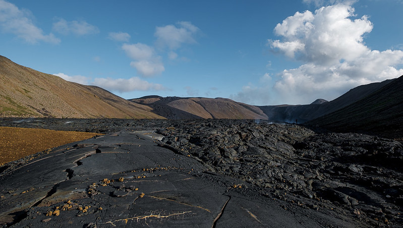
Featured image: Berserkur via Wikimedia, CC BY-SA 4.0.
