
Katla and Myrdalsjokull (glacier) by Muratart/Shutterstock)
- Iceland Met Office: Icelandic; English; Aviation Notices (VONAs)
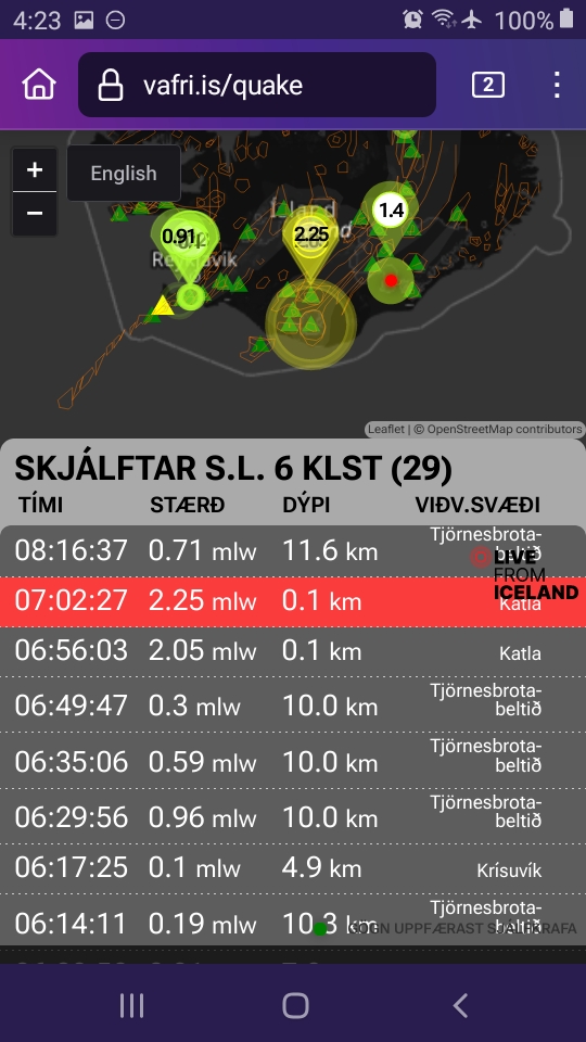
- RUV former live and earlier live coverage (autotranslated; videos only play at original URL, accessible through that little Google Translate menu at the top)
- Catalogue of Icelandic Volcanoes: Katla
- Global Volcanism Program Katla page
- London VAAC
September 30, 2024, 8:21 a.m., Pacific: This morning Katla had its strongest quake of the year thus far. While that still was less than a magnitude 4, and even though the IMO spokesperson interviewed here (autotranslated) says that this is normal for the time of year, I will pin this post again.
Katla is restless, and it seems to be getting a little more so. We’ll see how things go.
September 29, 2024, 11:22 a.m., Pacific: According to RUV (autotranslated), the jokulhlaup is expected to end today. They report:
…According to the Norwegian Meteorological Agency, it is not unusual for a river like Skálm to release overflow water after major events, like what happened this summer.
(I don’t know why Google sometimes mistranslates that word, but it is the Icelandic Met Office that they are talking about.)
September 28, 2024, 11:37 p.m., Pacific: Per IMO on Facebook just now, via Google Translate and with emphasis added:
Electrical conductivity has been increasing in Skálm since noon on Friday and was measured the highest yesterday evening, 286 µS/cm together with a water level increase of 62 cm. The run has fallen rapidly during the night and is now in a run. We would still like to ask people to be careful at the source of the river and near the riverbed, as there could be gas pollution in the area. No reports of sulfur smell have been received yet. It could possibly be a slow leak of geothermal water from under the glacier. Náttúruvárvakt VÍ will continue to patrol the area.
September 10, 2024, 6:45 a.m., Pacific (copied from here): Today’s IMO update via Google Translate (this is definitely from Katla, so I’ll copy this to that post, too):
Jökulhlaup in Skálm in winter
The second smaller event following the glacier run on July 27
10.9.2024The glacier run that has been going on in Skálm for the past 24 hours is in progress. Electrical conductivity and water level in the river were increasing from Saturday, September 7th until yesterday when measurements started to decrease again. Increased electrical conductivity is a sign of geothermal water in the river. The geothermal water comes from Mýrdalsjökull. Since yesterday afternoon, the electrical conductivity has returned to normal values, and this run is therefore in decline.
At the end of July this year, there was a significant glacier run in Skálm and the river flooded over highway 1 in a section. During that run, a considerable amount of ice turbulence was measured on seismometers around Mýrdalsjökull, but similar ice turbulence has not been detected in recent days. This is the second smaller event to follow that run, but another small run occurred in the river around August 10th.
Náttúruvárvakt VÍ continues to monitor the run, but directs tourists in the area to be careful at the source of the river and near the riverbed, as there could still be gas pollution in the area.
September 9, 2024, 3:34 p.m., Pacific (copied from here): There is a small jokulhlaup reported (autotranslated) again on the Skalm River.
They don’t mention Katla, which was the source of July’s strong outburst flood. Most likely Katla is at it again, but Eyjafjallajokull (which is much smaller) sits more or less on Katla’s “shoulder,” and though it has its own glacier and presumably its own jokulhlaup channels — they were bad in 2010! — there was that recent swarm that appeared on vafri.is to be at Eyjaf, so let’s wait for more information about the flood’s source.
August 11, 2024, 7:40 a.m., Pacific: Yesterday, water level rose a bit in the Skalm River (which flooded with the unusually large jokulhlaup in July) and IMO noted increased electrical conductivity.
Changes were small and reportedly (autotranslated) the event is almost over.
IMO had a banner on their vedur.is website yesterday about it and to warn of possible toxic gas levels near the sites where water melted by Katla flows out of Myrdals glacier, but they did not raise Katla’s activity status.
“Event” — that’s the word Google Translate uses for the IMO term. This layperson suspects that, if they were more sure about what’s actually going on in there, the boffins would be much more specific.
August 1, 2024, 9:49 a.m., Pacific: There is no change in aviation code status from Green, and no sign of impending trouble, but I’m going to pin this again partly because Katla had a low-intensity doublet three hours ago —

— and partly because Dr. Pall Einarsson seems to be keeping the door open, in this interview (autotranslated), to Katla being heard from some time fairly soon.
…geologists were convinced about 40 years later, in 1960, that Katla was about to erupt again. However, this big eruption has not yet returned and now 64 years have passed since then,” says Páll.
Flashes in the air
He therefore believes that the main conclusion that can be drawn from this behavior is that Katla has now broken its old eruption pattern and therefore there are flashes in the air, as it is impossible to predict what type and when the next eruption will occur.
“Main volcanoes are not prone to repeating themselves, but the larger the eruptions, the less likely it is that the volcanoes will erupt again in the same way as before, as large eruptions tend to change the entire volcanic system,” Páll says…
There aren’t literally flashes in the air — it’s probably an Icelandic colloquialism that Google Translate hasn’t picked up on yet (though GT has improved tremendously in terms of coherent translation of Icelandic since November and December 2023).
But I’ve read up a little on Katla while working on the Iceland series — which might be completed either this coming Sunday or the next — and have been impressed by its biggies (for references and more see Part 1 of the “Is Iceland Safe to Visit” part):
- Eldgja Fires in the 930s AD were from a Katla fissure swarm — the only known eruption of Katla outside its caldera. It was a larger flood lava eruption than Laki/Grimsvotn in 1783-84 (but not as large as the 8,600-year-old Thjorsa flood lava eruption from Bardarbunga’s fissures — many experts suspect that whatever is causing the hotspot and excessive mantle melting is centered under this region of Iceland’s lithosphere that hosts the three volcanoes, Vatnajokull and Myrdalsjokull (glaciers), and perhaps other volcanoes that I haven’t heard of yet). Dr. Einarsson even mentions the Eldgja Fires but not in any way suggesting that a repeat is likely soon; if it was, they would know. Katla is closely monitored, and the accumulation of that much magma before any flood lava eruption would set off much larger precursor signals than what volcanologists picked up so well in the year or two leading up to the first eruption in Fagradalsfjall, in 2021. I think he’s just making the point that Katla seems to supersize things, which it certainly does.
- When I came across mention of a long-ago jokulhlaup from Katla flowing at an estimated rate of 300,000 m3/second, I thought it was a typo. It’s not. That figure is used in several other papers and I believe it is the fastest water flow rate known on Earth (even factoring in all the great rivers — in flood!).
Now Katla doesn’t do that all the time. But the fact that Katla probably did it once is reason enough to be wary when Katla is not following an expected pattern (as Dr. Einarsson points out in the quote above) since jokulhlaups do not give many warning signs and the lowlands around Katla are inhabited, as well as containing vital infrastructure like the Ring Road.
Again, none of this might happen, but [layperson speculation] it is likely that Katla, which has never erupted during the era of modern instrumentation, likely has other surprises in store besides the unexpected volume of that recent jokulhlaup.[/layperson speculation]
So let’s keep the post pinned and see what happens.
July 29, 2024, 5:35 a.m., Pacific: The latest IMO update reports that things are returning to normal and Katla’s status is back to Green.
July 28, 2024, 5:18 a.m., Pacific: Overall, IMO reports in its update, the flood continues to subside, though a little increased water flow is noted in some other drainages.
This part of the update, via Google Translate, is very interesting and shows that Katla will be watched even more closely for some time:
Unclear what caused such a large run
It was an unusually large race compared to the usual races in these areas. At this stage, it is impossible to say what caused this large amount of runoff to come from under the glacier. It is clear, however, that there has been considerable activity at the northern end of the Kötlu crater, causing runoff to come from Mýrdalsjökull both on the west side and on the east side.
Satellite images show that the well-known caldera on Mýrdalsjökull has subsided. However, it is unclear what causes this large amount of rushing water to rush down Skálm in such a short time. All things considered, about 2 million cubic meters of water must collect in Mýrdalsjökull’s cauldrons before it flows forward. Based on the first estimate of the size of the run in Skálm, it is many times more than in a traditional run.
Scientists will analyze the collected data to get a better picture of what caused such a large run. But as was mentioned in the news yesterday, there are no signs in the Norwegian Meteorological Agency’s data that a volcanic eruption has caused a glacier run this time.
Again, ? why GT translates the Icelandic Met Office name this way. Their translations of Icelandic are much more coherent, though, compared to last November and December.
July 27, 2:41 p.m., Pacific: Things seem to be winding down — IMO’s new update, via Google Translate, notes:
Running from Mýrdalsjökull. The race has reached its peak at Highway 1
There is nothing in the data to suggest that the run is the result of a volcanic eruption under the glacier27.7.2024
Updated July 27 at 21:00
The flow in Skálm has decreased
The race has reached its peak at the highway
The race in Skálm is comparable to the race in Múlakvísl 2011 and likewise the race that was in Múlakvísl in 1955
It may take several days for the flow in Skálm to return to normal for the time of year.
There is nothing in the data that suggests that a volcanic eruption caused the run in Skálm
Measurements show that the flow in Skálm has significantly decreased. The gauge is located on the bridge over Skálm by highway 1, and therefore the flow from Mýrdalsjökull has reached its peak there. According to the very first estimate, it is believed that the magnitude of the flow was around 1,000 m 3 /s at the main road.
There are no signs that runoff has reached Múlakvísl or other rivers from Mýrdalsjökull.
The unrest that began to be felt at around 11 this morning, so we can only expect that the flow in Skálm will gradually decrease. It may take several days for the flow in Skálm to return to normal for the time of year.
The Norwegian Meteorological Agency continues to monitor the area and closely monitor unrest and seismic activity under the glacier. It can take up to 24 hours for the activity to return to what is known as “normal background activity”, so this scenario can be declared over.
Volcanic eruption not the cause of the glacier run today
There are no signs in the Norwegian Meteorological Agency’s data that a volcanic eruption caused the glacier run that occurred today. Although it was an unusually large run, the run is due to geothermal heat in the glacier’s cauldrons, meltwater accumulates, which later runs ahead of the glacier. A GPS meter located on Austmannsbunga shows clear signs that the changes measured in the caldera are a regular glacier run. However, it is unclear what causes more water to be released than is generally the case from such runs.
The Coast Guard went on a patrol flight with scientists from the Meteorological Office and the University of Iceland this afternoon to investigate the situation. During that flight, it was confirmed that runoff only came from Sandfellsjökull and from there reached the course of the river Skálm. There was no visibility over Mýrdalsjökull to confirm which boilers the running water came from.
July 27, 2024, 11:21 a.m., Pacific: Here is IMO’s update, about an hour ago.
They noted more turbulence this morning and now think it’s possible that more water could be released. Also, it’s already an unusually large flood — possibly bigger than the one in 2011 — and for that reason, even though the cause is considered to be geothermal heat, they’ve raised the aviation alert to Yellow.
Running from Mýrdalsjökull. The race has not reached its peak at Highway 1
The area at the glacier spur of Sólheimajökull has been evacuated due to uncertainty about the continuation of the activity27.7.2024
Updated July 27 at 17:00. The news will be updated later this evening.
An increase in electrical conductivity began to be measured in Skálm last night and this morning you could see increased unrest under the glacier
Runoff water comes from Sandfellsjökull as it is now and goes down to Skálmar’s course
Based on the photographs, it seems that the run has reached its maximum flow at the glacier step
It is most likely that this current has not reached its peak at the main road and significantly more runoff will come from under the glacier
It cannot be ruled out that runoff water comes from under the glacier in more places and runoff water reaches Múlakvísl
It is clear that this is an unusually large raceThis morning, the Norwegian Meteorological Agency sent out an announcement that increased electrical conductivity has been measured in rivers around Mýrdalsjökull.
An increase in electrical conductivity began to be measured in Skálm last night, and this morning you could see increased unrest under the glacier. Jökulhlaup began to be measured in the river Skálm around 13:20 today and it was a big run, possibly bigger than the last big run that was in 2011 and came from Kötlujökli on the eastern side of Mýrdalsjökli.
According to the information that the Norwegian Meteorological Agency received from a pilot, runoff water comes from Sandfellsjökull as it is now and goes down into Skálmar’s channel. Based on those pictures, it seems that the runoff has reached its maximum flow at the glacier step. However, the race has yet to reach its peak at Highway 1.
According to information from the Road Administration, water flows over the bridge over the river Skálm and over the ring road in a section of about one kilometer to the east of the bridge. Personnel from the Road Administration and the police have arrived and the ring road has been closed due to the run. The road is torn apart on the east side of the bridge and there is damage to the ends of the bridge due to the flood. Water has also flooded the road down to Álftaver.
It cannot be ruled out that much more liquid water comes from under the glacier
All things considered, it takes several hours for the flowing water to travel under the glacier and down into the riverbed. Late last night, a sign of turbulence was seen that could be the beginning of the rush and the amount of water that has now descended into the channel of the river Skálm and overflows the highway. Unrest then increased significantly around 11 this morning. This increased turbulence that was measured this morning could be a sign that even more liquid water is expected from the glacier. Then it cannot be ruled out that runoff water comes from under the glacier in more places and runoff water reaches Múlakvísl.
There is no telling when the rush can be expected to peak. In an unusually large run in 2011, it took about 10 hours from the time of high continuous turbulence to the release of runoff from the glacier. In 2011, running water reached Skálm and also Múlakkísl. It is not possible to say that this current run is behaving in a comparable way to the run in 2011. However, it is most likely that this current run has not reached its peak and that significantly more runoff water is yet to come from under the glacier. It is clear that this is an unusually large race.
…
Flight color code for Katla moved up to yellow. The area at Sólheimajökull has been evacuated
Due to the activity in Mýrdalsjökull, the flight color code for Katla has been changed to yellow. It means that the fire station is showing activity beyond what is considered basic activity. The National Police Commissioner’s Public Defense has declared a level of uncertainty regarding the run in consultation with the police chief in Southland.
Due to the great uncertainty about the continued development of events in Mýrdalsjökull and the possible risk of glacier slides down Sólheimajökull, the Norwegian Meteorological Agency proposed to the National Defense Service that Sólheimajökull, the area in front of the glacier spur and the service area at the end of Sólheimajökull road be evacuated. The time for warning due to an impending run in Jökulsá at Sólheimasandi could be very short and the risk in the area is high if there is a run.
Experts from the Norwegian Meteorological Agency together with scientists from the University of Iceland are now working to further analyze data to assess the possible development of activity in Mýrdalsjökull.
July 27, 2024, 8:58 a.m., Pacific: The seismic swarm continues and now there is news (autotranslated) of a jokulhlaup (glacial outburst flood), though not yet news of an eruption.
Checking for more details — if you check the Catalogue entry for Katla linked above, you’ll see that the floods (and eruptions) can be bad — or not. We’ll see how it goes.
This, from the linked article, is encouraging:
…Probably not a sign of eruption
Böðvar Sveinsson, a natural hazard expert at the Icelandic Meteorological Office, says that there are no signs that an eruption is about to begin.
“The latest developments suggest that this is a small race that we are actually seeing the end of this race. There has been a lot of unrest and there have been earthquakes, and the unrest is related to geothermal heat. Trembling very much like when boilers begin to empty,” he says, indicating that the race is ending rather than beginning….
Quick update, 9:32 a.m., Pacific: Per Visir (autotranslated):
…”It happens every year that some boilers empty, but the events are rarely big. The last major event was in Skálm 2011, which lasted for several hours. The greatest danger from this is near the glacier spurs, where the glacial water rages out,” says Einar Hjörleifsson, a natural hazard expert at the Norwegian Meteorological Agency.
He says this can be accompanied by high levels of gas pollution, and it can be dangerous for people to stay in the depressions in the landscape near the glacier spurs where the gas collects. The greatest concern is for tourists at Katlujökull on the east side of Mýrdalsjökull and Emstrur.
July 27, 2024, 4:49 a.m., Pacific: There was another round of small quakes — status is still at baseline and I see no current news stories or IMO updates on Katla:

July 15, 2024, 4:32 a.m., Pacific: There was a shallow doublet of 2-pointers in the area this morning:
Thus far, I’ve found no expert comments or news coverage about it online — just something to file as we keep watching.
Katla, I’ve learned, is monitored especially closely because of its powerful glacial outburst floods that can occur with little warning, and there is no increase in alert status.
June 19, 2024, 3:32 p.m., Pacific: There have been three quakes at Myrdalsjokull, the glacier capping Katla, today, Visir reports (autotranslated).
Quakes of this intensity aren’t unusual at Myrdalsjokull.
There is no mention of the extremely well-monitored volcano by Visir or at the IMO site where the quakes are briefly described in an updated geoscientist note.
Iceland has been having some M2 to M3-ish temblors lately, most recently today in the north central coast area where the Northern Volcanic Zone transitions, I believe, back into the Mid-Atlantic Ridge (Kolbeinsey segment) via the tectonically Reykjanes-like Grimsey oblique rift (Myrdalsjokull is in south central Iceland and Katla is part of Iceland’s East Volcanic Zone).
Eldey and ridge/insular shelf areas off the Reykjanes Peninsula have also had some M3 events in the last week or so.
[Layperson opinion: All of it is just the Mid-Atlantic Ridge doing its thing in and around the Iceland hotspot.
And that is all.[/Layperson opinion]
Update, July 10, 2023, 9:15 a.m., Pacific: Katla’s seismicity seems to have quieted a bit, but IMO is still issuing glacial-outburst information and gas updates for various sites.
With good reason, as this 2011 news video of a Katla jokullhaup suggests.
Will keep this pinned until the meltwater has flowed off and we can see whether or not the volcano continues to sleep.
July 6, 2023, 10:03 a.m., Pacific: The Icelandic Met Office has hoisted a warning today on their website that glacial-outburst-flood precursors near Katla, which were already high, are soaring.
Specialist note, via Google Translate:
Measurements show an increase of conductivity in Múlakvísl, which is now unusually high compared to the time of year. Gas meter on Láguhvolum measures geothermal gas in the area.
There are chances of water growth in Múlakvísl due to the increased percentage of geothermal water in the river. Gas pollution at the river can accompany geothermal water.
Written by the specialist on duty 06 Jul. 06:32
Still waiting on an eruption, though gas values do seem to be elevated and that gas must have a source
Update, July 3, 2023, 8:31 a.m., Pacific: Still waiting, actually. An outburst flood (jokulhaup) might be imminent, though, and a seismic swarm has begun.
Per IMO’s initial post (more updates here (autotranslated):
There has been increased seismic activity in Katla in the last few days. Shortly after midnight on the night of June 30, it started … and at 6:30 a.m. more than 95 earthquakes had been recorded, 8 over magnitude 3 and the largest 4.4. Earthquake activity in Mýrdalsjökull in recent weeks is the highest since autumn 2016. Measurements show an increase in electrical conductivity in Múlakvísl, which is now unusually high compared to the time of year. Gas meter on Láguhvolum shows an increase in geothermal gas. The interpretation of the measurements suggests geothermal activity, but magmatic movements cannot be ruled out.
…
There are chances of water growth in Múlakvísl due to the increased percentage of geothermal water in the river. Gas pollution by the river can accompany geothermal water. During the weekend, we can expect a right changing direction in the area and therefore gas can accumulate.
In the next few days, you can expect continued seismic activity in Mýrdalsjökull. Earthquakes increase the likelihood of rock and ice collapse.
People are advised to stay away from the process near the source of Múlakvíslar and at Kátlujökull.
Interestingly, their latest update at that link notes that further information will be available at the Norwegian Meteorology website — the first time I’ve seen them do that.
Am not sure if they might be referring to this test site or something through the regular website (Norwegian).
May 5, 2023, 2:52 a.m., Pacific: Per today’s IMO report (autotranslated), they have lowered the alert back to GREEN but are closely watching Katla.
Update, May 4, 2023, 4:14 p.m., Pacific: Reassuring updates from a nonscientist —
The earthquake swarm includes three quakes over 4.0M. Katla usually shows seasonal activity in August, September & October which makes this activity a bit unusual. Raising the code is not a sign of immediate eruption, but rather a precautionary step.
— Gisli Olafsson (@gislio) May 4, 2023
https://platform.twitter.com/widgets.js
— and the seismologist:
I can confirm.. was a busy day!
Intense 40 min swarm of shallow events. No signs of tremor (floodtremor or other..) https://t.co/PkE7YnN9rA— Kristín Jónsdóttir (@krjonsdottir) May 4, 2023
https://platform.twitter.com/widgets.js
More from the PNSN about volcanic earthquakes, including tremor and what it signifies. In Iceland, because of the ice atop some volcanoes, glacial floods are also signs of an eruption.
Update, May 4, 2023, 10:22 a.m., Pacific:. They went to Yellow today.
Here is the Icelandic Met Office’s report, autotranslated. Also, an Iceland Monitor story.
Found another good video, too; it’s from 2021:
Relax — it’s not in Icelandic. He is speaking English much better than I could speak Icelandic, plus you get the authentic pronunciation of all those place names.
Also this, from a seismologist there:
Left: Earthquakes in Katla (overlain by Mýrdalsjökull glacier) this morning at station Austmannsbunga. Right: Map showing earthquake locations. Blue lines indicate water divides and small circles indicate cauldrons, i.e. geothermal activity. @Vedurstofan #volcanomonitoring pic.twitter.com/T9KKr6gCOx
— Kristín Jónsdóttir (@krjonsdottir) May 4, 2023
https://platform.twitter.com/widgets.js
Original post
I think that’s Katla; it’s labeled “Katla” on Wikipedia, anyway, although the photographer calls it “Iceland.”
This subglacial volcano in southern Iceland was discussed at the same March 17th IMO science meeting that reviewed recent unrest at Askja.
The boffins noted unrest at both volcanoes but not enough to increase the alert level at either one.
Real-world Katla is impressive, though I have only just started looking into it this week. (The Netflix film is just some fiction.)
Let’s get a feel for it today with a couple of videos that were done several years ago, during an episode of more intense unrest than Katla is showing at present.
This backgrounder to a Reykjavik Grapevine article is from 2016:
I’m not sure which of these articles it might have been.
Of note, Katla is not a supervolcano, despite what the guy from Extreme Iceland says in that video.
It is large, certainly, and it does have a respectable number of VEI 3, 4, and 5 eruptions on the GVP page, but VEI 8 is a whole ‘nother thing.
This layperson suspects that this is especially true in the setting of a spreading ridge/mantle plume.
The next video, also from 2016, is a Dickinson College volcanologist discussing Katla.
Finally, here is what Raw Reykjavik found when it interviewed people living near Katla in 2019:
More information:
- Iceland Met Office post on the 1918 VEI 4 eruption.
- Wikipedia (English) on Katla
- Wikipedia (Icelandic, auto-translated) on Katla.
Updates, if any:
Featured image: ChrisTd via Wikimedia, CC BY 3.0
