
As promised, here is an update page about this Decade Volcano and its recent unrest.
Actually, as Kostas Papazachou, Professor of Seismology at the Aristotle University of Thessaloniki and chairman of the board of directors of the Institute of Study and Monitoring of the Santorini Volcano (IBIS), describes it here (Greek), there are two separate geological events ongoing.
Per browser translation:
- We have inside the Santorini caldera a seismic activity with small earthquakes (with sizes up to ~4), mainly in the Kameni fault, from Palaia Kameni to Fira. This seismicity is due to deformation of the volcano’s northern caldera, while both phenomena have been detected in time by the networks of IMPIS, which and he was the first to inform the Greek State. The phenomenon (which is still ongoing) is similar to that of 2011-2012, i.e. it is due to the same volcanic center, and is evolving like the previous one, i.e. relatively slowly (over several months).
- In the area of Anidros we have one intense seismic sequence, which began on the afternoon of January 26, 2025 and continues until and including the time this article was written (February 1, 2025, 8:00 PM). This sequence is in the faults of the Anhydros basin, although the uncertainties do not allow us to say exactly which (or which) faults they are on.
Read the whole thing with your browser translator or some other online translator — the professor covers the dual situation clearly and with complete transparency about what they do and do not know.
As for the volcano, it slept after its 1950 VEI 2 eruption at Nea Kameni until 2011, when ground deformation showed that magma was intruding under Nea Kameni (a lava dome cluster whose top is above sea level). That went on for a year and then declined.
Apparently last year the same sort of deformation began again and continues, this time involving both Nea Kameni and small section of the northern caldera wall.
Then, on January 26, 2025, an earthquake swarm began, mostly northeast of Santorini and Kolumbo (the submerged volcano just off Santorini’s northeastern coast, last active — and impressively so — in the 1600s).
Professor Papazachou gets into all of that and stresses that the quake swarm is a tectonic event — think in terms of Africa colliding with Europe because of plate tectonics — and the activity in Santorini caldera is volcanic, i.e., magma coming up from a reservoir miles down in the crust.
The two processes aren’t completely isolated, as tectonics and volcanism can affect each other in complex ways, but they are separate and both could just go on their own trajectories for a while and settle down.
It is unnerving, though, and anywhere from 6,000 to 9,000 of Santorini’s 17,000 permanent residents have evacuated, though no mandatory evacuation has been called yet.
The geoscientists are watching this closely, and we’ll just have to wait and see what happens.
Updates:
July 2, 2025, 6:05 a.m., Pacific: Well, this is unexpected!
“We found magma at deeper depths that is offset from both the main volcano and from the active volcanic seamount 10 kilometers (6 miles) to the northeast,” Hooft said. “Two Ph.D. students worked with me to probe deeper beneath the volcanic system than any prior efforts and found magma that proved to be the source of a sideways injection of magma deep in the crust, located right where the seismic swarm was initiated.”
February 22, 2025, 8:10 p.m., Pacific: Well, some good news, first as a tweet:
Today's (22/02/25) update on the seismic swarm off the island of Thera (Santorini) in #Greece.
It was another day below average, with 57 more events in the last 24 hours (the lowest total in 24 days).
No earthquakes above magnitude 4.0, with an overall total of 3750+ shocks… pic.twitter.com/39F0L5HJSr
— Giuseppe Petricca (@gmrpetricca) February 22, 2025
https://platform.twitter.com/widgets.js
Then as an article (Greek). Per browser translation:
After discussion among the members of the Committees and the presentation and examination of all the data so far, the following were unanimously formulated:
The seismic sequence in the sea area of Anydros between Thira and Amorgos is showing a decline, with 1,368 earthquakes from February 1 to date with a magnitude above 3.0 (and with a maximum recorded magnitude of M 5.3).
The current seismic activity in the area of Anydros island is due to submarine faults with a NE-SW direction and is part of the broader geodynamic context of the area. According to the available data, this activity is due to a combination of tectonics and deeper magmatism.
Seismic activity within the caldera remains at the same levels, while a decrease in the rate of ground deformation is observed in the wider area of Santorini, which is constantly monitored.
Public buildings, based on the inspections carried out so far, have demonstrated very good behavior under seismic loads.
February 15, 2025, 4:48 p.m., Pacific: Yesterday, there was some tremor recorded at seismic stations in Santorini Caldera:
I looked but could not find an official statement on it from government or local expert sources.
I have waited to blog about it but after checking again just now there still is nothing. The closest expert opinion I have found is a tweet from EMSC, which is quoted in this article:
The harmonic seismic vibrations that indicate possible volcanic activity on Santorini began suddenly on Friday night and stopped abruptly, according to the Euro-Mediterranean Seismological Center. “We hear some noise. We cannot be certain what is happening,” the center posted on X.
Earlier in the same article, they quoted a professor:
Early on, Dr. Synolakis had suggested that the Santorini earthquakes may not be tectonic, but caused by volcanic activity. “We are next to a volcano that is in an active phase. The displacements and earthquakes show that magma is rising to the surface, causing the cracks to break,” he explained.
It is possible that the volcanic activity will cease, as it has in the past. However, the scientist advised caution. “Obviously it can. We have seen it before. However, we need to evaluate other parameters, such as ground deformations, seabed measurements and volcanic gases.”
What is complicating the situation is that nearby incredibly strong and lengthy swarm near Amorgos Island.
News sources conflate those, which are tectonic and began in January 2025, with less-intense ones that, along with ground deformation, began at Santorini Caldera in 2024.
The other major complication is that Greece apparently doesn’t have a centralized observatory to collate information, advise on alert status, and issue regular public updates.
As a result, Netizens are freaking out — I actually saw a Turkish news story about concern over receding water and a scientist advising that it had to do with the Moon (i.e., the tides)! — and I imagine the public that has been or possibly could be affected on Santorini feels very frightened and confused.
Anyway, a paper downloadable at the EMSC site goes into detail about the seismovolcanic situation in the caldera and reports an estimated magma volume of around 6.5 million m3 present about 4.5 km underground, with likely lateral dike intrusion in January and early February 2025 of an estimated 3 million m3.
To put that into perspective, the Icelandic Met Office estimates a pre-eruption magma volume of 13 to 15 million m3 or more present under Svartsengi plain each time — and the resulting eruptions are fairly small, for Icelamd.
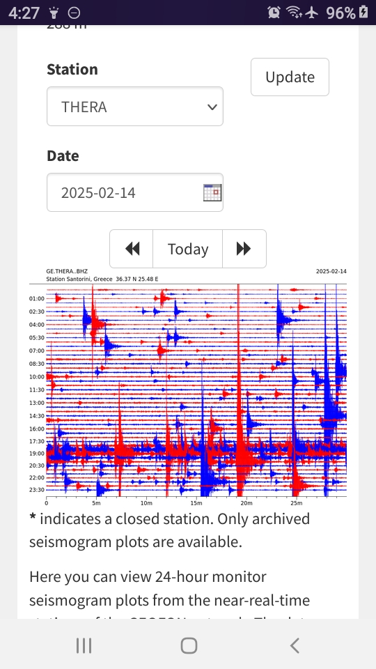
So there’s a small amount of magma causing changes to Santorini Caldera, doing typical things like occasionally moving around (a likely cause for the tremor signal and other smaller “fuzzy-looking” signals on that seismogram, in this layperson’s mind).
We’re definitely not facing another Minoan eruption here. Everyone has known the Kameni Islands are likely to erupt again and perhaps they are in the early stages of working towards that now.
This is socially and economically traumatic enough, being the first eruption since the tourism developments on the island, if it occurs.
There is also the unknown: What about Kolumbo? What about the Amorgos tectonic swarm?
And, unfortunately, there doesn’t appear to be any designated authority available to respond to such questions. That’s a big problem.
February 11, 2025, 03:32 a.m., Pacific: There are quite a few quakes on the USGS list now, but I see no other developments in online news.
Here is an animation of the swarm (note how few are at Santorini, where a separate process is going on):
Another animation of the seismic swarm off the island of Thera (Santorini) in #Greece, from midnight on Jan. 27th, 2025, to 21UTC on Feb. 10th, 2025.
This time, the charts show the 2300+ earthquakes daily number, location, and magnitude, highlighting the last 10 days in… pic.twitter.com/U0a6OgjXzy
— Giuseppe Petricca (@gmrpetricca) February 10, 2025
https://platform.twitter.com/widgets.js
What boggles my mind is the high percentage of 4- and 5-pointers — so much energy release!
February 7, 6:03 a.m., Pacific: There are even fewer quakes on the USGS list now BUT one of them is a 5-pointer.
Professor Papazachou did a Q&A interview (Greek) and said, among many other interesting things, that (browser translation):
…The image we had yesterday is that it has broken a piece around 15 kilometers. But there are pieces that are not broken, so the possibility of suddenly breaking a big piece and having a big earthquake remains. We are talking about an earthquake of the order of 6 Richter, which is a typical earthquake for the Greek area. Like the earthquake that happened in Tyrnavos, Arkalochori, Athens in 1999.
In his opinion, it appears unlikely that the seismic swarm will trigger an eruption.
Not mentioned by anyone in the article is the second process ongoing, the magma intrusion, but the last time this happened, back on 2011-2012, there was no eruption.
So maybe Santorini will not trigger an eruption, either.
Quick update: Italian volcanologists have done an in-depth post (Italian) on the swarm. It’s a little technical but answers some questions I was wondering about.
February 6, 2025, 11:39 p.m., Pacific: There are fewer quakes from this area today on the USGS list.
Also, from 21 hours ago:
サントリーニ島北東の地震さきほどまでの状況、NOAの震源データによる世界時6日からの震央分布、矩形内の1月26日からのM-T図(赤はM1.5 以上の積算個数)と時空間分布。6日になって活動域がまた少し南西に戻移動、今はAnydros島のあたり。NOAのデータを見るかぎり、深さには大きな変化はない。 pic.twitter.com/UGiMBBrn0f
— hacchan9642 (@hacchan9642) February 6, 2025
https://platform.twitter.com/widgets.js
X translation: “The situation until just now regarding the earthquake northeast of Santorini Island, the epicenter distribution from UTC February 6 according to NOA’s seismic data, the M-T diagram within the rectangle from January 26 (red indicates the cumulative number of M1.5 or greater) and spatiotemporal distribution. On the 6th, the active area moved slightly back to the southwest, now around Anydros Island. As far as can be seen from NOA’s data, there is no significant change in depth.”
Per the BBC, the Santorini area is shaking, too, and the government’s declared state of emergency will now last to March 3rd.
February 5, 2025, 9:18 p.m., Pacific: The tectonic earthquakes are not letting up.
Per the BBC a few hours ago:
…A strong earthquake has been recorded between the Greek islands of Amorgos and Santorini, after days of consecutive tremors in the area.
More than 11,000 people have already left Santorini with around 7,000 departing by ferry and 4,000 people leaving by air.The quake followed two smaller tremors minutes earlier, and was recorded at 21:09 local time (19:09 GMT) as a magnitude 5.2 tremor, making it the strongest in recent days. It is estimated to have occurred at a depth of 5km…
Per a knowledgeable account that I follow:
サントリーニ島北東の地震、まだまだ大きめの地震が続いている。2月になってからの震央分布、矩形内1月26日からのM-T図と時空間分布図。NOAジオダイナミクス研の震源データによる。ジグザグしながら震源域が北東に移動しているようすがはっきりしてきた。 pic.twitter.com/1opWMVJ8m6
— hacchan9642 (@hacchan9642) February 5, 2025
https://platform.twitter.com/widgets.js
X translation: “The earthquakes northeast of Santorini are still quite large. Here are the epicenter distributions since February, the M-T diagram within the rectangle from January 26, and the space-time distribution diagram. Based on the hypocenter data from NOA Geodynamics Research. It’s become clear that the hypocentral region is moving northeast in a zigzag pattern.”
Hypocenter is where the earth actually moves; epicenter is the point on the ground surface above the hypocenter.
Northeast is away from Santorini and Kolumbo volcanoes. As this layperson understands the geography there, per sources below, going SW to NE is a basin — a dropped down area in the crust, and a very common geological formation in tectonically active areas — occupied by, respectively, Santorini volcano, Kolumbo volcano, and the Anhydros/Amorgos island area where the quakes are occurring.
To put the amount of energy being released over days in this swarm into perspective, recall the several hours of similar magnitude quakes in Iceland’s Reykjanes Peninsula near Thorbjorn on November 10, 2023, when a plate boundary separated.
This swarm’s energy release is just amazing. This layperson’s guess is that, with magmatic heat near the surface at both Santorini and Kolumbo at the moment, the crust at that end of the basin is too ductile to fracture and release that stored-up energy. Perhaps the basin, therefore, has to break at the other end?
Only a guess. Time will tell.
Sources:
Lagios, E.; Sakkas, V.; Novali, F.; Bellotti, F.; and others. 2013. SqueeSAR™ and GPS ground deformation monitoring of Santorini Volcano (1992–2012): Tectonic implications. Tectonophysics, 594, 38-59.
Preine, J.; Hübscher, C.; Karstens, J.; and Nomikou, P. 2022. Volcano‐Tectonic Evolution of the Christiana‐Santorini‐Kolumbo Rift Zone. Tectonics, 41(11), e2022TC007524.
Featured image: Nick Hemingway, CC BY-SA-NC-ND 2.0
