
Ice you’ll see, but no fire in these places. The lava here has already hardened into black rock, made out of oceanic crustal material: basalt.
There is always room for a gorgeous Iceland video; such scenes are also relevant because, up until recently (in geologic terms), there was a lot more land like this — it probably bridged the North Atlantic!
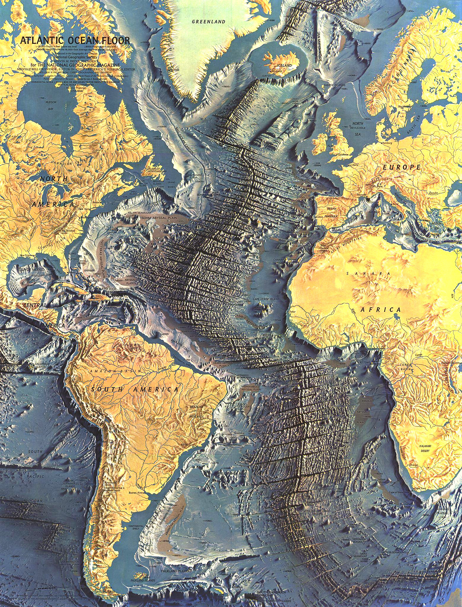
Even today, drowned remnants of a very broad ridge of igneous rock extend to the east as far as Scotland and westward to Greenland, sitting just a few hundred yards below the ocean surface. Meanwhile, north and south of Iceland and its basalt plateau, the Atlantic’s abyssal plain is more than a mile deep. (Einarsson, 2008; Hjartarson et al; Martinez et al.)

Geologists see that strange things have happened here.
Scientific debate continues — about this bridge, the associated continental shelves, hotspot contributions, whether there’s a microcontinent under eastern Iceland, etc. Nothing is simple here! By the way, we’ll soon be talking about that spreading ridge you see here coming up into Iceland from the south — as Ward points out, it starts out a mile below the ocean surface as the Reykjanes Ridge and rises above sea level at around 64° N latitude to become Iceland’s Reykjanes Peninsula. The world’s other well-established mid-ocean spreading ridges do not beach themselves this way. (Image: Adapted from ausdew, public domain)
The why of that former land bridge is unknown, since its existence can’t easily be explained by a basic plate tectonics model.
Imagine this —
— is the North Atlantic opening up some 50 to 60 million years ago.
Obviously there is no room here for a land bridge across the spreading center, yet one did form somehow, as the ocean basin widened, and it is still around, barely submerged, east and west of Iceland.
So much of the Atlantic Ocean’s history in these parts is still uncertain! (Foulger et al.; Hjartarson et al.)
Iceland itself, at the center of that ancient bridge, shouldn’t be present, either, let alone rise as much as a mile above the sea as dry land.
Yet there it is today: wild, beautiful — and volcanically hazardous to residents and neighbors alike.
The ridge, the mantle, and the Vikings
Back in the day, there were no humans around to appreciate the splendor of those hundreds upon hundreds of volcanically active, Atlantic-bridging miles.

It’s hard to find shareable images of Icelandic plant fossils, but wherever this came from, imagine the wonder of holding such a time traveler in your hand while standing on one of Iceland’s black sand beaches! (Image: PushkarenkoMariya/Shutterstock)
Plant fossils in ancient Icelandic rock, however, show that some living beings took advantage of the land bridge to migrate between North America, Greenland, and Europe. (Denk et al.)
These included oaks, beeches, and other trees not known for their ocean-crossing capabilities, as well as lower-profile vegetation.
Then apparently the basement furnaces shut off, or there was some other change in geologic processes that had been holding up the eastern and western parts of the land bridge while the North Atlantic widened.
Those sections gradually sank beneath the waves.
The Atlantic has since kept widening along its mid-ocean spreading ridge (which includes but isn’t limited to the Reykjanes Ridge). However, for the last six million years or so, only the central and tallest part of that old intercontinental connection — the 190 x 300-mile-wide field of volcanoes that we call Iceland — has remained high and dry. (Denk et al.; Hjartarson et al.)
The forested island Vikings would eventually settle (and deforest) remained above sea level through Plio-Pleistocene and recent times because Iceland gets a geological assist in the form of subterranean interactions between the Reykjanes Ridge and an unusual mantle melting process that is centered underneath Iceland’s crust.
This Iceland hotspot has not only raised the Reykjanes Ridge above sea level but also has built that impressive 280 x 460-mile-wide basalt lava plateau around and under the island.
(Einarsson, 2008; Hjartarson et al.; Sigmundsson et al., 2020; Ward)
You might have heard the process under Iceland described as a mantle plume (Allen et al.) — and it very well could be something like that — but there are other points of view, too. (Foulger et al.; Martinez et al.)
Many experts believe that heat plumes rise out of the depths of our planet, possibly from as far down as the core-mantle boundary! Relax. Thanks to Earth’s lithosphere, they can’t get to us and we’re not going down there.
All we need to know is that magma rises towards the surface here from both ridge and mantle, a double source of warmth near the Arctic Circle, building lots of basalt hills, valleys, and plains for ninth and tenth-century Vikings to explore when they moved in.
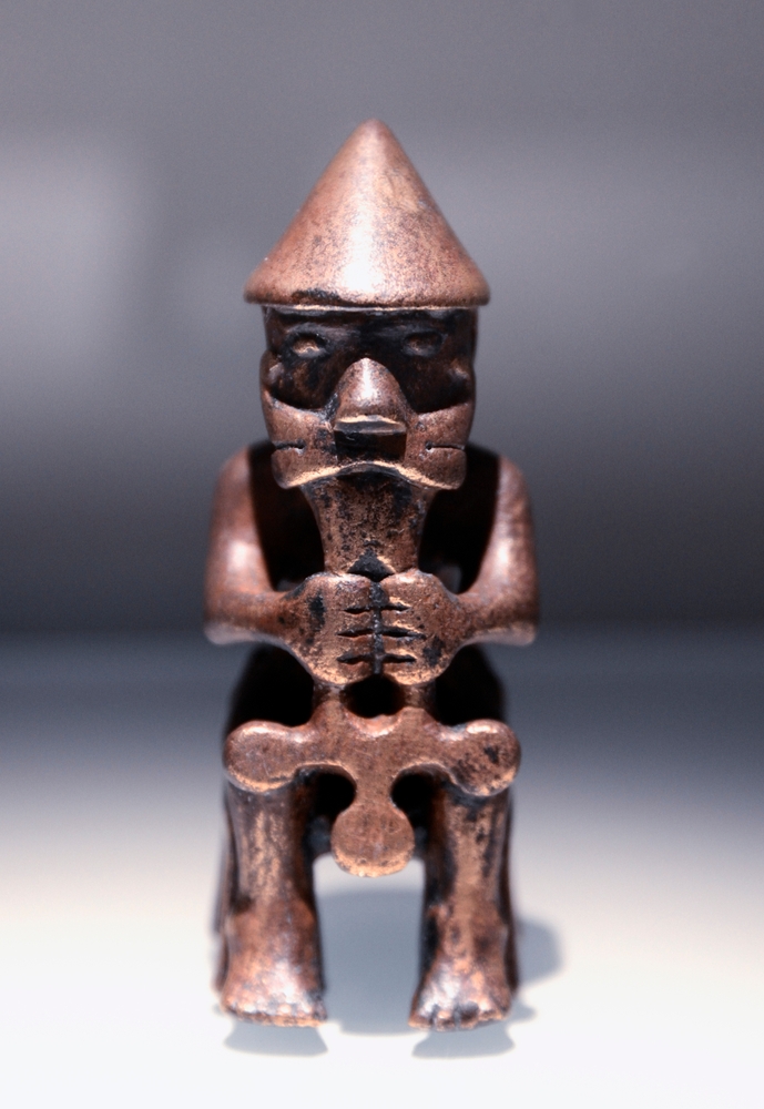
The Vikings’ Thor looks very different from his modern movie and comic book image. Mjolnir appears much more magical, too! (Photo by nikonka1/Shutterstock)
They could see that it was dangerous — one of Iceland’s biggest flood lava eruptions had just happened.
It didn’t faze them, though some historians speculate that those Eldgja Fires from 934 to 940 AD might have contributed to the Norse idea of Ragnarok.
In any event it was a new beginning, not the end of the world, and their descendants have since survived many more eruptions of various kinds down through the years (a total of fifty-six eruptions, per Thordarsson and Hoskuldsson!).
On the Reykjanes Peninsula, fissure eruptions stopped in the thirteenth century. (There is some geological evidence that peninsula volcanism happens every eight hundred to a thousand years, per Einarsson [2008] and Caracciolo et al., and lasts for decades to a couple of centuries before shutting down again.)
This peninsula was already inhabited at that point, but more people moved in as time passed, not only because there were no more eruptions but also because of its excellent harbors, pastures, geothermal resources, and other advantages.
About a third of Iceland’s people live on the Reykjanes Peninsula today.
More than thirty thousand of them went without heat for several days during a 2024 midwinter cold snap when lava from the current series of flows destroyed a key geothermal heating supply pipe.
At around 5:34 you can see workers desperately trying to complete the shielding on that pipe — work that started before the eruption. Toxic gases drove them away and the lava soon reached that heating pipe and destroyed it. Icelanders made it through the crisis. The pipe has been rebuilt and now is heavily shielded.
Iceland’s prolific volcanism is both beneficial and a problem.
- It’s good in that it has built a large island — with central heating! — where descendants of Vikings and residents of other backgrounds can thrive.
- It is not so good because eruptions endanger Icelanders and ruin their stuff over and over again. Sometimes eruptions here affect people outside Iceland, too — most notably in 2010 and in the late eighteenth century.
There are all sorts of volcanoes in Iceland (Thordarsson and Larsen), but in this post series we are only going to look at volcanism on the Reykjanes Peninsula, which cycled back on again in 2021 after an eight-century nap.
I am blogging it, and this crisis also will form the basis of the next post in this series, about volcano monitoring and emergency management.
Too, the peninsula is a very beautiful place —
Exhibits A and B:
— well worth a visit and not that hard to get a general geologic feel for if we approach Iceland in three dimensions.
All that requires is a baseball (and, of course, a map to help us find the Reykjanes Peninsula).

Reykjavik is located on the peninsula. If you can see the baseball stitch here, welcome to the blog, Geology PhD!. (Image: Peter Hermes Furian/Shutterstock)
The ridge: A baseball analogy
This isn’t mine. Back in the 1980s, a professor (whose name I don’t remember, unfortunately) helped us undergrad geology students understand the spherical geometry involved in plate tectonics by comparing Earth to a baseball and its outer crust to the ball’s leather cover.
To see why that makes sense, try fitting one of the many online 2D plate-tectonics graphics onto a globe of the same general proportions.
It can’t be done without either distorting the graphic or leaving some part of the globe bare.
Yet the Earth does it, and here’s how.
First, imagine that the 2D graphic is a flat sheet of leather cut to smoothly cover a baseball without any spaces.
Now sew that leather onto the ball:
Granted, baseballs don’t have intensely hot cores, no matter how hard the pitcher throws one.
And leather is not rock, though it may feel like rock to a batter hit by a pitch.
Nevertheless, countless studies over many decades consistently show that Earth does cover itself using a sort of reverse baseball stitch.
Not pretty, but it gets the job done. (Image: ausdew, public domain)
Molten material flows out of Earth’s vertical “stitches” — a/k/a ridge segments — spreading the leather crustal plate edges apart rather than bringing them together.
This basaltic material quickly cools and hardens into rock — ocean crust — and then subsides, moving away from the seam along those side “stitches,” or transform zones (angled on a baseball but usually perpendicular to the spreading axis seam in geology).
Our planet’s productive seam is the mid-ocean ridge. It runs all over the world, just as a baseball seam runs continuously over the ball.
Of course, the baseball comparison only goes so far.
To stay the same size, Earth must eventually swallow up some of that ocean crust through subduction zones.
The planet’s refusal to expand also contributes to ridge segment offsets instead of the classic vertical baseball stitch (you would not believe how much detailed geophysics I’m blithely skipping over here! I think the general idea is correct, though. If not, please let us know in the comments.)
On this up-close look at the ridge segments around Iceland —

— there is the Reykjanes Ridge going north towards Iceland, and at its far end are some vertical and sideways stitches offset ridge segments and transform zones shown.
But those disappear as the ridge approaches Iceland. The ridge climbs closer to the ocean surface, too. (Martinez et al.)
Frankly, not a whole lot is known about the southern Reykjanes Ridge, even today.
Not for lack of trying. This is how they must do field research there.
Expeditions to the ridge up north, around Iceland’s latitude, are much more fun thanks to that assist from mantle upwelling:
Too, it’s this northern part of the ridge that influences everyone as it comes ashore as the Reykjanes Peninsula and then transitions into other geological structures within the island.
How handy it is, then, to have that end of the mid-ocean ridge up where it can be studied on land — the only place in the world where this is possible on such a large scale! (Gudmundsson, 1995)
A drawback to life on the Mid-Atlantic Ridge that has become apparent since it woke up a few years ago is that there seem to be some important plumbing differences between ridge volcanism and non-ridge volcanoes — with Iceland’s hotspot only complicating the picture further.
Because of this unique situation, volcanologists have no examples from similar eruptions elsewhere to compare their findings with. It must make forecasting the current Reykjanes Peninsula eruptions quite a challenge for them.
Getting back to our analogy, Iceland is a patch on Baseball Earth.
That is, it fills in the space between the Reykjanes vertical stitch mid-ocean ridge segment to the south and the Kolbeinsey segment to the north. (Sigmundsson and Saemundsson)
A big seam patch like that would ruin a baseball. Earth merely works both kinds of “stitches” into the patch.
The ridge and Iceland
“Where de volcanoes at?” — Every tourist in Iceland ever. On this map, some internationally known volcanoes are shown as black triangles. (Image: Peter Hermes Furian/Shutterstock)
As you can see on this map, what would be vertical stitches on a baseball seam (or straight segments on a mid-oceanic ridge) are actually rather curvy volcanic zones — North, East, and West — in Iceland.
These “stitches” are distorted because science.
That is, if you’re curious and feel up for just a little jargon, as Foulger et al. note [with added comments from me], Iceland has widened into that ridge offset space between Reykjanes and Kolbeinsey over the last 15 million years “…via multiple unstable, migrating, overlapping spreading segments [places where molten material reaches the surface and erupts, i.e., volcanic zones and plate boundaries] connected by complex, immature shear transfer zones [sideways stitches the mostly nonvolcanic dashed lines on the above graphic] that reorganize every few Myr [million years]…”
😕
A little detailed Iceland geology goes a long way, doesn’t it?
In plain English, apart from what’s labeled as the Reykjanes Volcanic Belt in that graphic, de volcanoes be in de not-so-vertical stitches volcanic zones/near plate boundaries.
Most of Iceland’s sideways stitches transform zones are more or less perpendicular to the volcanic zones, but not here —
The Reykjanes Peninsula: Mind. Blown.
The Reykjanes Peninsula is a “sideways stitch” — so it’s a transform zone?
Here it is again.
Well, yeeeees (Khodayar et al.), but its daddy is the Reykjanes Ridge and the peninsula therefore has been a spreading center for six to seven million years (Clifton and Katterhorn) — which is why our mapmaker shows it as a solid line on the map and calls it the Reykjanes Volcanic Belt while using that dashed line for the South Island Seismic Zone.
If this seems confusing, don’t feel bad — geoscientists are often puzzled by Reykjanes Peninsula geology, too.
They do know how the peninsula can be both kinds of “stitch,” though.
It’s because Earth is big enough to sometimes hulk out and say “Puny man!” to the explanations we dream up for it.
There are places on its surface that have both extension (“vertical stitches,” a/k/a spreading centers, in our mid-ocean ridge example) AND a sideways motion (usually called strike/slip faulting, although “transform zone” is perfectly acceptable when describing it on a mid-ocean ridge).
The jargon for this is “transtensional“.
We’re not going to use the word again but that is how many volcanologists, including Halldorsson et al. and Saemundsson et al., see the Reykjanes Peninsula.
Einarsson (2008) and Einarsson et al. (2020) use more jargon when they call the Reykjanes Peninsula an “oblique rift,” but they also very handily describe exactly how this works on the ground — the peninsula’s spreading centers are sets of extending volcanic fissures under the influence of side-moving strike-slip faulting that handle the peninsula’s transform movements.

Figure 1, Hrubcová, P., Doubravová, J., and Vavryčuk, V. 2021. Non-double-couple earthquakes in 2017 swarm in Reykjanes Peninsula, SW Iceland: sensitive indicator of volcano-tectonic movements at slow-spreading rift. Earth and Planetary Science Letters, 563: 116875, CC BY 4.0.
The result of this combination of forces looks cool — a row of slanted Reykjanes Peninsula volcanic systems arranged like books leaning together on a shelf.
There are almost as many names for each “book” on the Reykjanes “shelf” as there are geoscientists studying them.
Just to make things more difficult for Iceland, a very complex tectonic plate boundary between the North America and Eurasia crustal plates also goes smack through the middle of the peninsula.
As we saw last time, part of this boundary opened up just north of and underneath Grindavik on November 10, 2023, leaving the town and its environs stranded in the gap between North America and Eurasia and sitting several hundred meters above a large, new magma-filled dike.
The magma didn’t reach the surface until December 18th, when an eruption occurred a mile or two north of Grindavik, in the central part of that dike.
In 2023 thus far, there have been additional eruptions in January, February, and March, plus at least one dike intrusion that stayed underground.
The last lava flow ended in early May but, at the time of writing (May 18), geoscientists warn that another eruption can come, probably in the same area but possibly elsewhere, at any time.
So, even though bookshelves have been mentioned, this is definitely not an academic matter!
Next time, we will look at how volcanologists, emergency managers, government, and the general public are dealing with this.
If you enjoyed the writing in this post, tips are welcome via the secure Stripe donation link. I won’t be saving your email for marketing or other spam, so here’s a big thank you in advance!
Featured image: Lukas Gojda/Shutterstock
